


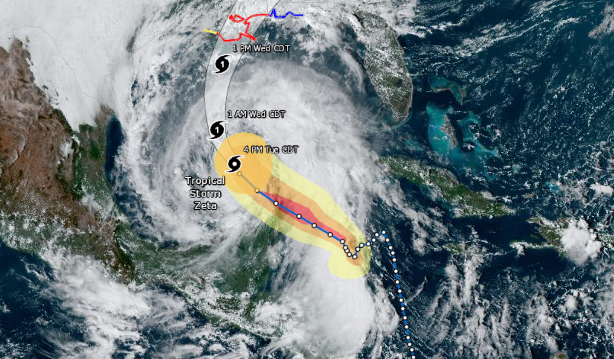
Hurricane Zeta made landfall along the northern tip of the Yucatan Peninsula in Mexico as a Category I storm with 80 MPH winds. Reports indicate minimal damage, with Zeta dropping 4 to 8 inches of rain before moving into the western Caribbean. The brush with land dropped the winds to 60 MPH, once again making Zeta a Tropical Storm, but restrengthening is expected with a collision course set for the Gulf Coast of the United States.
The National Weather Service predicts Zeta will make landfall as a Category I hurricane with 80 MPH winds on Wednesday. Current projections indicate the eye of the storm projected to land between New Orleans, Louisiana, and Mobile, Alabama. Hurricane forecast is challenging, and residents from the Texas-Louisana border to Florida’s panhandle should be preparing.
Hurricane Warnings extend from Morgan City, Lousiana to the Mississippi-Alabama border. A Tropical Storm Warning extends from the Mississippi-Alabama border to the Klakoosa-Walton County line in Florida. A Storm Surge Warning stretches from the Atchafalaya River’s mouth to Navarre, Florida, and includes Lake Pontchartrain, Lake Borgne, Pensacola Bay, and Mobile Bay.


Hurricane Zeta will be historic, being the 11th named storm to make landfall in the United States during the 2020 hurricane season and the fifth tropical system to arrive in storm-battered Louisiana.