Tag Archives: weather

Significant weather event likely on Friday the 13th

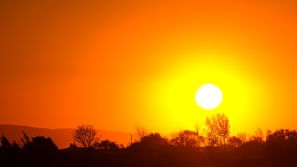
The remnants of Tropical Storm Atsani is charging across the Pacific Ocean, on a collision course with the Pacific Northwest. Although Atsani lost all tropical characteristics days ago, the energy and moisture it collected are expected to arrive Friday in a two-day weather event.

The challenge in forecasting wind storms in western Washington is that the center of circulation’s location determines our region’s impact. If the storm passes to our north, close to the southern tip of Vancouver Island in British Columbia, we get the brunt of a wind event. If the storm passes to our south, up the Columbia River basin, Oregon receives the brunt of the wind. An error in the forecasted path of just 50 miles is the difference between a significant wind event and what we like to call “a nothing burger.”

Typically the computer models aren’t in agreement on the “where,” which is the case with the Friday forecast. The GFS model, which hasn’t been the most accurate for our winter weather, forecasts a significant, possibly historic wind event, with the storm passing over Vancouver Island. The Euro model, which was stellar a few years ago but has lost some accuracy, predicts Oregon will receive the most impact.

It is too far out with landfall still 72 hours away to narrow down the track, but here is what we do know. Forecast models put central pressure at landfall between 973 and 983 millibars – that is significantly more intense than Tropical Storm Eta when it crossed the Florida Keys. Barometric pressure this low is typically associated with Category I and Category II hurricanes (our November wind storms have nothing related to the mechanics of a tropical system, even if they are often the remnants of tropical systems).

Wave height forecasts for Friday and Saturday are, in a word, alarming. Some computer models forecast heights of 45 feet off the Oregon coast, with some models predicting higher than 50 feet.

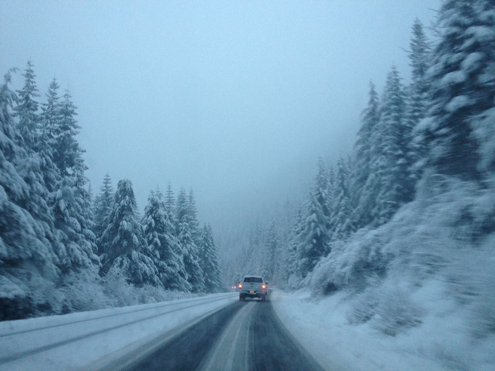
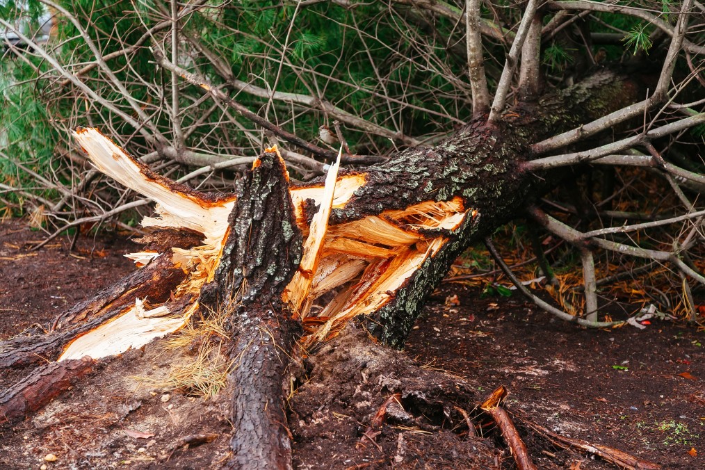
What should you know? For central Puget Sound, there is growing potential for a significant weather event on Friday and Saturday. More specifically to the eastside, the chances for power loss, tree, and property damage is increasing and require a close watch. Along the coast, damaging waves that will cause low area flooding, erosion, and large debris to wash ashore and shift are likely, with the where being the bigger question. The Cascades can expect wind and mountain snow, and a lot of it. The storm track will determine the snow level, but anyone planning to cross the passes this weekend should consider leaving a day early.

Opening the new SH-520 bridge to relieve wind and wave stress is no longer required, and the latest design also prevents waves from over-topping the railings. Also, with reduced traffic in general due to COVID-19, regional travel shouldn’t be too challenging during the evening commute.

The weather model we prefer? That model shows the storm passing to our north but at the lower end of the strength forecast. We will continue to update this growing situation.

Skiers rejoice – snow is coming to the Cascades

A cold and wet weather pattern has moved into western Washington, bringing lowland rains and mountain snows. Monday night will see snow levels drop to 2000 feet, enough for the white stuff to fall at all the passes (and our ski areas) through Wednesday morning. All of the passes and ski areas can expect six inches of snow to accumulate. On Wednesday, there is a break before the snow machine turns on again, with snow levels rising to around 3,000 feet. That’s right on the line for a rain/snow mix at Snoqualmie.

For the lowlands, Monday night and Tuesday are looking wet, with a break on Wednesday, followed by two more wet days at the end of the week. Friday is looking windy, but it is still too far out to say if we will see Wind Advisories in the lowlands.

Studded tires became legal again on Washington roads on November 1 this year, and if you plan to cross the passes, you should have a survival kit and tire chains packed. We will continue to monitor the situation.

Hurricane Eta sets sights on Florida for a one-two punch

Hurricane Eta, the 28th named storm of the 2020 Atlantic Hurricane Season, is set to become the 12th named storm to strike the United States on Monday. At 1:00 PM PST, Tropical Storm Eta was located about 225 miles south-southeast of Miami, with maximum sustained winds of 65 MPH. Forecasters at the National Hurricane Center predict Eta will cross the Florida Keys at a minimal Category I hurricane.

Hurricane warnings extended across the Florida Keys from Ocean Reef to Dry Tortuga, including Florida Bay. Additionally, the weather service announced Tropical Storm Warnings from the Brevard/Volusia County line to Englewood, including Lake Okeechobee. After striking the Florida Keys, forecasters predict Eta will hit the Florida coast for a second time later this week.

Hurricane Eta battered Guatemala, Nicaragua, and Honduras before reemerging in the Atlantic as a tropical depression. In Guatemala, government officials reported at least 150 people were dead or missing as devastating floods and mudslides tore through the Central American nation. Official news from Nicaragua, where state media has suppressed information, has been scant with reports of only three fatalities. Honduran officials have reported at least 23 deaths and expect the death toll to rises. The Mexican government said as many as 20 deaths and Costa Rica claimed two Eta related deaths caused by a mudslide.

2020 has been a historic hurricane season, tied for the most storms in a single Atlantic hurricane season and the most named storms to strike the United States in a single season. Eta will mark the 12th storm to make US landfall; a typical hurricane season has roughly two per year. In the Atlantic, forecasters are watching two more tropical waves, creating the potential for the 29th and 30th named storms.

You can follow Hurricane Eta at the NOAA website.

Sunny but cold weekend will give way to wet week

Puget Sound is head for a repeat of a couple of weeks ago after a soggy week that will give way to a more seasonable weekend.

Saturday: A perfect late fall day, partly sunny with a high of 44 – 48 in Kirkland-Woodinville-Bellevue depending on your location. Higher Hills like North Rose, and Finn Hill will be cooler while hot spots like downtown Bellevue and Totem Lake will reach the high 40s.

Saturday Night: Lows will dip to 32 to 35 under clear skies

Sunday: Bright sun with temperatures of 46 to 50 degrees but breezy, with a north wind up to 10 MPH

Sunday Night: Clear skies will give way by sunrise with lows 29 to 33

Monday: Clouding up with rain developing in the afternoon. Temperatures will be 45 to 47

Monday Night: Cold with periods of rain, temperature from 38 to 40 degrees and a south wind up to 10 MPH

The outlook for next week is pretty wet. The long-range forecast indicates significant rain is possible on Thursday and Friday, but too far to call accurately. Friday could include a windstorm event, but on a scale of 1 to 10, right now this is looking like a 2 or 3 – not a French Toast Emergency

Hurricane Zeta makes landfall in Louisiana with 110 MPH winds

Hurricane Zeta strengthened significantly above forecasted models as a strong Category II storm with 110 MPH winds and higher gusts, making landfall in Cocodrie, Lousiana at 2:44 PM PDT. The compact storm has hurricane-force winds extending 35 miles from the center and was moving at 24 MPH. Evacuation orders along the Louisiana, Alabama, Mississippi, and Florida panhandle had been sparse based on forecast models, and officials now worried about thousands in harm’s way.

Hurricane Warnings, Tropical Storm Warnings, and Storm Surge Warnings have remained unchanged since Tuesday, extending from Mississippi to Florida. As of 2:00 PM PDT, Zeta was 65 miles south-southwest of New Orleans. Storm surge, responsible for most hurricane-related deaths, was forecasted to be 7 to 11 feet at the mouth of the Pearl River on the Mississippi-Alabama border, and 6 to 9 feet at Port Fourchon, located at the mouth of Mississippi River.

Zeta is the 11th named storm to make landfall in the continental United States, and the fifth system to hit Lousiana in 2020. The National Weather Service is tracking three tropical waves across the Atlantic, any of which could develop into the 28th named storm, Eta.

Zeta strikes Mexico, expected to return to hurricane strength

Hurricane Zeta made landfall along the northern tip of the Yucatan Peninsula in Mexico as a Category I storm with 80 MPH winds. Reports indicate minimal damage, with Zeta dropping 4 to 8 inches of rain before moving into the western Caribbean. The brush with land dropped the winds to 60 MPH, once again making Zeta a Tropical Storm, but restrengthening is expected with a collision course set for the Gulf Coast of the United States. 

The National Weather Service predicts Zeta will make landfall as a Category I hurricane with 80 MPH winds on Wednesday. Current projections indicate the eye of the storm projected to land between New Orleans, Louisiana, and Mobile, Alabama. Hurricane forecast is challenging, and residents from the Texas-Louisana border to Florida’s panhandle should be preparing.

Hurricane Warnings extend from Morgan City, Lousiana to the Mississippi-Alabama border. A Tropical Storm Warning extends from the Mississippi-Alabama border to the Klakoosa-Walton County line in Florida. A Storm Surge Warning stretches from the Atchafalaya River’s mouth to Navarre, Florida, and includes Lake Pontchartrain, Lake Borgne, Pensacola Bay, and Mobile Bay.

Hurricane Zeta will be historic, being the 11th named storm to make landfall in the United States during the 2020 hurricane season and the fifth tropical system to arrive in storm-battered Louisiana.

Malcontentment Happy Hour: October 22, 2020

Happy Hour for October 22, 2020

  • Washington reaches a grim C Disease milestone
  • LGBTQ Commission calls for Mayor Durkan Resignation
  • Bobby Jones struggle to play soccer at as a transgender teen and seeking equality for all
  • The Say Their Names Memorial Arrives in Kirkland
  • Winter is coming, and I’m not talking in metaphors BOOKMARK, LIKE, FOLLOW,

Fourth of July forecast, low tides, and ferry boats

Fourth of July Forecast

So you want to know about the weather forecast for the Fourth of July? Errr mer Gerd, it’s cool and cloudy! It’s June Gloom in July; the fourth is ruined! Relax.

Today we are going to be well below normal with high temperatures topping out from 60 to 65 depending on your location in Kirkland. Basically, the needle isn’t going to move much through the day. We’ll have a thick blanket of clouds but can’t rule out the sun peeking through from time to time. We’ll get another round of scattered light showers this afternoon and evening – stress scattered and light.

Wednesday will be more cloudy then sunny, and there is a chance in the morning for some drizzle or a stray shower. Temperatures will be 70 to 75, and the afternoon will clear up. In other words, Wednesday is going to be a textbook June Gloom day.

The Fourth, the big day, the event, it will have Air Force planes, tanks, VIP seats for Republican donors, screaming eagles, and an orange leader. Oh, that’s Washington D.C., I digress. For us, we’ll start cloudy, but no chance of rain or drizzle. The clouds will burn off to a spectacular day with high temperatures of 71 to 76. It is going to be a beautiful day and clear for fireworks.

Looking forward past the fourth of July, our unofficial start of summer (July 5) is also textbook for Seattle. Partly cloudy to sunny through the period, almost no chance of rain, with temperatures warming up to the mid-80s by the middle of the month.

Lowest tides of the year

There is also a special bonus for this Fourth of July. Puget Sound will be having the lowest tides of the year this week, and they are timed ideally. For the Duwamish Head:

Tuesday: -3.0 feet @ 11:14 AM

Wednesday: -3.4 feet @ 11:58 AM

Thursday: -3.0 feet @ 12:43 PM

Friday: -3.0 feet @ 1:31 PM

This is our annual chance to tide pool and it is happening when a lot of people have the day off. Remember to know the tides, don’t get stranded, wear the right footwear, and be safe. It will be very slippery out there. Also, remember not to harass the sealife and use leave no trace ethics.

Jetty Island Ferry starts daily service

Also! The Jetty Island Ferry in Everett starts its annual daily runs on Friday, July 5, 2019. The first ferry of the year will launch at 10:00 AM. From Friday to Sunday the ferry runs from 10:00 AM to 9:00 PM, you can see the schedule here. Please note that ferry runs can be canceled due to extremely low tides, so it is likely ferry service will be disrupted this upcoming weekend. If you plan to visit Jetty Island, especially midday to the afternoon on Friday, Saturday, or Sunday, call ahead for schedule information.

Weather records are already falling

The weather is not climate.

Climate is not the weather.

We sure have been using a lot of Wite-out and erasers in the record books this year, and after the record high of yesterday, new records were set just as the sun was rising on the 12th of June.

Seattle-Tacoma International Airport set a record for the warmest low temperature for June 12, where the mercury dropped only to 65 degrees for a few minutes. That beat the old record of 56 degrees and was the fourth warmest June low temperature since weather records have been kept in Seattle.

The official forecast is for 89 degrees, but as I’ve written previously the computer models don’t do a good job of capturing the impact of thermal troughs on our high temperatures, and forecast low. We saw that yesterday with an official forecast high of 83, and an actual high of 87.

We have more cloud cover today that helped hold the heat in overnight, and will moderate our temperatures, slightly. That’s the wild card, how much cloud cover, for how long, and does it thicken up during the heat of the day. There is the slimmest chance of some showers drifting off of the Cascades this afternoon, but the humidity is very low so they’ll have a hard time not falling apart as they drift west.

If we don’t get thickening clouds between noon and 6 PM, expect the official high to land between 92 and 93 degrees, the forecast is 89. This will break the KSEA record of 85, and the Federal Building record of 88. As for Kirkland you can expect the entire community to hit 90 day, unless we get some stray drops. Wouldn’t surprise me to see Totem Lake around 93 or 94 -our area hot spot.

Stay cool and remember:

  • Juanita Beach is still closed due to e-coli contamination
  • Area lakes and rivers are still cold, be careful when swimming
  • Don’t leave your pets in your car – not even for a few minutes
  • Don’t leave your kids in your car – not even for a few minutes
  • Haggard? Tired? Stressed? Double check that backseat before leaving home, especially if you have kids or pets – shit happens
  • Bring patience to your commute, this kind of heat will test the mechanical condition of vehicles and expect stalls and breakdown to fuck up our area traffic

Keep it cool!

Malcontent, out

Another round of record-setting heat is coming this week

The headline says it all. We have a classic thermal trough setting up on Tuesday, we cook on Wednesday, and the heat falls apart on Thursday. We started June slightly warmer than normal (two outlier days that were very below normal) and with a typical, June Gloom, pattern. There is almost no chance for rain in the next 10 days (anything past 5 days is throwing darts). There is a tiny chance of some drizzle on Friday right now, but even that is too far off to predict with confidence.

Let’s start with Tuesday. Winds will pick up and be out of the north but then die out around midday. Kirkland is looking at a high of 80 to 83, depending on your location. High hills and right along the water, think 80 degrees, Totem Lake, our hot spot, 83. Tuesday night we will only get down to 60 degrees with a blanket of clouds moving in.

Wednesday is a little complicated. The models are calling for clouds to hold for most of the day and little wind, so this is a weak thermal trough. We’re looking at record-setting temperatures of 86 to 90 degrees in Kirkland. At Seattle-Tacoma International Airport (KSEA) the official weather forecast is a high of 89 degrees. This would break the previous record of 85. As I’ve written in the past, the computer models don’t do a good job of capturing the impact of thermal troughs in the forecast and usually predict 2 degrees lower than actual, so right now, I’m pretty confident we will see our first “official” 90-degree day on Wednesday. If we get a little more east wind, or the clouds break up sooner, we’ll be hotter. If the cloud blanket is thicker than the models indicate, we’ll be cooler. Stay tuned.

Thursday the thermal trough moves east, but Kirkland will still hit 80 to 83 degrees with a near copy of Tuesday. Friday the winds shift to the west, northwest again and the marine air pushes back in. That gives us our very slight chance for some morning drizzle on Friday, but nothing that will move the needle on our growing rainfall deficit.

Please remember for the heat:

  • You can still get sunburned on a cloudy day. Wear your damn sunscreen because Seattle is practically the skin cancer capital of the United States.
  • Don’t leave your pets in your car. No having the window open isn’t enough. No, I just went in for five minutes doesn’t cut it. On a 90 degree day, the inside of your car can soar to 130 or 140 degrees in minutes. That is death, a horrible, awful death.
  • I shouldn’t have to say don’t leave your kids in the car — I really shouldn’t have to.
  • I shouldn’t have to say don’t throw your cigarette butts out the window when you drive because they can start a fire when the air is dry and warm, but it needs repeating.
  • Area lakes and rivers are still dangerously cold. Please have a talk with your teens if they have swimming, river floats, or boating plans. Jumping into water under 50 degrees can cause a gasp reflex you can’t control, inhale a big mouthful of water, and that’s it. It happens every year, and it has already happened in 2019. These are senseless, preventable deaths.

Stay cool eastside!