Tag Archives: weather

Record-setting January heatwave in Seattle ends

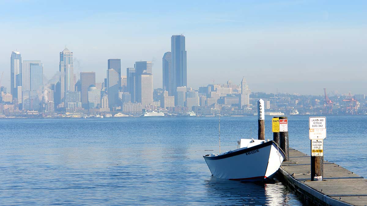
[WBHG News 24 – Kirkland] – It isn’t unusual for Seattle to tickle 60 degrees in January, but to reach or pass 60 degrees four days in a row was enough to set a new heatwave record. It stayed above 50 degrees for 5.5 days – 131 hours from January 27 to February 1, and three new high-temperature records were added to the books.

Weather records

DateNormal LowNormal High2024 Low2024 High
January 2738° F49° F48° F -50° F at 11:00 AM56° F
January 2838° F49° F51° F61° F – record
January 2938° F49° F51° F61° F – record
January 3038° F49° F51° F60° F – record
January 3138° F49° F53° F60° F
February 138° F49° F47° F – 50° F at 10:00 PM58° F
High and low temperatures versus average at Seatac Airport from January 27 to February 1, 2024

The four-day streak broke the previous three-day record set in 2015, which was also the warmest January in modern history, with an average high of 49.9 degrees. Because 2024 was a fire and ice experience with a cold snap from the 11th to the 18th, the average high was 45.74-degrees, but still more than 4 degrees above normal.

Does this prove climate change

Weather is not climate, and climate is not weather. A singular weather event, like a four-day heatwave, does not prove climate change, just as a seven-day cold snap does not disprove it. Since 1981, the average daily high in January has increased by 1.4 degrees, and the average low climbed 2.6 degrees. Almost all climatologists agree that part of that broader increase, and our increasingly wet weather, has been caused by human activity.

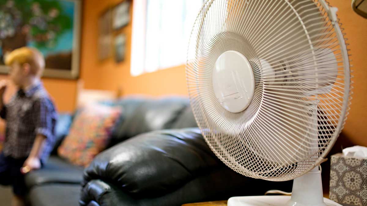
What was unusual about the 2024 winter heatwave was how warm the low temperatures were from January 28 to 31 – 13 to 15 degrees above normal. Had the January heatwave been in July, Seattle’s low temperatures would have been 70, 70, 70, and 72. How warm would that have been? The warmest low temperature in Seattle’s history was 73 degrees during the June 2021 “heatpocalypse.” It would have been misery for the region, which has the second-lowest number of air-conditioned buildings and homes in the United States.

What’s next

As for the week ahead, starting Saturday, normal temperatures are returning, with highs near 50 and lows close to 40. Saturday will be cloudy but dry, and Sunday should be pleasant under party-cloudy skies.

Freezing Rain Poised to Glaze Parts of Puget Sound on Tuesday

[WBHG News 24 – Kirkland, WA] – Seattle temperatures rose above freezing for the first time in 89 hours on Monday, but a sloppy weather system is poised to bring snow, sleet, and freezing rain to the Puget Sound lowlands on Tuesday night.

During the evening commute, precipitation will arrive in Puget Sound, rapidly spreading. From Tacoma north, expect snow and sleet before a transition to freezing rain and rain.

Focusing on our forecast area of eastern Puget Sound – Kirkland, Bellevue, Bothell, Kenmore, Redmond, and Woodinville – snow will be falling across the entire region by 7 PM. Up to 1/2 an inch of wet accumulation is possible before the transition begins. Higher hills and along the King-Snohomish County line may see a little more.

Between 8 PM and 10 PM on Tuesday, the snow and sleet will transition to freezing rain and rain. Up to 1/10 of an inch of accumulation is possible on the east side of central Puget Sound, but there is a lot of disagreement in the forecast models. We’re forecasting a transition between 1 AM and 3 AM on Wednesday morning, but keeping an eye on the situation.

The center of Seattle will have a mostly rain event, with the line between rain and a period of freezing rain roughly in the middle of Lake Washington. Kenmore and Northgate will also be in the area of freezing rain. If you’re driving east from Seattle on I-90, you may enter the tunnel on Mercer Island with it raining and exit the other side into freezing rain!

The Euro, which is the best model for predicting winter weather in our area is forecasting a transition between 5 AM and 7 AM. If this model is correct, the Wednesday morning commute will be even more challenging.

You should put off any travel on Tuesday after the evening commute, especially during the overnight hours. Low traffic and convective cooling will accelerate ice build-up on ramps, bridges, and side roads. If you have to drive, give yourself plenty of extra time, route around hills, leave extra room between you and other vehicles, and plan ahead as you approach traffic lights and stop signs.

Heat Advisory issued for another round of record-breaking weather

[KIRKLAND, Wash.] – (MTN) The National Weather Service has issued a Heat Advisory from noon Wednesday to midnight Thursday for Western Washington, with temperatures expected to flirt with the 90-degree mark. Seattle set a record for the most days in a year over 90 degrees and tied the record for the most days at or over 95 degrees in a year earlier this month.

It isn’t all bad news if you’re not a warm weather fan. The region has crossed over the point where 100 degrees are highly unlikely and inching closer to where 90-degree heat will be in the rearview mirror. So far, 2022 has been almost smoke-free. Air quality flirted with moderately unhealthy last week, with one afternoon providing orange-tinged afternoon light due to a layer of high-altitude smoke. Keen noses might have noticed the smell of smoke in the air on Monday evening.

Rest of Today

The afternoon will be pleasant for most, while old-school eastsiders might find it too warm. High temperatures will be 82 to 86 degrees under clear skies with winds from 5 to 10 MPH.

Tuesday Night

Temperatures will be pleasant, providing perfect sleeping with a low of 58 to 61 degrees.

Wednesday

Clouds may roll in and help moderate temperatures, making it difficult to break the 90-degree barrier. In the Bellevue-Kirkland-Woodinville area, highs will be 87 to 91 degrees under clear skies, with a light onshore flow forming toward the end of the day. Clouds will start to move in near sunset.

Wednesday Night

Partly to mostly cloudy skies will act like a blanket, while a weak onshore flow will hold back temperatures from dropping after sunset. Area lows will be 63 to 67. The onshore flow will shift overnight, causing humidity to climb.

Thursday

Partly to mostly cloudy skies won’t stop the mercury from climbing. Thursday morning will have the “it is going to be a hot day” feel as you head out the door. High temperatures will be 88 to 93 degrees. The dew point will be 63 to 65, which isn’t terrible, but will make the air feel a touch sticky.

Thursday Night

Cloud cover will once again act like a blanket that holds in the day’s heat. Low temperatures will be 63 to 66.

Friday Outlook

Friday and the rest of the weekend look to be partly cloudy, with highs in the 70s and 80s and pleasant sleeping weather returning.

Heat Advisory issued for Sunday and Monday with a side order of smoke

[KIRKLAND, Wash.] – (MTN) The National Weather Service has issued a Heat Advisory from noon Sunday to 9 PM Monday for Western Washington, with temperatures expected to flirt with the 90-degree mark. Smoke is expected to roll into the region and linger through Tuesday.

Saturday Night

Saturday evening will be pleasant with a northwest breeze from 5 to 10 MPH. Temperatures will be perfect for sleeping – 56 to 60 degrees.

Sunday

Sunny skies with light winds will heat things up with highs reaching 88 to 92 degrees. Temperatures will be cooler by the water and hotter in urban canyons and our area hot spots like Totem Lake and Kingsgate. An onshore flow will develop, pulling smoke over the Cascades. The AQI will be moderately unhealthy, 51 to 100 PM2.5. Very sensitive groups should limit their time outdoors and avoid strenuous activity. Photographers will want to have their cameras ready for a brilliant sunset.

Sunday Night

Temperatures will drop to 57 to 61 degrees, and smoke will remain moderately unhealthy, with the AQI between 51 and 100. Smoke tends to be worse at night as cooler air sinks and pulls it closer to the ground.

Monday

Monday’s forecast is complex, which makes it tricky. If the smoke becomes denser than current models, it will moderate high temperatures. Cloud cover is expected to move in from a weak disturbance, and that will also impact the high temperature and how much smoke settles in the area. High temperatures will reach 89 to 92 degrees in the Bellevue-Kirkland-Woodinville area, with an AQI of 51 to 100. Clouds aren’t expected to roll in until very late on Tuesday, but if that accelerates, it will moderate temperatures and convert our smoke into smog.

Monday Night

Low temperatures will be 59 to 65 degrees depending on when the clouds arrive and how much smoke is in the area. Expect cooler temperatures if the current weather models hold and warmer temperatures if the area gets blanketed. AQI will remain 51 to 100. By sunrise, winds will shift to an offshore flow, moderating our temperatures and blowing any smoke left out of our region.

Tuesday Outlook

Tuesday will be mostly cloudy, with smoke blowing out of the region. Expect the AQI to move back to normal by the afternoon. High temperatures will be 80 to 85 degrees with a southwest wind increasing to 7 to 10 MPH. On Tuesday night, there is a small chance of some rain showers moving through the area, cleaning the air out and moderating temperatures back into the 70s for Wednesday.

Wildfire smoke might make an unwanted visit by the end of the weekend

Smoke season has become a new summertime feature in Puget Sound during the last decade, and after a cold, wet spring suppressed fire season, our area’s luck might be running out.

Wind could carry smoke from a wildfire burning near vantage over the Cascades late this weekend and into the start of next week during a period where high temperatures will tickle 90 degrees. This won’t be a repeat of 2020 or 2021 when thick blankets of smoke choked the area, but there is the potential to impact vulnerable populations and put the taste and smell of smoke into the air.

If you haven’t restocked your smoke season supplies and revisited your plan, now is the time to get prepared.

  • Get some N-95 masks, especially if you work or exercise outdoors. N-95 masks work when tightly fitted to the face. Surgical masks don’t block fine particulates, so they aren’t effective in the smoky air. The particles in smoke are accumulative in your lungs. Repeated exposure over the years can have health implications decades later.
  • Smoky days in Puget Sound typically go hand-in-hand with our hottest days due to the onshore flow carrying smoke into our region. In 2018 and 2020, we avoided 100+ degree heatwaves because the dense blanket of smoke kept daytime highs down by 3 to 6 degrees. Ideally, on the worst days, you should keep your windows closed. Now is the time to consider a portable air conditioner if you haven’t been convinced yet for at least one room to create a clean air space in your home.
  • If your choices are sitting in dangerous heat in an enclosed space or opening a window to regulate temperatures while allowing smoke to circulate, you should open your windows. If you have vulnerable family members or care for the elderly, consider finding relief in air-conditioned places.
  • Along with a room with AC, having a box fan with a furnace filter taped to the “intake” side (the side that pulls the air) has been shown to reduce particulate matter in the air dramatically. If you can’t afford an AC, a $35 box fan and a $15 filter can significantly improve air quality in a single room.
File photo – a homemade smoke filter using a box fan, duct tape, and a 20X25 standard furnace filter
  • Smoke typically is at its worst after sunset and during the overnight hours. As the air cools overnight, it sinks, which tends to pull the blanket of smoke to lower altitudes. After sunrise and the air starts to heat up, the rising warm air lifts the smokes up to higher elevations.
  • When you drive your car run your AC in the “max” or “recirculation” mode. This recycles the air within your cabin. If your car doesn’t have a working AC, consider wearing an N-95 mask when driving.
  • On the worst smoky days, don’t do outdoor activity if you can. If you work outdoors, your employer should provide N-95 masks. This is vital on days where there is ash fall.
  • Exercise should be done indoors in a climate-controlled setting. If you have medical issues, talk to your primary care physician about what is best for you.
  • Contact lens wearers should make sure their glasses prescription is up to snuff. Smoke can irritate the eyes, which can be made worse by contacts.
  • Ash is very alkaline and damaging to car paint. Additionally, ash can create spiderweb scratches in auto finishes. On days with bad ashfall, consider gently rinsing your car off with a hose or using a leaf blower. Don’t brush ash off your car or use an automated car wash before removing the particles.

Seattle’s 6-day heatwave is one for the record books

[KIRKLAND, Wash.] – (MTN) Clouds and marine air rolled into Puget Sound, putting an end to a six-day run of temperatures over 90 degrees, the longest heatwave since weather records have been kept in Seattle.

The infamous heatwave of 2021, which killed over a dozen and smashed multiple weather recordings, including setting an all-time high of 108 degrees at Seatac Airport, couldn’t pull off five days in a row over 90. The heatwave of 2022 set the new mark and did it without the benefit of an onshore flow. Winds were light through the entire period but were mostly from the west, northwest, and north. If the wind had been from the east, Seattle likely would have broken 100 degrees on several days.

Record highs

Multiple records were set, but the bar was high. July 28 and 29 were competing against the 2009 three-day heatwave where Seattle reached 94 on the 27th, 97 on the 28th, and the previous all-time record high of 103 on the 29th. That heatwave was caused by an onshore flow and ended when the winds shifted overnight on the 29th, ushering in cloudy skies and normal temperatures. The heatwave of 2022 was shockingly consistent.

  • July 26 – 94 degrees – broke the old record of 92
  • July 27 – 91 degrees
  • July 28 – 94 degrees
  • July 29 – 95 degrees
  • July 30 – 95 degrees – three-way tie of 5-days in a row over 90 degrees, prior records were 1981 and 2015
  • July 31 – 95 degrees – longest streak over 90 degrees and tie for the longest streak of highs reaching 95 degrees or hotter; the prior record was 2021

July 26 to 30 was the fourth hottest streak on record, with an average high temperature of 93.8 degrees. The record-setting heatwaves of 1981, 2009, and 2021 were hotter.

Was this due to climate change

Weather is not climate, and climate is not weather. A heatwave in Puget Sound does not prove or disprove climate change. Just as the cold, wet, cloudy non-existent Puget Sound spring did not disprove or prove climate change. Globally, 2022 is currently the fifth hottest on record through June. Record-setting heat has hit Europe, Asia, and North America.

Will we have a smoke season

Washington’s cold and wet spring provided a good snowpack and slowed down the growth of underbrush and other burn materials. The heatwave that baked the region has removed some of that safety margin, and a large wildfire has erupted near Weed, California, on the Oregon-California border. For the next six to eight weeks, the chances of smoke rolling into Puget Sound will likely increase looking at the long-term weather models.

The time to prepare for smoke is now by making sure you have a supply of N-95 masks, particularly if you exercise or work outdoors or have moderate to severe asthma or other clinical breathing issues. If you don’t have air conditioning, now is the time to set up your clean air room and have a plan in place in the event it is over 85 or 90 degrees with heavy smoke. You can build your own smoke filter for under $50 with a box fan, furnace filter, and small bungee cords. Securely attach the air filter to the fan’s intake side, ensuring the arrow on the filter faces the right way.

Update: Excessive Heat Warning extended through Sunday as heatwave continues

[KIRKLAND, Wash.] – (MTN) The National Weather Service extended the Excessive Heat Warning for Western Washington through 9 PM Sunday as a record-breaking heatwave continues to bake the region.

On Tuesday, the temperature reached 94 degrees at Seatac Airport, breaking the previous record of 92. Wednesday’s high reached 91 degrees, and Thursday hit 94. Forecast models are coming into alignment that a 90-plus degree day on Sunday is likely. If the region reaches the mark, it would be the first six-day streak of temperatures 90 or above in modern history.

Friday

Friday is starting off two degrees warmer than the low on Thursday. High temperatures will be 93 to 97 degrees. The dew point at Seatac is rising indicating it will feel more humid than earlier in the week, making today feel more oppressive.

Friday Night

Winds will pick up overnight, with a light breeze providing some relief. Nighttime lows will be 60 to 64.

Saturday

Bright sun and searing temperatures will bake the area for a fifth day. Highs will reach 93 to 97 in the Bellevue-Kirkland-Woodinville area with almost no wind.

Saturday Night

A shift to a more unsettled pattern won’t start on Saturday night, with skies remaining mostly clear. Nighttime lows will be 59 to 63.

Sunday

Clouds won’t roll in with a marine layer push until early on Monday. The region has a very realistic chance of experiencing six days of 90 degrees or hotter in a row since weather records have been kept in Seattle – the Federal Building or Seatac Airport.

High temperatures will be 90 to 94 degrees.

Monday Outlook

A more normal weather pattern will return next week, with a strong marine layer pushing into the region as the thermal trough and the high pressure system slide away. Monday looks to be party to mostly cloudy, with a high of 79 to 83. There will be an offshore flow with winds from 8 to 12 MPH, providing much needed relief.

Due to our unseasonably cold spring and deep snowpack, area rivers, streams, and lakes remain very cold. It is possible to get hypothermia, even on a 90-degree day. Stream flow is also high, so tubers and kayakers should use caution. Currents are faster than usual. Never swim, tube, or boat near downed trees or low head dams; it is very dangerous.

Do not leave pets or children in your car, even for “just a minute.” Temperatures can soar to over 110 degrees in less than 10 minutes, leading to heat stroke or worse.

Regrettably, due to the current COVID BA.5 surge and community spread of monkeypox, people seeking cooler indoor spaces should consider wearing a tight fighting N-95 mask.

Excessive Heat Warning extended through Saturday as the heatwave continues

[KIRKLAND, Wash.] – (MTN) The National Weather Service extended the Excessive Heat Warning for Western Washington through 9 PM Saturday as a record breaking heatwave continues to bake the region.

On Tuesday the temperature reached 94 degrees at Seatac Airport, breaking the previous record of 92. Wednesday’s high reached 91 degrees. Forecast models are hinting that a high of 90 degrees on Sunday is within reach. If that were to happen, it would be the first six day streak of temperatures 90 or above in modern history.

A thermal trough, high pressure, and light winds have come together to send temperatures west of the Cascades into the 90s and over 100 degrees in the eastern part of the state. Humidity has been a little lower than the initial forecast models, and overnight temperatures have been a few degrees cooler adding a small amount of relief in the morning hours.

Thursday

Clear sunny skies with a light wind from the northwest and north will keep the heat going. The high will reach 89 to 93 degrees through the Bellevue-Kirkland-Woodinville area. Downtown Bellevue and Totem Lake will be the hot spots, while higher spots like Finn Hill and Houghton, as well as along the water, will be a touch cooler.

Thursday Night

Temperatures will stay above 70 until 1 AM to 3 AM, dropping to 6 to 64 degrees close to dawn.

Friday

Friday will be hotter as heat remains entrenched over the region. High temperatures will be 93 to 97 degrees. The models are suggesting that it may be a bit more humid than the previous days, adding a layer of awful for those who don’t have air conditioning.

Friday Night

Winds will pick up overnight, with a light breeze potentially pulling in some marine air. Temperatures will be closer to fine with lows dipping to 60 to 64 degrees around sunrise.

Saturday

Appears to be a near copy of Friday, with just a little less humidity. High temperatures will be 93 to 97 degrees.

Saturday Night

Some clouds start to move in, but not enough to make it mostly or totally cloudy. Lows will be 61 to 65.

Sunday Outlook

Clouds start to move in on Sunday and depending on when they arrive and thicken up will have a significant impact on the high temperature. If they arrive earlier in the day, highs will moderate and be between 85 and 89 degrees. If the clouds arrive later in the day, highs will reach 89 to 93.

Due to our unseasonably cold spring and deep snowpack, area rivers, streams, and lakes remain very cold. It is possible to get hypothermia, even on a 90-degree day. Stream flow is also high, so tubers and kayakers should use caution. Currents are faster than usual. Never swim, tube, or boat near downed trees or low head dams, it is very dangerous.

Do not leave pets or children in your car, even for “just a minute.” Temperatures can soar to over 110 degrees in less than 10 minutes, leading to heat stroke or worse.

Regrettably, due to the current COVID BA.5 surge and community spread of monkeypox, people seeking cooler indoor spaces should consider wearing a tight fighting N-95 mask.

Excessive Heat Warning for Western Washington as potential record-tying heatwave begins

[KIRKLAND, Wash.] – (MTN) The National Weather Service has issued an Excessive Heat Warning for Western Washington from noon Tuesday to 9 PM Friday for high temperatures over 90 degrees and lows in the mid-60s.

A thermal trough, high pressure, and light winds have come together to send temperatures west of the Cascades into the 90s and over 100 degrees in the eastern part of the state. Temperatures aren’t being pushed up from an on-shore flow off the east slopes, so humidity will be high in Puget Sound, with dew points in the mid-60s through Friday, making it feel hotter than it is.

Tuesday

Clear sunny skies with a light wind from the north and northeast will send temperatures soaring. The high will reach 92 to 96 degrees through the Bellevue-Kirkland-Woodinville area. Downtown Bellevue and Totem Lake will be the hot spots, while higher spots like Finn Hill and Houghton, as well as along the water, will be a touch cooler. The dew point will be in the mid-60s, making it feel like it is 94 to 99 degrees.

Tuesday Night

Temperatures will stay above 80 until 11 PM to midnight and won’t drop below 70 until close to dawn. Lows for the Bellevue-Kirkland-Woodinville area will be 63 to 66.

Wednesday

Hump day looks to be almost identical to Tuesday, with clear skies and little wind. High temperatures will be 93 to 97 degrees. The humidity will make it feel like it is 94 to 99 degrees. There is a small chance for a slight onshore flow to form late in the day. That will drop the dew point. However, it will also hold the temperatures higher later in the day.

Wednesday Night

Temperatures will hold above 70 degrees well into the night, dropping below 70 between 2 AM and 4 AM. Lows will be 63 to 65 around sunrise.

Thursday

The cooler start means a slightly cooler day ahead, but it won’t be much of an improvement. High temperatures will reach 92 to 96 degrees, with the dew point still holding in the mid-60s. It will feel like 93 to 98.

Thursday Night

Right now, this appears to be the most uncomfortable night of the week. Lows will be 64 to 67, with humidity between 80% to 90%. Temperatures won’t drop below 70 degrees until 2 AM to 4 AM.

Friday

On Friday, the thermal trough will start to move, and the high-pressure area will slide a bit more to the east. High temperatures will reach 92 to 95 degrees. It will still feel like it is 94 to 97 degrees, but the shifting weather pattern will cause the humidity level to decrease by sunset.

Friday Night

Temperatures will moderate slightly, but it still won’t fall below 70 degrees until 1 AM to 3 AM. There will be little wind, and the humidity will still be high, with lows falling to 63 to 65 degrees.

Saturday

Saturday could be the day we tie a weather record of five days in a row over 90 degrees. High temperatures will be 89 to 93 degrees under clear skies. The dew point will be between 58 and 61 degrees, given the area the only day that will feel like a “normal” 90-degree day in Western Washington.

The Week Ahead

Sunday looks cooler, but temperatures will still reach 84 to 87, and the overnight lows will still be above 60. By the start of next week, it appears we’ll return to a normal weather pattern of daytime temperatures in the 70s and nighttime temperatures in the high 50s.

Due to our unseasonably cold spring and deep snowpack, area rivers, streams, and lakes remain very cold. It is possible to get hypothermia, even on a 90-degree day. Stream flow is also high, so tubers and kayakers should use caution. Currents are faster than usual. Never swim, tube, or boat near downed trees or low head dams, it is very dangerous.

Do not leave pets or children in your car, even for “just a minute.” Temperatures can soar to over 110 degrees in less than 10 minutes, leading to heat stroke or worse.

Regrettably, due to the current COVID BA.5 surge and community spread of monkeypox, people seeking cooler indoor spaces should consider wearing a tight fighting N-95 mask.

Sizzling summer temperatures will broil Western Washington during the work week

[KIRKLAND, Wash.] – MTN The average summer Western Washington has been enjoying is about to heat up, with a four-day streak of 90-plus degree weather ahead. A thermal trough, high pressure, and light winds will combine to create a classic Washington summer heat wave.

After 2021, the words “heat wave” may bring back bad memories of three days in a row over 100 degrees – it won’t be that hot. Daytime temperatures will cross 90 degrees Tuesday through Friday, while lows will likely stay in the high 60s. Temperatures won’t drop below 70 until close to sunrise, so there won’t be much overnight relief from the heat.

Sunday

A perfect late-July day awaits the Bellevue-Kirkland-Woodinville area. Skies will be mostly sunny with high temperatures between 80 to 84. Some clouds will start to roll in close to sunset.

Sunday Night

Partly cloudy skies with a light breeze from the northeast with a low of 58 to 61 degrees – perfect sleeping weather.

Monday

It warms up a little more, but the area isn’t roasting yet. Morning clouds will burn off, and the high temperatures will reach 84 to 88 degrees.

Monday Night

High pressure will slide down from British Columbia to our north, and a thermal trough will form overnight. Overnight temperatures will fall to 62 to 64 degrees. On Tuesday, things start to heat up.

Tuesday

Clear sunny skies with a light wind from the north and northeast will send temperatures soaring. The high will reach 90 to 93 degrees through the Bellevue-Kirkland-Woodinville area. Downtown Bellevue and Totem Lake will be the hot spots, while Finn Hill and right along the water might not quite get to 90.

Tuesday Night

Temperatures will stay well into the 70s past midnight before falling to 65 to 67 degrees close to sunrise. Thee won’t be much of a breeze to offer any relief.

Wednesday

The week’s hottest day will get even warmer thanks to a weak easterly flow off the Cascades. High temperatures will be 92 to 96 under clear skies.

Wednesday Night

Temperatures once again will stay well past 70 overnight, falling to 65 to 68 degrees close to sunrise. It will be almost windless, so make sure those fans are ready.

Rest of the Week

On Thursday and Friday, the high-pressure center starts to drift slowly, moderating temperatures a little bit. it is too far out to make an accurate forecast, but models support temperatures reaching 90 to 94 on both days, with lows at night falling to 64 to 67. Friday night might be a little cooler as the high-pressure area starts to move out of our region and the thermal trough breaks up.

Due to our unseasonably cold spring and deep snowpack, area rivers, streams, and lakes remain very cold. It is possible to get hypothermia, even on a 90-degree day. Stream flow is also high, so tubers and kayakers should use caution. Currents are faster than usual. Never swim, tube, or boat near downed trees or low head dams, it is very dangerous.

Do not leave pets or children in your car, even for “just a minute.” Temperatures can soar to over 110 degrees in less than 10 minutes, leading to heat stroke or worse.

If local and county officials believe that there is a heat emergency, cooling centers will be opened. King County, Woodinville, and Kirkland opened cooling centers last year, while Bellevue partnered with area businesses.

Regrettably, due to the current COVID BA.5 surge and community spread of monkeypox, people seeking cooler indoor spaces should consider wearing a tight fighting N-95 mask.