French Toast Emergency
Heat Advisory issued for Sunday and Monday with a side order of smoke
Temperatures will approach 90 as smoke delivers moderately unhealthy air.
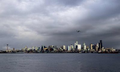
[KIRKLAND, Wash.] – (MTN) The National Weather Service has issued a Heat Advisory from noon Sunday to 9 PM Monday for Western Washington, with temperatures expected to flirt with the 90-degree mark. Smoke is expected to roll into the region and linger through Tuesday.
Saturday Night
Saturday evening will be pleasant with a northwest breeze from 5 to 10 MPH. Temperatures will be perfect for sleeping – 56 to 60 degrees.
Sunday
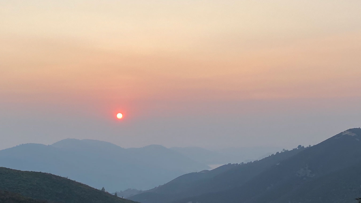
Sunny skies with light winds will heat things up with highs reaching 88 to 92 degrees. Temperatures will be cooler by the water and hotter in urban canyons and our area hot spots like Totem Lake and Kingsgate. An onshore flow will develop, pulling smoke over the Cascades. The AQI will be moderately unhealthy, 51 to 100 PM2.5. Very sensitive groups should limit their time outdoors and avoid strenuous activity. Photographers will want to have their cameras ready for a brilliant sunset.

Sunday Night
Temperatures will drop to 57 to 61 degrees, and smoke will remain moderately unhealthy, with the AQI between 51 and 100. Smoke tends to be worse at night as cooler air sinks and pulls it closer to the ground.
Monday
Monday’s forecast is complex, which makes it tricky. If the smoke becomes denser than current models, it will moderate high temperatures. Cloud cover is expected to move in from a weak disturbance, and that will also impact the high temperature and how much smoke settles in the area. High temperatures will reach 89 to 92 degrees in the Bellevue-Kirkland-Woodinville area, with an AQI of 51 to 100. Clouds aren’t expected to roll in until very late on Tuesday, but if that accelerates, it will moderate temperatures and convert our smoke into smog.
Monday Night
Low temperatures will be 59 to 65 degrees depending on when the clouds arrive and how much smoke is in the area. Expect cooler temperatures if the current weather models hold and warmer temperatures if the area gets blanketed. AQI will remain 51 to 100. By sunrise, winds will shift to an offshore flow, moderating our temperatures and blowing any smoke left out of our region.
Tuesday Outlook
Tuesday will be mostly cloudy, with smoke blowing out of the region. Expect the AQI to move back to normal by the afternoon. High temperatures will be 80 to 85 degrees with a southwest wind increasing to 7 to 10 MPH. On Tuesday night, there is a small chance of some rain showers moving through the area, cleaning the air out and moderating temperatures back into the 70s for Wednesday.
Please Support Malcontent News
|
When you become a subscriber, you help us stay independent and paid advertiser free. A free press is a Constitutional right, but it doesn’t come free. Our core missions are showing you an unfiltered view of the before, during, and after, defend the First Amendment, and amplify BIPOC and LGBTQIA+ voices in an advertisement free experience. |
|
 |
For as little as $5 a month, you can support Malcontent News. Becoming a Patreon will help cover technology, data, bandwidth, and travel costs. Patreons get early access to content and a Discord server, virtual meetings with the staff, and private Zoom meetings. Subscribe NOW! |
 |
A one-time Venmo donation can help with safety gear, equipment, or a small thank you to show your appreciation for what Malcontent News provides. No amount is too small, even $5 goes a long way. Venmo NOW! |