Tag Archives: weather

It Wouldn’t be 2022 Western Washington Weather if it Didn’t Rain on Independence Day

[KIRKLAND, Wash.] – MTN The Independence Day long week weather forecast for the Bellevue-Kirkland-Woodinville area isn’t a complete washout, but unseasonably cool, cloudy, and rain showers await from Saturday to Monday.

Friday night will be seasonable under mostly clear skies and a low of 52 to 56 degrees. If the pine pollen that showed up later than normal this year doesn’t bother your nose, it’s a perfect night to open the windows and enjoy the sleeping weather.

Saturday clouds will roll in and it will be the warmest day of the weekend. The high will be 71 to 74 degrees which is seasonable for this time of year. The chance for some stray rain showers moving into the area will increase but should hold off until after sunset.

Saturday night the chance of rain increases with numerous rain showers by sunrise. The clouds will act like a blanket and moderate evening temperatures with a low of 55 to 57 degrees.

Sunday will be the wettest day with showers and light rain tapering off in the afternoon. There may be some breaks in the clouds by sunset, with a lingering chance of rain showers. The high will be about 10 degrees below normal – 63 to 65 degrees.

Sunday night will be mostly cloudy with scattered rain showers. Low temperatures will be 55 to 57 degrees.

Monday will be mostly cloudy to cloudy, with the chance of rain showers tapering off by sunset. High temperatures will be 67 to 69 degrees. If the clouds break up some more in the afternoon, 70 degrees could be possible.

In true Western Washington fashion, Tuesday, July 5 will be sunny under partly cloudy skies. The high temperature will be 73 to 77 degrees.

Puget Sound lowlands facing a frigid week with record-setting cold

[KIRKLAND, Wash.] – (MTN) Record cold is on tap for the week ahead with temperatures 15 to 20 degrees below normal. There is a slight chance for a few stray flakes of snow late Sunday night before the region dries out and a cold sun peeks through partly cloudy skies.

A weak disturbance currently developing in Eastern British Columbia will move into Eastern Washington on Sunday Night, bringing cloudy skies to the Puget Sound lowlands. A strong area of high pressure off Vancouver Island will keep the disturbance to our east, and push it southward into Oregon. As the two centers of circulation push against each other winds will increase on Monday afternoon. In the lowlands, winds will be 10 to 15 MPH from the north, with higher gusts. The north wind will pull cold air southward into Washington.

Temperatures will be in the mid-30s on Monday morning, reaching a high of 42 to 44 along the I-405 corridor. There is little support for a convergence zone to form on Sunday night, and not enough moisture to produce pockets of accumulating snow. Lows on Monday night will drop to 26 to 28 degrees. This is just the opening act.

The area of high pressure will move further east on Tuesday, while the low-pressure area will get better organized and drift to southwest Oregon. A cold front will move through the lowlands on Tuesday afternoon, with winds of 10 to 20 MPH and higher gusts, pushing additional cold air in from the Fraser Valley. Area skies will clear out before sunset, enhancing radiational cooling overnight. The daytime high will be 37 to 39, before dropping to record-cold with lows of 19 to 21 degrees.

Wednesday will be cold under mostly sunny skies with a high of 36 to 39. High clouds that move in during the late afternoon will thicken up overnight and help keep things slightly warmer. Lows will reach 26 to 28 degrees with a very slight chance of a light snow flurry with little to no accumulation.

Looking at the long-range weather model, Thursday should be a mostly sunny day. Daytime temperatures will break over 40 degrees with a high of 40 to 44. Nighttime lows will reach 23 to 27, putting the current record of 24 at risk. For now, Friday is forecasted to be a repeat a Thursday, with clouds thickening up in the evening.

Cold temperatures will bring life threatening conditions and can freeze pipes

Temperatures this low are life-threatening to the houseless. At press time, there was no information about available cold weather shelters, or what action King County officials are taking.

The coming week will also be dangerous to pets and on Tuesday night, backyard livestock. Cats and dogs will need places to escape the cold, ideally inside your house. Water bowls for animals will freeze making it impossible for them to hydrate.

Outside faucets should have hoses disconnected and be covered or wrapped to protect them from freezing. In older homes with sinks that face outside walls, setting your faucets to a weak trickle and opening the under-sink cabinet doors will help prevent pipes from freezing. Know where the water shutoff valve is for your house and make sure if you need a tool to use it, that you have one.

Local store shelves emptying as weather, holidays, and COVID stress the supply chain

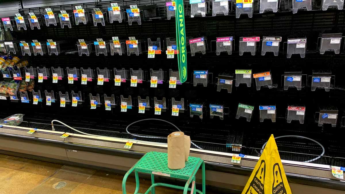
[KIRKLAND, Wash.] – (MTN) Empty spots on store shelves and coolers are getting bigger across Puget Sound as the labor shortage, weather, post-holiday buying, and COVID place increasing stress on supply chains.

Shortages of cold medication and home rapid COVID tests have grown to include fresh produce, milk, pet food, and some dry goods. Shortages are spotty and vary across stores. In Seattle, social media and pictures show empty dairy sections. In Kirkland, Fred Meyer had plenty of milk, eggs, and cheese but very little fresh produce.

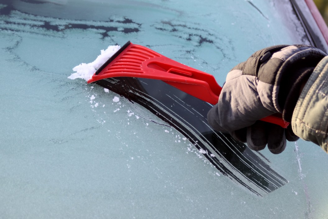
The holiday buying season both for goods and food products arrived just before a snowstorm and historic cold blanketed the region. The timing combined to empty shelves for some, but by New Year’s many locations had recovered.

The COVID variant Omicron is sickening a record number of people, with worker shortages across every sector from hospitals to warehouses. With national unemployment at a robust 3.9 percent, the nation was already deep into a worker shortage before the ongoing coronavirus surge.

The trucking industry is short over 80,000 drivers nationally. Drivers are typically paid by the mile, and go unpaid when they aren’t moving. Labor shortages at warehouses and distribution centers can leave bulk freight motor carriers waiting for hours, and sometimes days without pay. Additionally, trucker pay has declined 50 percent in the last 20 years, forcing experienced drivers to leave the industry. Long-haul bulk freight has suffered the most, with many drivers wanting better pay or assurances they will get to sleep in their own beds at night.

Tracking technology has turned into a double-edged sword for the freight industry. The same systems that monitor driver behavior, safety, and location, have created a Fifth Element style driving environment. As an example, if a driver is moving in a freight yard or loading dock and exceeds 5 MPH, tracking systems will consider that movement as travel. If the driver is only moving their vehicle but on a mandatory rest window, they get penalized. Drivers have complained that getting stuck in traffic results in filling out online forms and explaining to dispatchers why they aren’t moving and on schedule.

Washington awoke on Friday morning to find the region was being pummeled by another once in a 100-year weather event. Heavy rain, flooding, and historic snowfall have crippled land transit into Puget Sound closing all mountain passes, stopping railroads, and for a short period this morning, closing a 20 mile stretch of I-5 in Lewis County. A similar weather system in December of 2007 crippled transit and disrupted the supply chain in Western Washington.

Wenatchee and Leavenworth received record amounts of snowfall on Thursday, with Leavenworth declaring a state of emergency. The Bavarian-themed tourist town received three feet of snow in 24 hours. Chelan County also declared a state of emergency and made a disaster declaration due to record snowfall.

All mountain passes are closed until at least Sunday due to record amounts of snow, avalanche danger, landslides, and downed trees. Snoqualmie Pass has recorded 69 inches of snow in four-and-a-half days with more expected through Friday. Stevens, Whites, and Blewett Passes haven’t had updated snowfall reports since Jan. 5.

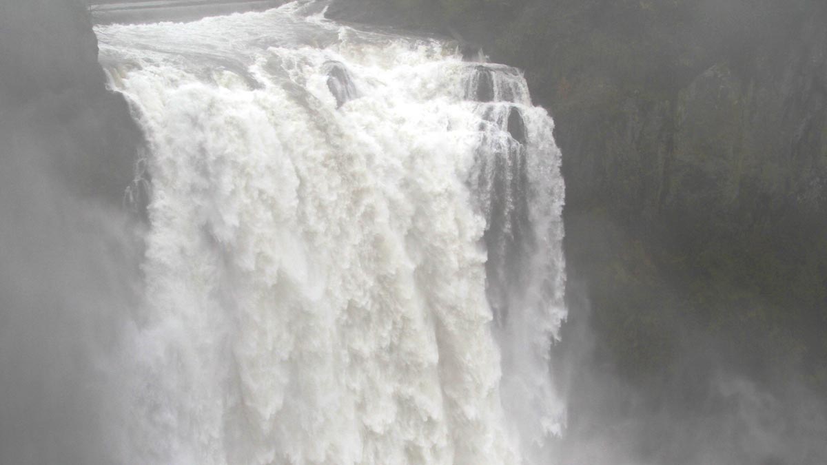
The same weather system that has buried the Cascades is causing historic flooding in South Puget Sound, Southwest Washington, and in communities such as Issaquah. The Washington State Department of Transportation was forced to close a 20-mile section of I-5 between Centralia and Chehalis on Friday morning, the first major closure due to flooding since 2007. The highway is temporarily reopened this afternoon, but DOT traffic cameras showed water lapping at the edges of I-5. The Chehalis River isn’t expected to crest until Friday night or early Saturday morning.

The Newaukum and Skookumchuck Rivers reached near-record levels. The Thurston County Sheriff was appealing for people to follow evacuation orders and not to ignore road closures. In Issaquah, a phase two alert was issued on Thursday, when the Issaquah Creek broke its banks. On Friday morning, floodwaters were slowly receding.

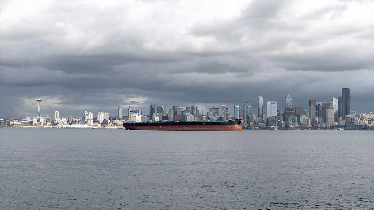
The timing of these disruptions has created a perfect storm for the delivery of goods into the region. By Friday evening, the only way in and out of Puget Sound, the Islands, and the Olympic Peninsula will be by boat or aircraft. Combined with a growing number of COVID cases sidelining more workers, Western Washington should accept more empty shelves in the days to come.

Wind Advisory issued for the eastside – a lot of weather ahead today

[KIRKLAND] – (MTN) The National Weather Service added a Wind Advisory to the eastside at 7:36 a.m. through 4:00 p.m. today including Bellevue, Redmond, Kirkland, Bothell, Kenmore, Newport Hills, Sahalee, and Pine Lake.

Temperatures in the Bellevue-Kirkland-Woodinville area were over 60 degrees as an intense flow of sub-tropical air was pushed ahead of an advancing cold front. The area has reached high temperatures for the day with the front advancing into our region.

Winds will be from the south and increase as the cold front approaches, and then shift to the southwest and west and intensify. Southwest winds will rise to 20 to 30 mph with gusts to 45 mph. The ground is extremely saturated, increasing the possibility of trees being blown down. Scatter power outages are likely as the morning progresses.

When the wind shifts to the southwest temperatures will drop and by sunset will be down to 45 degrees. Drivers should prepare for a long commute on Monday evening and give themselves some extra time. Heavy rain, landslide risk, and saturated soil can impact Sounder Train service, commuters should check on conditions in the evening and have an alternative plan for the return home.

Never drive around road closed or high water warning signs, especially in the dark. According to FEMA, a passenger car or car-based sport utility vehicle can stall out in six inches of water and start to float in 12. Even if you successfully drive through high water, moisture can get into critical mechanical components and foul lubricants causing long-term damage.

Wind and rain on Monday will bring more woe to the Puget Sound lowlands

[KIRKLAND] – (MTN) When it rains it pours and it has been pouring in Western Washington for almost a week with flood watches and warnings across the region. Monday will deliver yet another punch of heavy rain and the strongest winds yet driven along an atmospheric river extending out into the Pacific Ocean.

The forecast for tomorrow is extremely challenging with little agreement across weather models. The strongest winds will move through Central Puget Sound from 6 a.m. to noon on Monday. For wind storms, Malcontent News puts more weight on the Euro Model, which is forecasting a Wind Advisory grade event for the morning.

The National Weather Service has not issued a Wind Advisory at this time. On Sunday at Seatac Airport winds reached Wind Advisory territory for three hours, peaking with a gust of 42 MPH.

For Sunday night, the rain will increase between 11 p.m. and midnight with breezy winds from the south. It will be unseasonably warm, with low temperatures from 55 to 57. South winds will be 10 to 15 MPH with increasing gusts toward daybreak. Overnight rainfall will be around one-tenth of an inch.

Monday morning will be wet, windy, and warm. Temperatures will reach 57 to 59 degrees early in the day before dropping sharply in the afternoon. Winds will continue from the south from 15 to 25 MPH with gusts to 45 MPH. Rainfall with be close to three-quarters of an inch through the area, further saturating the soil.

Saturated soils combined with the wind will increase the chance of trees being uprooted, as well as enhance the landslide risk. Scattered power outages are likely. By sunset, the winds will die down along with the rain. Overnight temperatures will drop to 38 to 40 degrees.

Drivers should prepare for a long commute on Monday morning and give themselves some extra time. Heavy rain, landslide risk, and saturated soil can impact Sounder Train service, commuters should check on conditions in the morning and have an alternative plan for the return home.

People should never drive around road closed or high water warning signs, especially in the dark. According to FEMA, a passenger car or car-based sport utility vehicle can stall out in six inches of water and start to float in 12. Even if you successfully drive through high water, moisture can get into critical mechanical components and foul lubricants causing long-term damage.

Bomb cyclone on Sunday kicks off 4 days of wet and windy weather

Photo credit: Zoom.Earth

[KIRKLAND] – (MTN) A string of powerful storms riding an atmospheric river will slam into the West Coast through Wednesday bringing high winds and heavy rain, but it appears Central Puget Sound will be spared.

It is possible we could see Wind Advisories for the Bellevue-Kirkland-Woodinville area on Sunday, Monday, or Tuesday. Right now, Monday is the most interesting day. A 50-mile change in the path of a fall wind storm can have a significant impact on our Puget Sound microclimates.

A “bomb cyclone” is developing to our west and will track north of Puget Sound and linger off Vancouver Island. The forecasted storm track is getting more consistent across the weather models this afternoon but there remains some disagreement.

The North American Mesoscale (NAM) model is forecasting the center will come closer to the Washington coast. If the NAM is correct, winds will be around 5 MPH higher than the current forecast. That isn’t quite enough for a Wind Advisory, but it is close. Additionally, the NAM model supports winds from the south, which enhances the impact for residents of Juanita, Finn Hill, and Kenmore.

Sunday morning will start off dry with wind and rain increasing by noon. Bellevue-Kirkland-Woodinville can expect winds up to 20 MPH that last for three to six hours. The storm system will linger off the coast as it heads towards Vancouver Island, creating blustery conditions overnight. Temperatures will be 56 to 59 degrees and expect up to a third of an inch of rain.

Sunday night temperatures will be 47 to 49 degrees, with winds of 10 to 15 MPH.

Monday looks a lot more interesting but there remains disagreement in the weather models. The Global Forecast System (GFS) is more conservative for storm development while the NAM, ECMWF, and ICON are in agreement a significant wind event is coming to the Straight of Juan de Fuca, the San Juan Islands, and North Washington. We believe this is the day to keep an eye out for a Wind Advisory and could create spotty power outages in the Central Puget Sound lowlands.

Bellevue-Kirkland-Woodinville will see south winds of 15 to 20 MPH and higher gusts. Peak winds will last for up to 12 hours, starting close to lunchtime. South winds move unobstructed across Lake Washington impacting Juanita, Finn Hill, and Kenmore more than other areas. Expect up to half an inch of rain with temperatures from 55 to 57 degrees.

Many leaves remain on trees that suffered significant heat stress over the summer so it won’t take much to bring limbs down.

Monday night temperatures will drop to 48 to 50 degrees and rain will turn to showers. Winds will still be 5 to 15 MPH and continue from the south.

Tuesday another system will arrive along Vancouver Island. This one doesn’t look as strong as Monday’s system, but there is a fair amount of uncertainty in the weather models. Winds will be 10 to 20 MPH for the Bellevue-Kirkland-Woodinville area with up to a half-inch of rain. Temperatures will cool with highs between 53 and 55.

Looking into the crystal ball for the trick or treaters on Halloween, the weather forecast is looking perfect with no rain and highs in the 50s dropping to the mid-40s.

Special Delivery! Fall weather arrives with a wet and windy weekend ahead

[KIRKLAND, Wash.] – (MTN) After a rollercoaster summer of record-shattering heat, a tie for the driest July since weather records have been kept, and 51 days without rain, fall is arriving. A particularly strong storm system for mid-September is delivering three days of rain, the potential for urban flooding, and strong winds on Friday afternoon.

The central pressure of the storm approaching is flirting with 990 MB, which is similar to Hurricane Nicholas that hit Texas on September 14. For the Kirkland-Bellevue-Woodinville area, the two issues will be rain through the weekend and wind this afternoon.

It’s already raining across the region, and rain will fall through the day, with the chance for heavy showers and even a growl of thunder. Over lunchtime, there could be a break in the rain, but don’t be fooled. Between 3 to 5 PM will the rain will pick up, get heavier, and the winds will increase. Peak winds will be between 7 PM and 10 PM at 15 to 20 MPH, with gusts up to 40 MPH.

The heatwave in June followed by very little rain has stressed many trees that are still full of leaves. Between the heat stress and the foliage that can act like sails, the usual trouble spots such as Finn Hill should expect to lose power. There isn’t enough wind in the forecast model in Central Puget Sound for a Wind Advisory, but areas north of Everett could see gusts over 50 MPH.

Temperatures will be in the low to mid-60s. Over the next 24 hours, close to an inch of rain should be expected for the area.

Rain will taper off briefly on Saturday morning, while the wind will continue into the afternoon. Another shot of rain will arrive around noon, and you should expect rain through Sunday. On Saturday another 1/3 of an inch is expected, with another 1/3 on Sunday. If the forecast model holds, our region will get a month of rain in 3 days, in what will feel like a repeat of our major rain event back on June 13-14.

Temperatures will hold in the mid-60s during the day and the mid-50s during the night.

Rain could get heavy enough to cause some minor urban flooding in locations such as 120th in Kirkland in front of Fred Meyer.

Here we go again, record-setting heatwave to sear Seattle a second time

[KIRKLAND, Wash.] – (MTN) The Seattle area is poised to break 100 degrees for the fourth time this summer, with a significant heatwave forecasted for the rest of the week. The National Weather Service issued an Excessive Heat Warning, including the Puget Sound Lowlands, from noon on Wednesday to 7 PM on Saturday.

A ridge of high pressure is building over the Pacific Ocean, bringing eyebrow-raising heat to our region, but not as hot as the record-shattering heatwave in June. Temperatures broke 100 degrees three days in a row earlier this year during a historic heatwave that shattered all-time temperature records from Alaska to California. 

In addition to the heat, Western Washington can expect some smoke to move into the region. High-pressure areas circulate counter-clockwise, which will pull smoke up from Southern Oregon and Northern California. Thursday and Friday are looking to be the worst days, but they won’t be like last year’s conditions. Most of it will be aloft, but some near-surface smoke is supported in the models. One other plot twist, the smoke is making Friday’s forecast pretty challenging.

Wednesday will start with partly cloudy skies and a low around 60 degrees F. in the Kirkland-Bellevue-Woodinville area. Temperatures will reach 87 to 90 degrees F. The usual hot spots of Totem Lake, Kingsgate, and the urban canyons of downtown Bellevue will likely get to the 90 degrees F. mark.

Wednesday night temperatures will drop to 62 to 64 degrees F. in our area. We’ll get a bit of offshore flow overnight, making it a bit uncomfortable, and pulling smoke into our region.

Thursday will see high temperatures from 95 to 98 degrees F. with increasingly hazy skies. The dewpoint will be around 60 degrees F., making it feel a little sticky. The air quality will decline to moderate with PM 2.5 in the 55 to 70 range. The record high is 96.

Thursday night will see high-altitude smoke continue to thicken, which will act as a blanket. Nighttime temperatures will be uncomfortable, with lows from 66 to 68 F. Winds will be near calm, with a slight offshore flow. As the air cools, some of that vertically integrated smoke will sink, and there isn’t much wind to circulate the air. The air quality will be moderate, with PM 2.5 in the 70 to 90 range.

Friday’s forecast is a tough call. The more smoke in the air, the more it will help lower high temperatures. The high-pressure area will continue to drive eastward, and the wind will shift to be more west-northwest during the day or early evening. High temperatures on Friday will be 97 to 100 degrees F. for the Kirkland-Bellevue-Woodinville area, which is 15 to 20 degrees above normal. If the smoke is thicker than the models indicate, shaving a few degrees from the high is possible. The air quality will be moderate, with PM 2.5 will be in the 55 to 70 range. I would expect to have the hazy orange glow we’ve seen a few times this year during the day. The record high is only 91 and is destined to be shattered.

Friday night won’t offer much relief again, but the smoke will begin to be pushed out. Lows will be 65 to 67 F. Air quality will be good to moderate, with PM 2.5 in the 40 to 60 range.

Saturday looks to be our fourth day in a row where the area will hit 90 degrees F. Highs will be 89 to 92, with clouds building in the afternoon as marine air pushes in from the coast. 

In June, we reached out to King County Health and other area experts to get advice on dealing with extreme heat. If you don’t have access to air conditioning, we can’t promise these tips will keep you from being miserable, but they will help keep you safe.

A smoky heatwave is on the horizon

[KIRKLAND, Wash] – (MTN) After a few brushes with smoke this summer which gave us orange skies and bright sunsets, forecast models are pointing to the region’s luck running out next week. After tying the second-longest dry streak in Seattle history and a cool wet weekend ahead, Seattle’s smoke season appears to be arriving next week.

A shift in the wind next week coupled with our second heatwave of 2021, will bring increasing amounts of beginning late Tuesday.

The week will begin pleasantly. Monday’s high will be around 80 degrees for the Kirkland-Bellevue-Woodinville area under partly cloudy skies. Monday night will provide good sleeping weather, with lows in the high 50s.

Tuesday will begin a warmup as winds shift and start pulling smoke from British Columbia into the lowlands. Temperatures will climb into the mid-80’s. Air quality should remain good with most of the smoke remaining aloft.

Wednesday air quality will start to decline and with smoke, increasing high temperatures get harder to forecast. The computer weather models don’t do a good job of considering significant surface or high altitude smoke. Temperatures will be 86 to 88 degrees, however, if smoke is thick aloft, they could moderate.

Thursday and Friday are still a bit too far out to predict accurately, but confidence is high that we will have our second hottest heatwave of the year. If it wasn’t for our historic event in June, this would be a bigger topic. Thursday looks to be in the mid-90s and Friday the high 90s – which would be record-breaking heat. There is a good chance we will have an offshore flow, which will pull smoke from eastern Washington over the Cascades.

If the region gets significant smoke similar to 2017, 2018, and 2020, the high temperatures could moderate by 4 to 6 degrees. The worse the air quality gets, the cooler it will get. But with computer models indicating 96 to 99 degrees without smoke for Kirkland-Bellevue-Woodinville on Friday, cool will be relative.

The best way to protect yourself during smoke season is to limit your time outdoors. A tight-fighting N95 mask provides the best protection. If you don’t have air conditioning, you can set up a clean room in your home with a portable air conditioner and a box fan with a furnace filter to make an air purifier. You can read more about preparing for the smoke season in this story from 2019.

After 50 days and 50 nights finally some rain in sight

[KIRKLAND, Wash] – (MTN) The last time it rained at Seattle-Tacoma Airport, where official weather records are kept, was June 15 – 50 days ago. Despite spotty showers and thunderstorms passing through the area yesterday, and some spot drizzle and showers two weeks ago, the rain gauge only got a trace in July. That is the fifth time Seattle has had a rainless month, and the third time in the last ten years. It looks like that is about to change.

If you found a casino to take a rain bet and you picked August 6, you might be a winner – our dry streak is likely to end after day 52. The longest dry streak in Seattle history was in 2017 when the region went 55 days without measurable rain at SeaTac.

Today will feel a big muggy like yesterday with high temperatures in the mid-80s for Kirkland-Bellevue-Woodinville. We have another chance for some pop-up showers and thunderstorms in the early evening hours. Last night’s weather helped push out the vertically integrated smoke, so it will be less hazy.

Thursday will also have a muggy feel, with dew points approaching 60 degrees and highs once again in the mid-80s. Thursday night and Friday morning are when we get our chance for rain.

A system carrying moisture is finally going to reach our region and bring with it widespread showers and much cooler air. The chance of rain peaks in the morning hours and slowly tapers off through the day. It will be cloudy, and the high temperatures will reach 70 degrees for our area.

The weekend is looking cloudy and cool with temperatures during the day around 70. Late Saturday and into Sunday morning looks like another chance for widespread rain showers in the region.

The long-range forecast shows a return to summer next week and drying out again.