Tag Archives: weather

Sun, Smoke, and Showers loom as dry streak extends to day 45

[KIRKLAND] – (MTN) Another heat dome is building in the southwest bringing extreme heat to the western states, with a bump in temperatures for Western Washington coming. The Kirkland-Bellevue- Woodinville area will see nothing like what we had at the end of June, and we are in an era where a 90-degree day in the summer is a “new normal.”

Friday will see our region tickle 90 degrees in the hot spots such as Kingsgate, Totem Lake, and the urban canyons of downtown Bellevue. Cooler spots like Finn Hill, the Houghton Highlands, and right on Lake Washington will be around 88 degrees. East of the Cascades will be much hotter. Spokane is under an Excessive Heat Warning with a high today of 100, 103 on Friday, and 105 on Saturday.

The offshore flow that will start tomorrow will also carry with it smoke from fires burning outside of Winthrop, Washington, and British Columbia. Additionally, the circulation around the high pressure system will pull the smoke up from Oregon. There is nothing in the models to indicate the air quality will get chew or reach dangerous levels, in Western Washington, but unhealthy air is possible for the lowlands on Saturday.

Sunday will cool down due to a combination of events including vertically integrated smoke holding the temperature down, a shift to an onshore flow, and the heat dome moving westward. However, this will also pump moisture into the region making it feel sticky and adding a chance for showers and thunderstorms. The chances are slim right now, and it would require storms to drift off of the Cascades westward into the lowlands.

At 45 days, the dry streak at SeaTac Airport (KSEA) currently sits at 45 days. It seems safe to say at this point that July 2021 will tie July 2017 as the driest month in Seattle history, with just a trace of rain. However, the dry streak has a chance of ending on Sunday. The bad news for firefighters and our parched eastern half of the state is lightning is literally the last thing they need.

The long range forecast shows a growing chance for rain showers through most of next week. There is nothing definite, but I wouldn’t bet against our record streak of 55 dry days in a row falling next week. All it takes is .01 inches of rain at SeaTac Airport to end the streak.

DNR land closing in Eastern Washington due to extreme fire risk

[CHELAN, Wash] The Washington State Department of Natural Resources is temporarily closing all recreational and public access to DNR-managed lands in eastern Washington beginning at 12:01 a.m. on Friday, July 23.

This temporary closure will apply to DNR-managed state lands, conservation areas, community forests, and any associated roads, trails, campgrounds, recreational sites, or recreational facilities.

“This summer is smashing all our records and leaving the state bone dry, leaving eastern Washington to face an ongoing, tremendous risk of wildfire,” said Commissioner of Public Lands Hilary Franz, the elected official who oversees DNR.

In the most recent update to the US Drought Monitor – parts of Eastern Washington under under “exceptional drought” conditions for the first time in 20 years

“Our firefighters are already stretched thin fighting major fires across our state. We must take reasonable steps – and make sacrifices – in order to protect them and our communities.”

DNR decided to close recreational and public access to its managed lands in eastern Washington based on a number of factors, including current extreme hot and dry conditions, a forecast that shows no meaningful precipitation in the near future, current fuel loads, and a concern for public safety.

After a late-June heat wave that shattered many all-time temperature records across Washington, the vast majority of the state is currently in a drought emergency. Additionally, the number of fire ignitions in the state is approximately double the 10-year average, with months of fire season still to go. In all areas of eastern Washington, fire danger is at very high or extreme levels.

The decision to close recreation and all public access on DNR-managed lands east of the Cascades is in addition to the burn ban that Commissioner Franz enacted earlier this month on the 13 million acres of forestlands under DNR fire protection. The burn ban will remain in effect through at least September 30. Campfires also remain banned on DNR-managed lands statewide due to ongoing fire danger.

DNR joins the Umatilla National Forest and the Confederated Tribes of the Colville Reservation in closing lands in eastern Washington to public access.

Anyone who spots a wildfire should call 911 to report it as soon as possible. DNR joins the Umatilla National Forest and the Confederated Tribes of the Colville Reservation in closing lands in eastern Washington to public access.

Washington has had over 900 wildfires in 2021 that have burned more than 140,000 acres.

Washington State Parks are not impacted, however, state parks are under a burn ban.

It rained so the dry streak is over! Not exactly

[Seatac, Wash] – (MTN) Our tip line blew up this morning with reports of very light rain from Renton to Everett moving through the area. The marine layer that pushed in overnight made it almost to the Cascade crest, with low clouds all the way to Skykomish. But, as of this writing, the dry streak continues.

No rain has fallen into the rain gauge at the National Weather Service Office at SeaTac International Airport, so for now, rainfall for today is 0.00. It has been 36 days since measurable rain has fallen at the airport, where weather records are kept.

The showers and drizzle moving through the region are very light, barely being picked up by radar, and not enough to move the needle on the ongoing dry conditions.

The longest dry streak in Seattle history was 55 days and happened in 2017. During that dry streak, it rained very lightly on July 27 through many areas of the Puget Sound lowlands, but officially not at SeaTac, which got a trace of rain. July 2017 was the driest month in Seattle history and even if the rain had fallen in the gauge, it is likely it would have remained the driest month in Seattle history.

If SeaTac Airport gets 0.01 inches of rain, the dry streak will end, but that doesn’t seem likely with the marine layer starting to pull back. There is another chance for some mist, drizzle, or light rain showers tomorrow, but I wouldn’t bet money on it.

Soggy Seattle? City goes 30 days without rain as drought intensifies

[SEATAC, Wash.] – (MTN) Seattle has not lived up to its soggy reputation going 30 days without rain, with the last measurable drops falling in the early morning hours of June 14. July is historically the driest month for Seattle, with .60 inches of rain typically falling. The forecast indicates no chance of rain for the next five days, and the long-range forecast suggests the same.

Drought conditions blanket southwest, central, and eastern Washington

The longest dry streak in Seattle history was 55 days, set in 2017. The driest month in Seattle history was July 2017, when only a trace of rain fell into the gauge at SeaTac Airport.

Officials sounded the alarm about growing drought conditions in the Pacific Northwest this spring when March and April were much drier than usual. A burst of sub-tropical moisture made June wetter than average but not enough to help with the rainfall deficit. While temperatures have moderated in western Washington, central and eastern Washington are under a Red Flag Warning and Heat Advisory.

The Northwest Interagency Coordination Center reports 5 large uncontained fires are burning in Washington. The Red Apple Fire near Cashmere exploded to more than 4,000 acres forcing evacuations. A portion of the North Cascades Highway outside of Winthrop is closed due to the Cedar Creek Fire burning outside Mazama. The seven-mile section is expected to be closed through the weekend.

Wildfires erupt from BC to California – smoke arrives in Puget Sound on Friday

[KIRKLAND] – (MTN) In Canada, 54 wildfires have erupted in the last 48 hours, causing evacuations and burning the village of Lytton, while smoke from wildfires in Oregon and California has already drifted into Washington state – smoke season is here. Smoke density is light to moderate and at higher altitudes, so air quality remains good. Still, forecast models indicating significant smoke will be arriving from the Fraser Valley into Whatcom County and working its way southward on Friday.

NOAA High Resolution Rapid Refresh map showing high altitude smoke blanketing most of Washington state in the next 24 hours

Air quality in western Washington could be called superior today, while many stations in eastern Washington are reporting moderate air pollution. Around Kamloops, British Columbia air quality is unhealthy and deteriorating.

Heavier smoke from Canada is expected to arrive along the Washington border on Friday morning. Weather conditions will keep most of the smoke aloft. Models indicate that smoke may settle into central Puget Sound on Friday night, dropping air quality to moderate levels. At this time, there is nothing in the forecast or model to support dangerous levels of air pollution in the next few days.

The ongoing long-term drought and record setting heat has been devastating for British Columbia forests. Bark beetles have destroyed millions of acres of softwood trees. The beetles hatch simultaneously during periods of high temperatures and voraciously chew their way through trees. The dead trees have no commercial value and have created millions of acres of wildfire fuel.

The worst wildfires in Canada tore through the village of Lytton, British Columbia, yesterday with almost no warning. Residents were ordered to evacuate immediately, and many escaped with only their pets and the clothes on their backs. The mayor stated, “the whole town is on fire,” yesterday. Canadian officials believe the fire was human-caused.

Lytton made international news on Tuesday when the temperature reached 49.6 degrees Centigrade, almost 122 degrees, and an all-time record high for Canada. In contrast, the highest temperature ever recorded in Las Vegas, Nevada, stands at 117 degrees.

In California, the Lava Fire, which was started by lightning, has burned 17,591 acres and is only 19% contained, according to Mount Shasta News. The fire is burning on the outskirts of Weed, California. The Tennant Fire started on Monday and has grown to 8,159 acres and is only 6% contained.

Last night evacuation orders were issued for the residents of Antelope Sink and Bray, California.

In Oregon, Governor Kate Brown declared a wildfire emergency yesterday to provide aid in response to a significant fire near Redmond. Yesterday the airport in Redmond was forced to close due to smoke, and 100 residents in Wasco County received “go-now” evacuation orders. The Wrentham Market Fire has grown to over 10,000 acres. The Bureau of Land Management (BLM) has activated 40 people to help fight the conflagration. According to the Oregon State Fire Marshal, high winds yesterday made fighting the fire a challenge and caused several flare ups. Two buildings have been destroyed, but no homes at this time.

There are no significant wildfires in Washington at this time, but officials from the local to the state level are deeply concerned about the coming Fourth of July holiday and human-caused fires in the coming days. Some communities, such as Bellevue and Mercer Island, have made emergency declarations banning all outdoor fires, including those in approved fire pits and even charcoal grilles. Kirkland opted not to declare an outright ban, but Kirkland Fire Chief Joe Sanford made a public appeal for the community not to have any outdoor fires.

https://malcontentment.com/wp-content/uploads/2021/07/Kirkland-Fire-Department.mp4
statement by kirkland fire chief joe sanford

The Pacific Northwest, northern California, and western Canada are reeling after a record crushing heatwave sent temperatures soaring well into the hundreds over the entire region for 3 to 5 days. Heat-related death reports from British Columbia to Oregon now number in the hundreds, and officials were finding people who had died in their homes from apparent heatstroke on Wednesday during welfare checks. Washington state is still analyzing fatality data.

Three-hundred-and-fifty-eight people had to be hospitalized due to heat-related injuries throughout western Washington and over 1,000 were sent to emergency rooms. Hospital officials stated that the patient load was similar to the worst days of the COVID pandemic at the peak of the heatwave.

The National Multi-Agency Coordination Group (NMAC) is at Level 4 preparedness, the second earliest the United States has reached this level.

Central Puget sound has experienced significant wildfire smoke every year except one, since 2015.

Seatle’s burning question – is it hot enough to bake cookies on the dashboard of a truck?

[KIRKLAND] – (MTN) The record isn’t officially in, but SeaTac Airport got to at least 106 degrees with an unexpected west wind helping keep things cooler than forecasted. Less than 20 miles to the northeast, Bellevue and Kirkland appear to be the regional hot spots with temperatures from 108 to 114 throughout the area. So the question of the afternoon is, is it hot enough to bake cookies on the dashboard of a car?

You may have seen the videos of people putting prepared cookie dough a foil lined cookie sheet in a car during the heat of the day, and eating baked or semi-baked cookies a couple of hours later. We’re putting it to the test.

We bought an 88 cent Kroger brand 12-pack of break and bake cookie dough and put it on a foil-lined pan in our company truck. The truck has been parked all day, and the dashboard is facing due west with direct sun. The temperature according to our weather station is 111 degrees and a thermometer we put inside the truck had gone past the 120-degree mark and was pointing at the -60, so roughly 155-160 degrees inside.

We put the cookies in at 4:01 PM and we’ll see if we can have milk and cookie time at 6:00 PM. Do you think they’ll be ready?

Check back later tonight for the verdict.

‘Never seen data like this before’ – Seattle prepares for the unimaginable

[SEATTLE] – (MTN) Seattle officials gathered to outline the city’s planned response for the historic heatwave that will bake our region in the coming days. The city has activated the Emergency Operations Center and is working on a multiagency response to protect vulnerable residents of the area.

The National Weather Service issued an Excessive Heat Warning this afternoon, effective from 2 PM Friday to 9 PM Monday. Forecasters stated in today’s press conference, “we have never seen data like this before.” Forecast models indicate that Monday could soar to 108 degrees, which would shatter the all-time record high set in 2009.

A 24-hour emergency shelter will be opened at the Fisher Pavilion, which can accommodate up to 73 people and will be managed by the Salvation Army. The city is scrambling to open as many libraries as possible but is struggling with staffing the locations. The plan calls to have 7 libraries, including the Central Library downtown, open on Saturday, 5 on Sunday, and 3 on Monday. Later in the week, the city hopes to have 6 to 10 libraries open daily. An exact list will be available on the Seattle Public Library website.

Seattle’s Senior Centers have been closed due to COVID. The city is working to open the Greenwood, Pike Place, West Seattle, Southeast Seattle, Central Area, and Wallingford Community Senior Centers. People are advised to call ahead to confirm hours for each day. The city already started distributing fans to vulnerable seniors earlier this week.

The Lake City Community Center will be open from 9 AM to 6 PM and will have evaporative coolers to provide some comfort in the non-airconditioned facility. The International District Community Center will also be open from 2 PM to 8 PM for cooling.

Seattle City Parks and Recreation will have 8 of the 9 area beaches open starting on Saturday from 11 AM to 7 PM. The only beach closure is East Greenlake, but West Greenlake will be open. A spokesperson stated the reason for the closure was due to staffing. Additionally, the city is reopening indoor and outdoor pools, wading pools, and spray parks to the public. The 11 wading pools and six spray pools will be open from noon to 7 PM. The city’s two indoor pools and two outdoor pools will be open following their normal schedule before COVID closed the facilities down. Mayor Durkan stated that 100 public drinking fountains are now operational in the city, and they are working around the clock to turn and fix as many as possible.

Seattle City Parks also asked parents to test surface temperatures of playground equipment and surfaces to make sure they are not too hot. A spokesperson stated it could be possible to get burns.

The Seattle Fire Department has suspended training for the weekend to provide the maximum staff level and will distribute water to the public from 9 AM to 6 PM. Both Health One units will be operating over the weekend. COVID testing and vaccination sites will operate as planned, including the planned pop-up vaccination centers at Seattle Pride on 11th a the corner of Cal Anderson Park from 1 PM to 5 PM on Saturday. The HOPE Team will be performing welfare checks on the elderly and the unhomed.

Seattle City Light believes that the electrical grid will not be overwhelmed with this heat event, with peak usage typically in the wintertime. A spokesperson indicated that historically the highest demand used 75% of capacity, and summertime demand typically peaks at 50%. They will be monitoring for any possible wildfires that could threaten transmission rights of way. Finally, all planned outages for maintenance this weekend have been canceled.

The city has canceled all planned road projects this weekend (state projects may still go forward) and will be spraying bridges with water to prevent them from warping or the surfaces buckling due to the heat.

Employers who have people work outside or in non-airconditioned facilities were urged to allow workers to take frequent breaks in cool or shaded areas and have drinking water available.

Historic, unprecedented, and dangerous – heatwave will shatter weather records

[KIRKLAND] – (MTN) Meteorologists around the world have their eyes on the Pacific Northwest as an unprecedented and historic heatwave will send temperatures to dangerous levels never seen in the Seattle area. A strong upper-level ridge, an area of high pressure, is building off the coast of Washington and will park over British Columbia this weekend. Forecasting models have been consistent for almost a week, and what was disbelief a few days ago has turned into shock.

Hot will it get? Seattle will be hotter than Miami, Houston or Jerusalem, and forecasted temperatures will rival Yuma, Arizona and Cairo, Egypt.

During a typical heatwave, like the one the region experienced in July 2009, an area of high pressure forms over the four corners region of the United States and drifts northwest off our coast. These systems create an onshore flow, pulling dry warm air from eastern Washington into the Puget Sound lowlands and blocking the cool marine air of the Pacific Ocean.

East winds send air down the Cascades causing the air to compress. The compression squeezes out the moisture and warms the air, giving us our 90 plus degree days in the lowlands, and sometimes very strong winds in the foothills in towns like North Bend and Issaquah. For our coming heatwave the location of the ridge, how fast it is building, and how intense it is, has never occurred.

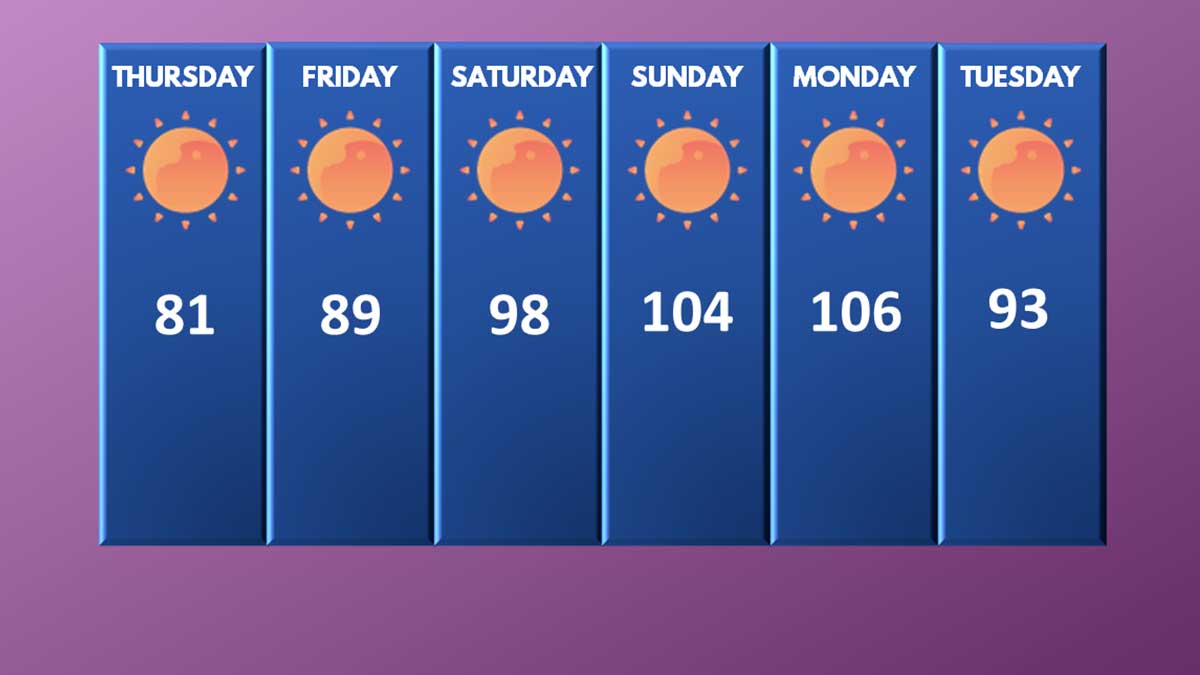
Normal highs for June are the high 60s to low 70s, so even our “cool” day on Wednesday with a high of 77 was above normal. Thursday will be pleasant before the blowtorch is pointed at the region.

Thursday: The marine layer and low clouds that came in this morning didn’t push as far inland as yesterday. Today will be sunny with some possible high clouds north of the Kirkland-Bellevue-Woodinville area. Temperatures will be 79 to 83 degrees.

Thursday Night: A marine layer will try to push in from the coast one last time, but it won’t make it to our area. It will be partly cloudy before dawn, with temperatures from 59 to 63.

Friday: The onshore flow will start and intensify through the day. Friday will be similar to Monday this week with sunny skies and temperatures from 87 to 91 degrees. Winds will be light.

Friday Night: With high pressure building to our north, hot air from the desert southwest will flood into our region. Friday night lows will be 64 to 68 degrees under clear skies.

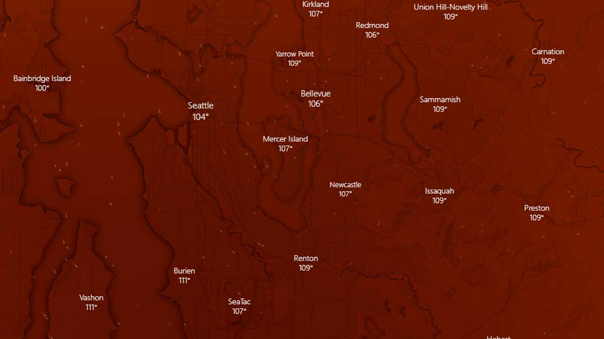
Saturday: Hot air will entrench into the region, sending temperatures soaring. The further away from the water and south you go the hotter it will get. Highs on Saturday will be 97 to 101 in the Kirkland-Bellevue-Woodinville area. It may be slightly cooler right on the shore of Lake Washington. Our hot spots like downtown Bellevue, Totem Lake, and Kingsgate will see the highest temperatures. Saturday’s record high is 93 degrees set at the Federal Building (91 at SeaTac Airport), and both records will be smashed. The all-time record high for June is 98 degrees, and that record is at risk. If it doesn’t get broken on Saturday, it will get destroyed on Sunday.

Saturday Night: The ridge of high pressure will continue to intensify, providing little relief from the heat. Low temperatures will be record-setting, dropping only to 69 to 73 degrees under clear skies.

Sunday: It will be historically and dangerously hot. High temperatures will soar to 102 to 106 degrees through our area under sunny skies. The record high for Seattle is 91, and it will be obliterated. The all-time record high for Seattle is 103 degrees, set on July 29, 2009. That record is at risk of being broken.

Sunday Night: Historically hot with the highest low temperatures in Seattle history. Lows will be 72 to 76 degrees under clear skies with no wind. The heatwave is happening during our longest days of the year, with less than 8 hours between sunset and sunrise, offering little respite from the heat.

Monday: Unprecedently hot with historic and dangerous temperatures. Highs will soar to 103 to 107 degrees under cloudless skies and light winds. The record high for Seattle is 91 degrees and will be shattered.

Monday Night: The ridge of high pressure will finally start to move eastward, allowing cooler air from the coastline to moderate our temperatures. Temperatures will be 65 to 69 degrees under mostly clear skies.

Tuesday: Temperatures will still be 20 to 25 degrees above normal. Highs temperatures will reach 91 to 95 degrees. The record high for Seattle is 93 degrees and will be at risk of being broken.

Typically after heatwaves, our region gets a big push of marine air and returns to near normal temperatures with a cool gray morning. The long-range forecast as far out as we can see shows a very light offshore flow will return, but will not bring a big push of marine air. Temperatures will remain 10 to 15 degrees above normal according to long range models.

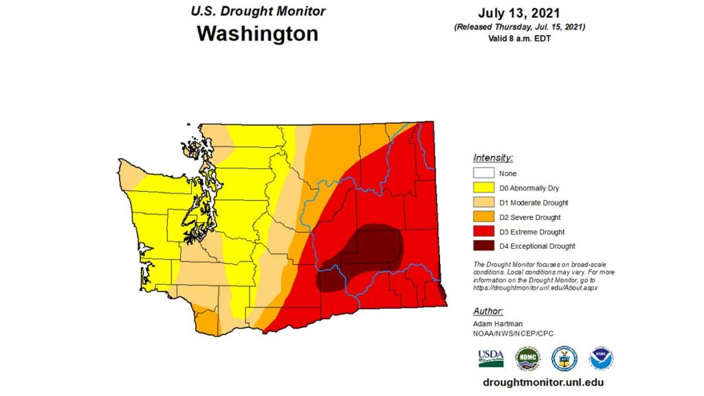
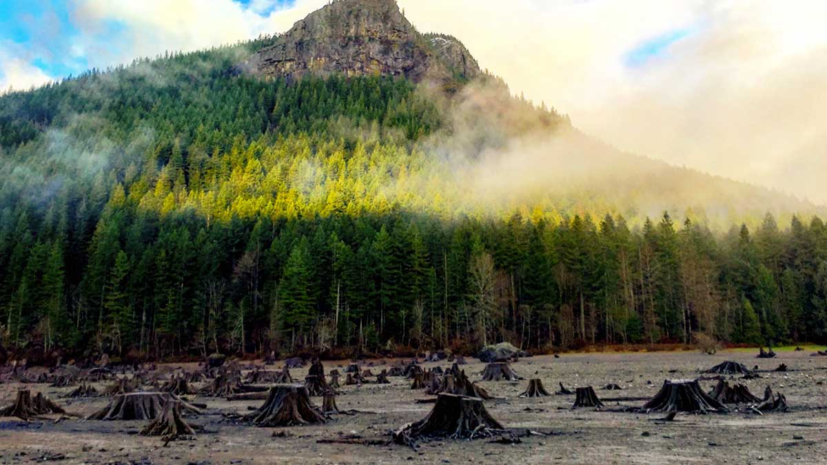
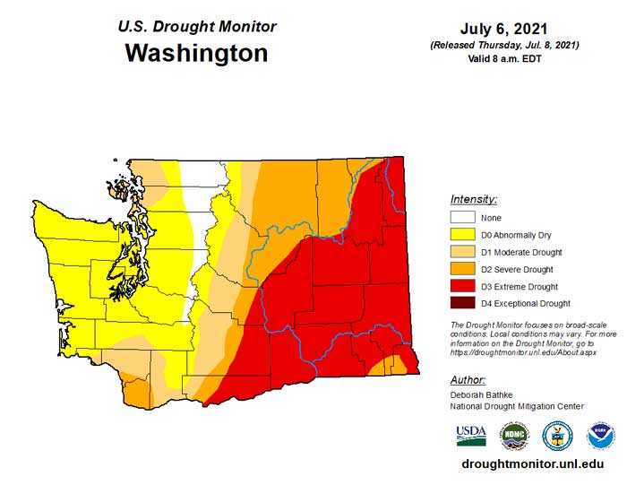
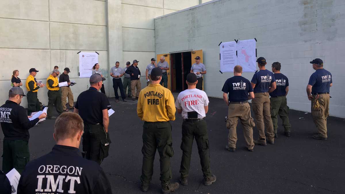
Burn bans instated throughout Washington as fire danger soars

The King County Fire Marshall has issued a stage 1 fire safety burn ban effective Thursday until further notice for unincorporated areas of King County. For the Kirkland-Bellevue-Woodinville area, sections of Woodinville are impacted. The ban applies to “all outdoor burning, except for barbecues and small recreational fires in established fire pits at approved campgrounds or private property with the owner’s permission.” An approved fire bit is 25 feet from all structures, 20 feet away from overhanging branches, has no vegetation within 10 feet, is no more than 36″ across, and is made of concrete or metal. The fire must be attended at all times and must be fully extinguished.

The Washington State Department of Natural Resources has also issued multiple burn bans throughout Washington state.

King, Pierce, Kitsap, and Mason counties are under a level 4 burn ban until further notice due to moderate fire danger. Industrial fires are banned, and only recreational fires are allowed and must be attended.

Grays Harbor, Jefferson, and Clallam counties are under a level 2 burn ban until further notice due to moderate fire danger. Rule and permit fires are banned, industrial or debris fires are not allowed, and campfires are allowed only in designated campgrounds on DNR land.

Lewis, Cowlitz, Clark, and Pacific counties are under a level 4 burn ban due to moderate fire danger starting Friday, June 25, until further notice. industrial or debris fires are not allowed, and campfires are allowed only in designated campgrounds on DNR land.

Chelan and Wenatchee counties are under a level 4 burn ban due to high fire danger. Rule and permit fires are banned, industrial or debris fires are not allowed, and campfires are allowed only in designated campgrounds on DNR land.

Power grid in Western Washington should hold, Oregon officials fret

Area officials aren’t concerned about the power grid and its ability to keep up with demand. Seattle is the least air-conditioned city in the continental United States, with only 33.7% of Seattle homes equipped with central air or a room AC unit, compared to 89% of the United States. Many office buildings and commercial spaces remain empty due to COVID restrictions.

Oregon officials are more concerned particularly in the Portland area where 70% of homes now have air conditioning. PGE in Oregon has stated they are ready for the surge in demand and do not anticipate a need to do rolling blackouts in northern Oregon. Temperatures could reach over 110 degrees Saturday to Monday in Portland.

How you can keep it cool during this weekend’s heatwave

[KIRKLAND] – (MTN) Meteorologists don’t toss around words such as historic and unprecedented lightly, but those adjectives perfectly describe the heatwave that starts on Friday. Temperatures of 95 to 105 degrees are dangerous for humans and pets and not typical for the Puget Sound lowlands. 

We have reached out to Kirkland, Bellevue, and King County Health to find out their plans with the community. Kirkland and King County are finalizing their programs, and at publication time, Bellevue has not responded to our request. 

Here are some tips from King County Health and other area experts on dealing with the extreme weather this weekend. If you don’t have access to air conditioning, we can’t promise these tips will keep you from being miserable, but they will help keep you safe.

Stay cool

  • The best way to keep cool is to find air conditioning. If you don’t have access to air conditioning, consider visiting a mall or other cooled public spaces. The indoor mask mandate for COVID ends on June 29, so you will still need to mask up indoors. Locally, Crossroads Mall is a popular place to go to beat the heat.
  • Consider having a staycation at an area hotel with air conditioning. Occupancy rates are low but expect hotels to be booked solid the closer we get to the weekend.  
  • Cover your windows and follow the indoor and outdoor temperatures. In the evening, open your windows as soon as the outside temperature is cooler than the inside temperature. In the morning, close your windows and all your blinds and curtains. You can wrap cardboard with aluminum foil to reflect solar energy from windows that face the west or south. When the inside becomes hotter than the outside, open the windows again.
  • Wear light-colored clothing and dress lightly. Your body can cool itself better.
  • Take a cool-cold shower or bath. If you live in a multistory building with no air conditioning, covering yourself in cold, wet towels can provide some comfort.
  • If you live in a multistory building, move to the lowest level. If you can move to a basement area, you’ll find even more relief.
  • Most in-room portable air conditioners are ineffective. Air conditioners that face outside and can be placed in a window work best. Be sure to secure a portable air conditioner following the manufacturer’s directions.

Stay hydrated

  • Drink plenty of water. If you feel thirsty, you are already dehydrated. Watch your urine to check your hydration – it should be straw-colored to clear looking. If it is dark yellow to brown, you could be dangerously dehydrated.
  • Don’t drink alcohol or large amounts of caffeine. Alcohol and caffeinated drinks such as soft drinks, energy drinks, coffee, and tea, dehydrate you.
  • Carry bottled water or a water bottle with you at all times and take frequent small sips. Don’t wait until you feel thirsty to drink.

When outside

  • Limit your time in direct sunlight. Avoid being outside from 11 AM to 6 PM if at all possible. Our heatwave is coming during the longest days of the year in the Puget Sound region. The extended daylight elongates our hottest hours, and peak temperatures typically come between 5 PM and 6 PM this time of the year.
  • Never leave infants, children, or anyone with mobility challenges in a parked car, even with the windows down.
  • Wear sunscreen and reapply frequently. There isn’t much difference in protection above SPF-30. If you get sunburned, you diminish your body’s natural ability to cool down. Don’t swim for 30 minutes after applying sunscreen and reapply when you come out of the water. Consider wearing a swim shirt with UV protection if you’re going to kayak, canoe, or paddleboard. Washington state has one of the highest skin cancer rates in the United States.
  • Wear footwear everywhere. We rarely get so hot in Puget Sound, where sand, concrete, and pavement can burn. Don’t walk on hard surfaces or the beach without footwear. If you are wearing sandals or open shoes, be sure to apply sunscreen to your feet. 

For pets

  • Never leave your pets in a locked car, even if the windows are down.
  • If you have access to air conditioning, it is best to bring your pets inside – if you’re hot, they are hot.
  • If you have outdoor only pets or livestock, ensure they have access to shade and cool surfaces to stand and lie on, such as grass. Enclosed dog houses and chicken coops can get much hotter than outside areas and won’t provide adequate shade.
  • Don’t walk your dog or other pet on hard surfaces like pavement and concrete, even for short distances. Their paws can get burned. If it’s too hot for you to stand still barefoot, it is too hot for them.
  • Provide plenty of water for your pets and livestock. Consider getting a kiddie pool for animals to drink from or lay in to cool off.
  • Do not assume that your electric car or car with a remote starting system will stay running even for a short time. It is best to leave your pet home.
  • It is illegal in Washington for someone who is not a commissioned law enforcement officer or animal control officer to break a car window to rescue a pet in distress. Call 911 first and seek permission for immediate intervention. If you are still compelled to break a window, only do so with third-party witnesses who agree that the animal is in immediate danger.
  • Know the signs of heat exhaustion and heat stroke in your pets
    • Excessive panting
    • Confusion and disorientation
    • Vomiting or diarrhea
    • Bright red gums
    • Body temperature over 104° F.
    • Collapse, seizure, or coma
At 95 degrees, the inside of a car can become dangerous for pets and humans alike in under 10 minutes

Pre-Existing health issues

  • Certain medications can impact your natural ability to deal with hot weather or increase your chances of getting sunburned. If you have questions, contact your medical provider.
  • Do not take salt tablets unless directed by a medical professional.
  • Some medications, such as certain antibiotics, can lose their effectiveness due to sun exposure. Check with your healthcare provider if you have questions.

Water safety

  • All of our bodies of water are still very cold, and hypothermia is possible even on a 100-degree day. Wear a lifejacket (personal floatation device) if you plan to canoe, kayak, paddleboard, waterski, or go boating.
  • Swim in designated areas, preferably with a lifeguard. Do not swim alone, and do not swim outside of your abilities.
  • Never allow children to swim unsupervised.
  • Don’t leave backyard pools, even above ground or shallow portable pools, unsecured. If you own a private pool, check to make sure your gate is up to code and the safety latches operate correctly.
  • If you plan to tube, raft, kayak, or canoe in our area rivers, stay within your ability. High temperatures increase snowpack and ice melt, raising river levels, increasing flow, and lowering temperatures.
    • Never do water recreation near low head dams. If you go over, the currents at the base of the dam are almost impossible to escape.
    • If you find yourself in white water, try to head downstream feet first and face up to prevent head injuries, and see where you are going. Don’t panic, and try to steer yourself to where you can get out of the water, even if that means becoming stranded mid-river and waiting for rescue.
    • Avoid down trees in the water, also known as strainers and plan your route around them. It is extremely difficult to escape from the branches due to the water pressure pushing against your body. 
    • Never dive in areas where you don’t know the depth or unaware of any possible underwater obstacles.

Protecting others

  • If you have friends or family who are elderly or have mobility challenges, do periodic welfare checks, especially if they don’t have access to air conditioning.
  • The extreme heat will dramatically increase fire danger, even in the urban areas of the lowlands. Refrain from using fireworks, which are currently illegal in all areas of King County. If you use a backyard fire pit, make sure the fire is completely extinguished, and there are no hot embers when you are done using it.
  • The houseless community has fewer options for getting out of the heat. Donations of bottled water and non-caffeinated sports drinks will help keep the unhomed community safe.

Recognizing heat-related injuries – heat exhaustion and heat stroke

  • Heat exhaustion is caused when a person’s body can’t cool down quickly enough. Know the symptoms:
    • Muscle cramps, especially in the arms, legs, and abdomen
    • Weakness
    • Dizziness
    • Extreme thirst
    • Headache
    • Nausea
    • Vomiting
  • If you see someone exhibiting these symptoms, move them to a cool area, have them slowly sip water or a sports beverage. If they do not start feeling better after 30 minutes, seek medical attention for heat stroke.
  • Heat stroke is a serious medical emergency and can be fatal. Heat exhaustion usually precedes heat stroke. Know the symptoms:
    • Body temperature over 103° F.
    • Red, hot, dry skin – the inability to sweat
    • Rapid, strong pulse
    • Fast breathing
    • Severe nausea
    • Confusion, altered mental state
    • Loss of consciousness
    • Seizure
  • If you see someone exhibiting these symptoms, contact emergency services and move them to a cooler area immediately.  

UPDATED: Get ready to roast, historic heatwave ahead for Pacific Northwest

Update: The National Weather Service has issued an Excessive Heat Watch from Friday afternoon through Monday afternoon for temperatures approaching 100 degrees.


[KIRKLAND] – (MTN) Seattle tied the record high on Monday, with SeaTac Airport recording a high of 89 degrees, but if the forecast models hold, 89 may seem like sweater weather compared to what lies ahead. Puget Sound could see a historic heatwave this weekend and into early next week.

A powerful ridge of high pressure is expected to develop and push into our area on Friday, allowing a tongue of brutally hot air from the desert southwest to flow into our region. How hot? Some computer models are forecasting temperatures as high as 110 degrees for Seattle on Monday! Relax, those models are outliers, but the use of the word “historic” to describe what could be coming isn’t hyperbole.

The Pacific Northwest is notoriously tricky to forecast because a weather system moving 50 or 100 miles off the predicted path can dramatically impact accuracy. The location of the ridge, how effective it is on blocking any offshore flow, and the strength of the ridge has forecast models indicating a 25 degree spread for this weekend. It is like looking at snowstorm weather models forecasting 2″ of snow to 14″ of snow and trying to decide which one is right.

Stop stalling, or I’ll stop reading!

So far, this is what I think we are looking at, but my confidence isn’t high enough to say, “this is the forecast.”

The ridge will arrive on Friday, and the marine layer that pushed in a little bit today, and will push in hard tomorrow, will be on its way out. Friday looks like a near copy of Monday, with highs from 86 to 90 in the Kirkland-Bellevue-Woodinville area.

Friday night won’t offer much relief, and temperatures will be from 62 to 65 under clear and windless skies. Saturday is when the furnace kicks in.

Saturday could be historically hot. Temperatures in the Kirkland-Bellevue-Woodinville area will be 97 to 101 under clear skies and almost no wind. The record high for Saturday is 93, and I feel confident enough to say this record is at risk. If SeaTac Airport reaches 100 degrees on Saturday, it will be the fourth time in history Seattle has officially reached 100 degrees. Some forecast models are putting the dewpoint in the high 50s, which isn’t southeastern United States sticky, but it will be enough to notice this isn’t exactly our typical dry heat.

Saturday night has the potential to be historically hot. Forecast models are indicating almost no breeze to look forward to and an onshore flow. The only saving grace is it will be clear a night, allowing some of the heat to radiate to space. Lows will be 67 to 71.

Sunday is looking even hotter. The ridge will further entrench offshore, pumping the historically hot air into our region. Highs on Sunday could be 98 to 102. The record high on June 27 is 91 degrees and even if the forecast moderates, that record will almost certainly be broken. Some models show the dew point reaching 60 degrees. Last year during our hottest days we had desert humidity as low as 14%. Dew points will be about 15 degrees higher. It won’t’ feel like Georgia, but it won’t feel like eastern Washington either.

Sunday night looks like a copy of Saturday night. A relentless onshore flow, near windless and clear. Lows will be 67 to 71.

Monday is too far out to predict with confidence, but the models indicate it could be as hot or even hotter than Sunday. If the ridge aligns in the right spot and parks for long enough, there is a real possibility of three 100 degree days in a row for our area with dewpoints near 60, which would be unprecedented.

The ridge looks to move eastward on Tuesday and the onshore flow finally breaks up. Real relief won’t come until Wednesday, June 30. Writing a forecast more than 4 or 5 days out is throwing darts, but if I had to make a prediction, Tuesday could reach 90.

If you think this all sounds horrible, it could be worse. Portland, Oregon could reach 100 on Friday and 110 on Saturday, Sunday, and Monday. Spokane is looking at a 6-day streak over 100 degrees as a possibility, with highs reaching up to 110 by Monday.

The all-time record high in June is 98 degrees. Historically, Seattle has never seen three 100 degree days in a row, and in my 21 years here, I have never seen a forecast model so supportive of this kind of heatwave. The all-time record high for Seattle is 103, reached on July 29, 2020. That record appears safe, but that will be cold comfort for many.

Last year, forecast models supported several days but not in a row, possibly reaching 100 degrees or higher, but dense forest fire smoke moderated our highs by 4 to 8 degrees keeping us in the mid-90s on the worst days. There is no smoke in the forecast, but the risk of brushfires and wildfires even in the lowlands will dramatically increase as we approach the Fourth of July, even if these high temperatures moderate into the 90s as we get closer to the weekend and our confidence grows in the forecast.