Tag Archives: weather

Seattle is getting a Juneuary upgrade with possible record-breaking temperatures ahead

[KIRKLAND] – (MTN) If you’re thinking June has been a wild ride so far with record heat, the coldest day in 9 years, and almost a month of rain in a single day, you would be correct. So far, June 2021 has been provided all of the above and we’re headed back to the furnace with potential record heat ahead.

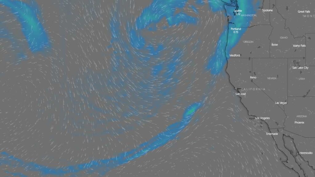
Currently, the desert southwest is baking in historical heat. Phoenix Arizona reached 116 degrees, Palm Springs, California tied its all-time record high of 123, and Furnace Creek, California reached 128 on Thursday as electrical grids strained to keep up with demand. That area of high pressure is going to drift west and carry with it hot air into Puget Sound. By Sunday our region will be in a classic offshore flow pattern which pumps dry, warm air into the lowlands.

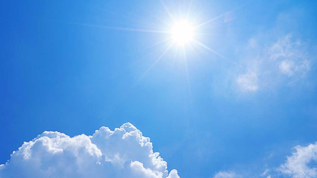
For today, the Kirkland-Bellevue-Woodinville area will be seasonably warm with highs from 71-74 under blue skies. Evening temperatures will drop to 50-54 degrees during the overnight with another glorious day as we get ready to end spring.

Saturday will see highs reaching 73-77 under partly cloudy skies. The evening will be noticeably warmer with lows from 53-56 – perfect sleeping weather.

Sunday will see winds increase to 10 to 15 MPH as that area of high pressure drifts further to the west, and temperatures move into the 80s for the entire area. When the winds die down on Sunday, the heat pump and onshore flow will be on and highs will reach 82 to 86. Lows will be 57 to 60, while humidity will continue to drop.

Monday is the day we’re going to cook and has the potential to break weather records. The computer models we’re looking at indicate temperatures in our area will be 85 to 89, but we have found that many weather models don’t account for the offshore flow enough. Highs at SeaTac Airport, where it matters for the record books, will be 87 to 91. Highs in the Kirkland-Bellevue-Woodinville area will be 88 to 92. The record high at SeaTac Airport for Monday is 89, and that is definitely at risk. A toasty day on what will be the longest day of the year and the first day of summer.

Monday night as the potential to set a record warm “low” temperature. The warmest low at SeaTac Airport is 61, and we wouldn’t bet against that record getting broken. Low temperatures for our area will be 59 to 62.

There is almost no chance of rain in the forecast for as far out as we can see. The eastern flow will continue on Tuesday but the marine air will start to push back in, moderating temperatures. Wednesday looks to be mostly cloudy as the marine air rushes back in to the lowlands. It wouldn’t be unreasonable to say some pockets of very light mist or drizzle are possible on Wednesday in the early morning hours.

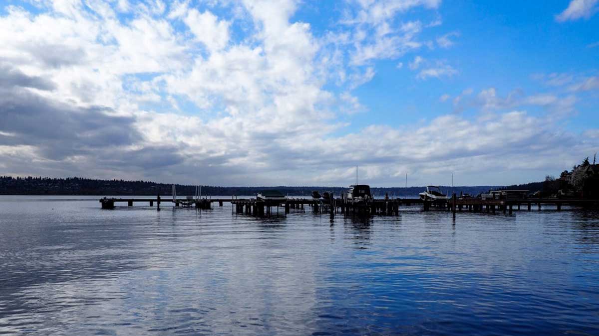
Despite the heat that is coming this weekend and early next week, area lakes and rivers, along with Puget Sound continue to be cold. Snowpack was almost historically high and the warm temperatures will increase mountain runoff, making our area rivers cold and fast. Even on a 90 degree day, hypothermia is possible. If you’re planning to visit our area rivers, canoe, kayak, or innertube in safe areas, or at your skill level and wear a flotation device.

Approaching record rainfall for June 13 and it’s still coming down

[SEATTLE] – (MTN) The forecast called for a soggy and humid Sunday and that is exactly what the Puget Sound region is getting today. Rain from the current system moved in around 10 PM last night dropping 1/3 of an inch on the dot from the start of Sunday to about 10 AM. The middle of the day had a few drips before the rain returned around 3 PM. Another half-inch has fallen with more on the way, putting the unofficial total at 0.85 inches.

The weather record for June 13 at SeaTac Airport is 1.03 inches, interestingly set in 2020. The wettest June day ever was June 3, 1905 at the Federal Building downtown when 1.42 inches of rain fell. The wettest day at SeaTac was June 7, 1985, when 1.33 inches of rain fell.

Unofficially, June 2021 is at 2.17 inches, well above the monthly average of 1.57 inches, and creeping closer to top ten territory. Despite the wet start to meteorological summer, the region is still running a serious rainfall deficit.

Temperatures were cooler than the forecast models indicating, only getting to an unofficial high of 64. the humidity was delivered as forecasted, with dew points in the 60s in most of the area.

The weather is considered a contributing factor to a 13-car accident on I-5 at 1:15 AM in downtown Seattle. The initial accident caused a 3-car pile-up in the backup which resulted in the death of an off-duty Seattle police officer who exited his vehicle to render assistance.

Soggy, steamy, east coast style weekend ahead

[KIRKLAND] – (MTN) The Seattle area had the fourth driest spring in history, and it appears that the region will make up some of that precipitation deficit this weekend. An unusual weather pattern will bring a Pineapple Express to the Pacific Northwest on Sunday. Sunday will feel more like a rainy March day in Orlando versus our usual June gloom.

Two rare events are coming together to turn Seattle from Fifty Shades of Grey to Sixty Shades of Sticky. Pineapple Express weather systems are more associated with wintertime storms carrying tropical moisture on a conveyor belt straight to the Pacific Northwest. These systems bring heavy rains, breezy conditions, and warmer temperatures.

Sunday’s weather models shows a river of moisture extending from Hawaii to the Pacific Northwest

Usually, when we warm up in Seattle, it is from an eastern flow from the Cascades. The air compresses and gets warmer, squeezing out the moisture at the same time. Our hottest days typically have low humidity, so we get a “dry heat” in the lowlands to make it feel more tolerable. These same easterly flows dry out our air, preventing rain from falling.

In more recent years, we have gotten hot days from warm air coming from the southwestern United States, which is happening this weekend.

In reviewing the weather models, there is agreement on when and where but disagreement on how much rain. There is widespread agreement that southwest Washington and the Olympics will get significant rain on Sunday morning and the Cascades later in the day as the system makes landfall. One model predicts widespread record rainfall for Seattle, with the potential for one inch of rain – average rainfall for June is 1.57 inches! 

For the rest of Friday, our area will see a typical Juneuary day of clouds, rain showers, and sun breaks. High temperatures will struggle to reach 58 to 62 in the Kirkland-Bellevue-Woodinville area. The wettest period will be between 2 PM and 4 PM.

Friday night could bring some more light showers into the area, with lows from 52 to 54 degrees.

Saturday is looking pleasant, although partly to mostly cloudy. Highs will be 73 to 78, depending on what time the cloud cover starts to thicken up for the main event. It won’t feel sticky, but you may think to yourself, “this feels warmer than the 70s.”

Saturday night and early Sunday morning, the Pineapple Express arrives. Models are predicting rain will increase from 3 AM to 5 AM. Low temperatures will only drop to around 60 degrees, and dew points will creep into to 60s.

Sunday will see variable amounts of rain. Heavy rain showers will form with a chance for some grumbles of thunder. In the heaviest pockets, there could be minor street flooding and reduced visibility. Temperatures will hover around 70 degrees, while the dew point could reach 67. Your friends and family on the east coast won’t offer any sympathy if you call and complain about it being muggy, but this is a rare event for Puget Sound.

How much rain you will get on Sunday will depend on your location, and weather records will fall if a heavy pocket of rain lingers over the rain gauge at Seattle-Tacoma International Airport. Some areas may see 1/3 to 1/2 an inch of rain, while localized areas could see an inch or more. 

Looking further out, Monday will get a little drier, but the humidity will linger. Tuesday appears to bring a round of spotty showers and thunderstorms to the area before moving back to a dry summertime pattern.

Summer arrives right on time (technically)

[KIRKLAND] – (MTN) Meteorological summer starts on June 1 and the weather gods are smiling upon Puget Sound with warm temperatures ahead.

The entire Kirkland-Bellevue-Woodinville area will see blue skies and temperatures from 79 to 83 degrees. Finn Hill, North Rose Hill, and right along Lake Washington might not pierce 80, while area hot spots like Totem Lake will be warmer.

Tonight will be sleeping weather with temperatures dropping to 55 to 57 degrees under clear skies.

Tomorrow will be even warmer with the entire area getting over 80. Temperatures will be 82 to 86 with abundant sunshine.

Thursday the marine layer will start to push back in, and the region will be mostly cloudy. Highs will be 71 to 74.

Friday is a bit far out, but appears to be pleasant, and 69 to 73 before rain pushes in for Saturday.

A desperately needed drippy week lies ahead

[KIRKLAND] – (MTN) The forecast next week is looking cool and damp after the first 3 weeks of May have produced only 2/3 of an inch of rain and April dropping less than an inch. The first 14 days of 2021 were exceptionally wet, with 5.74 inches of rain falling at Seattle-Tacoma International Airport, before a slow drying out with average rainfall in February, and below average in March.

On Sunday the marine layer will be even stronger than today, with a chance of drizzle over the lowlands. The day will stay cloudy, with some sun breaks in the afternoon and highs below normal from 62 to 65 degrees through the Kirkland-Bellevue-Woodinville region.

Sunday night through Tuesday is looking rather wet, and if the forecast model holds, we’ll exceed April’s rain total by Tuesday morning. Monday will have showers through the day and highs only 58 to 61 through our area. Monday night showers will turn to steady rain overnight, before tapering off Tuesday morning. Tuesday will have sun breaks again in the afternoon, with highs from 61 to 63.

Wednesday through Friday is further out in the weather models, but for now, Wednesday is looking like the best day next week. The marine layer will hold on with clouds in the morning, and then moisture will move back in late during the day. Highs will be 66 to 69, giving us a normal late-day May.

Thursday and Friday are also looking wet.

If you’re wondering about Memorial Day weekend that forecast is too far out to be accurate. For now, the computer models are favorable for Saturday and Monday. The models for Sunday don’t look like a washout, but there is a lot of disagreement on how much moisture will be in the area.

Rain comes on Tuesday as Puget Sound lowlands precipitation deficit grows

[KIRKLAND] – (MTN) Less than an inch of rain fell in April at Seatac International Airport (KSEA) and halfway through May, only .52 inches has fallen so far, and more than half of that on May 4. With temperatures tickling 80 degrees on the eastside today, it is easy to ignore the growing deficit as our dry season inches closer.

Significant drought is already gripping the nation from eastern Washington to Minnesota, south to Texas, and then back west to California. In Los Angeles, the Palisades Fire has grown to more than 1,000 acres with mandatory evacuations ordered in fire-ravaged Topanga. In April, during a near historically early fire weather alert, a dozen fires popped up in western Washington, with one burning in Auburn for almost a week.

Only the Cascade and Olympic Mountains ranges are normal in the state of Washington, as drought conditions grow through the rest of the state

Monday will be cloudy and much cooler, with temperatures in the low 60s. Monday night and into Tuesday morning, rain will move in with .25 inches possible on the eastside. Rain will gradually give way to clouds but some drips are possible into Wednesday morning.

The long-range forecast is more seasonable with temperatures in the mid-60s to around 70, but the dry weather pattern returns. The Puget Sound lowlands get most of its water from snowpack melt in the summer months, and the snowpack was at or near record levels this year.

The continued dry weather will increase wildfire risk as the summer progresses. In 2020 wildfires tore through the western side of the Cascades from Oregon to Washington, shrouding the area in dark clouds of smoke for weeks.

Cool weather will persist into the first week of April

[KIRKLAND] – (MTN) By local standards, this past winter wasn’t a hardship, especially for a La Nina year. The forecast models point to a sunny and dry week ahead, but nighttime temperatures will hover at or below freezing during the start of the week. The long-range forecast shows a cooling trend into next week and a wetter pattern.

A common question the gardening community asks us is when will the last frost be. Statistically speaking, we are past the point of having a hard frost (below 27 degrees), and the average date for the last possible frost in the Kirkland area is April 4. Historically speaking, Kirkland has had measurable snow as late as April 11, so temperatures below freezing are still possible deep into April. 

Sunday, Monday, and Tuesday will see lows from 30 to 33 through the Kirkland-Bellevue-Woodinville region. Sunday night will be after a rainy day, so it’s unlikely there will be frost. Monday and Tuesday night look like solid possibilities, so gardeners should plan their planting accordingly. The long-range forecast shows lows in the high 30s through the first week of April.

Our prediction for the last possible day for frost in our region is April 11. If you’re getting tired of the cool weather, don’t despair. By the end of the week, daytime highs will be approaching 60 degrees. 

Yesterday’s weather isn’t very unusual for March

[KIRKLAND] – (MTN) The weather yesterday put on a choose your own adventure show across the region. Torrential rain, gusty winds, graupel, hail, and lightning crashed from black skies followed by periods of calm. Rinse, recycle, and repeat until the evening hours came. The weather may have seemed wild, but it isn’t an unusual March weather pattern. The picture of what is affectionately called a “mothership,” in meteorology? That wasn’t taken yesterday. That picture was snapped on March 6, 2016, in Kirkland!

To produce the wild weather we had yesterday you need moisture, atmospheric energy, and instability. When colder air rides over the top of warmer air, the warmer air wants to rise, and the colder air wants to sink. Throw in our microclimates, terrain, and the Convergence Zone, and you end up with some crazy weather. Warm air rushing up can carry raindrops into the colder air above, which freeze. They fall back down to be carried aloft again and build another layer. Eventually, the frozen raindrops grow so heavy the updrafts can’t carry them anymore, so they fall as hail. The miniature snowballs that fell yesterday are called graupel. Graupel forms when snowflakes at a higher elevation clump together, and are lifted repeatedly by updrafts like hail. The little snowballs reach a weight where they can’t be carried anymore.

Thunderstorms in the Pacific Northwest are unlike those that form in other parts of the country. In the Midwest and even out to the Northeast, supercell thunderstorms can tower 50,000 to 60,000 feet in the air. Here, the Pacific Ocean moderates our temperatures so thunderstorm rarely grow taller than 15,000 to 20,000 feet. The rumbles yesterday were created by the same instability that produced downpours, hail, and graupel. There are exceptions for Pacific Northwest thunderstorm development but they are exceedingly rare. For example, September 8, 2019, had a line of thunderstorms form after dark that would be more at home in Alabama than Washington.

Our bursts of wild lowland weather in March happens because of changing weather patterns as we approach astrological spring (meteorological spring started on March 1) and the Jet Stream starts to shift. The moisture and instability create our wild weather.

Pictures of Mammatus clouds flooded social media yesterday. These formations look like pouches hanging from the sky and are more associated with severe weather in the Midwest. They are formed when cold air is falling and pulls the cloud formations downward.

As for the rest of the week? The weather forecast is calling for normal conditions with highs in the 50s and lows in the 30s. Wednesday will produce a little rain, but no wild weather ahead!

Update: Stevens, White, & Snoqualmie Passes closing due to extreme avalanche danger, Pineapple Express arrives

UPDATE: Washington Department of Transportation added White Pass to the mandatory 6 PM closure.

[SEATTLE] – (MTN) Washington Department of Transportation announced they would be closing Stevens Pass, White Pass, and Snoqualmie Pass at 6 PM on Sunday due to an extreme risk of Avalanche. Our earlier cold snap and snow event created some of the deepest snowpacks in the country, but the looming Pineapple Express weather system will make the snow highly unstable. The three closures essential cuts the state in half.

Both mountain passes have had periodic closures today, and require chains for all vehicles except AWD/4WD. Stevens Pass has had 64 inches of snow in the last 7 days and 425 inches of snow so far this winter season, while Alpental at Snoqualmie has had 440 inches.

Operators of Stevens Pass ski area announced they were closing at 4 PM today. Operators at Snoqualmie Pass announced Alpental was closed, the sledding and tubing area would close at 3:30 PM, and the remainder of the ski area would close at 4 PM. Both ski areas appealed for people to stay “in bounds” due to the growing danger.

In the lowlands, the coming week will be warm, wet, and windy. In our local forecast area of Kirkland-Bellevue-Woodinville, residents should prepare for potential power outages tonight. Although the official forecast is calling for winds of 10 to 20 MPH and there is no advisory or warning, the weather model we trust is favorable for borderline Wind Advisory conditions early Monday morning. Temperatures on Monday will reach the mid-50s, 15 degrees warmer than a week earlier. Although lowland rain amounts won’t set any records, the lowland snow combined with the heavy rain that followed has left the ground saturated. The lowlands could see a growing risk of landslides as the week progresses.