Tag Archives: wind storm

Here we blow again! Torrential rain and strong winds on tap for Friday night

[KIRKLAND, Wash.] – (MTN) Western Washington is under a series of weather warnings after a brief break from the rain, with winds up to 50 MPH and over an inch of rain on tap for Friday night and Saturday.

The National Weather Service has issued a Wind Advisory from 7 p.m. Friday to 10 a.m. Saturday the Bellevue area. Winds of 20 to 35 MPH with gusts to 50 MPH are expected overnight.

On Friday, scattered rain showers will transition to steady rain by nightfall. Winds will begin to increase through the evening as heavy rain develops. Temperatures will stay in the mid-40s.

Friday night rain will be heavy with winds peaking between 2 AM and 6 AM. Temperatures will remain in the mid-40s and up to an inch of rain is expected.

Winds will be from the south impacting Finn Hill, Juanita, Kenmore, and Kingsgate. Power outages in the usual eastside trouble spots are likely. Because the ground is saturated and can’t absorb much moisture, it won’t take much for the wind to knock down trees and create additional issues.

On Saturday the wind and rain with gradually taper off, but it will remain wet and breezy. Temperatures will hold steady in the mid-40s with winds from 10 to 15 MPH.

The weather models hint at some possible lowland snow next week, but we’re not very optimistic the region will see anything beyond a few wet flakes – for now.

Wind Advisory issued for the eastside – a lot of weather ahead today

[KIRKLAND] – (MTN) The National Weather Service added a Wind Advisory to the eastside at 7:36 a.m. through 4:00 p.m. today including Bellevue, Redmond, Kirkland, Bothell, Kenmore, Newport Hills, Sahalee, and Pine Lake.

Temperatures in the Bellevue-Kirkland-Woodinville area were over 60 degrees as an intense flow of sub-tropical air was pushed ahead of an advancing cold front. The area has reached high temperatures for the day with the front advancing into our region.

Winds will be from the south and increase as the cold front approaches, and then shift to the southwest and west and intensify. Southwest winds will rise to 20 to 30 mph with gusts to 45 mph. The ground is extremely saturated, increasing the possibility of trees being blown down. Scatter power outages are likely as the morning progresses.

When the wind shifts to the southwest temperatures will drop and by sunset will be down to 45 degrees. Drivers should prepare for a long commute on Monday evening and give themselves some extra time. Heavy rain, landslide risk, and saturated soil can impact Sounder Train service, commuters should check on conditions in the evening and have an alternative plan for the return home.

Never drive around road closed or high water warning signs, especially in the dark. According to FEMA, a passenger car or car-based sport utility vehicle can stall out in six inches of water and start to float in 12. Even if you successfully drive through high water, moisture can get into critical mechanical components and foul lubricants causing long-term damage.

Wind and rain on Monday will bring more woe to the Puget Sound lowlands

[KIRKLAND] – (MTN) When it rains it pours and it has been pouring in Western Washington for almost a week with flood watches and warnings across the region. Monday will deliver yet another punch of heavy rain and the strongest winds yet driven along an atmospheric river extending out into the Pacific Ocean.

The forecast for tomorrow is extremely challenging with little agreement across weather models. The strongest winds will move through Central Puget Sound from 6 a.m. to noon on Monday. For wind storms, Malcontent News puts more weight on the Euro Model, which is forecasting a Wind Advisory grade event for the morning.

The National Weather Service has not issued a Wind Advisory at this time. On Sunday at Seatac Airport winds reached Wind Advisory territory for three hours, peaking with a gust of 42 MPH.

For Sunday night, the rain will increase between 11 p.m. and midnight with breezy winds from the south. It will be unseasonably warm, with low temperatures from 55 to 57. South winds will be 10 to 15 MPH with increasing gusts toward daybreak. Overnight rainfall will be around one-tenth of an inch.

Monday morning will be wet, windy, and warm. Temperatures will reach 57 to 59 degrees early in the day before dropping sharply in the afternoon. Winds will continue from the south from 15 to 25 MPH with gusts to 45 MPH. Rainfall with be close to three-quarters of an inch through the area, further saturating the soil.

Saturated soils combined with the wind will increase the chance of trees being uprooted, as well as enhance the landslide risk. Scattered power outages are likely. By sunset, the winds will die down along with the rain. Overnight temperatures will drop to 38 to 40 degrees.

Drivers should prepare for a long commute on Monday morning and give themselves some extra time. Heavy rain, landslide risk, and saturated soil can impact Sounder Train service, commuters should check on conditions in the morning and have an alternative plan for the return home.

People should never drive around road closed or high water warning signs, especially in the dark. According to FEMA, a passenger car or car-based sport utility vehicle can stall out in six inches of water and start to float in 12. Even if you successfully drive through high water, moisture can get into critical mechanical components and foul lubricants causing long-term damage.

Bomb cyclone on Sunday kicks off 4 days of wet and windy weather

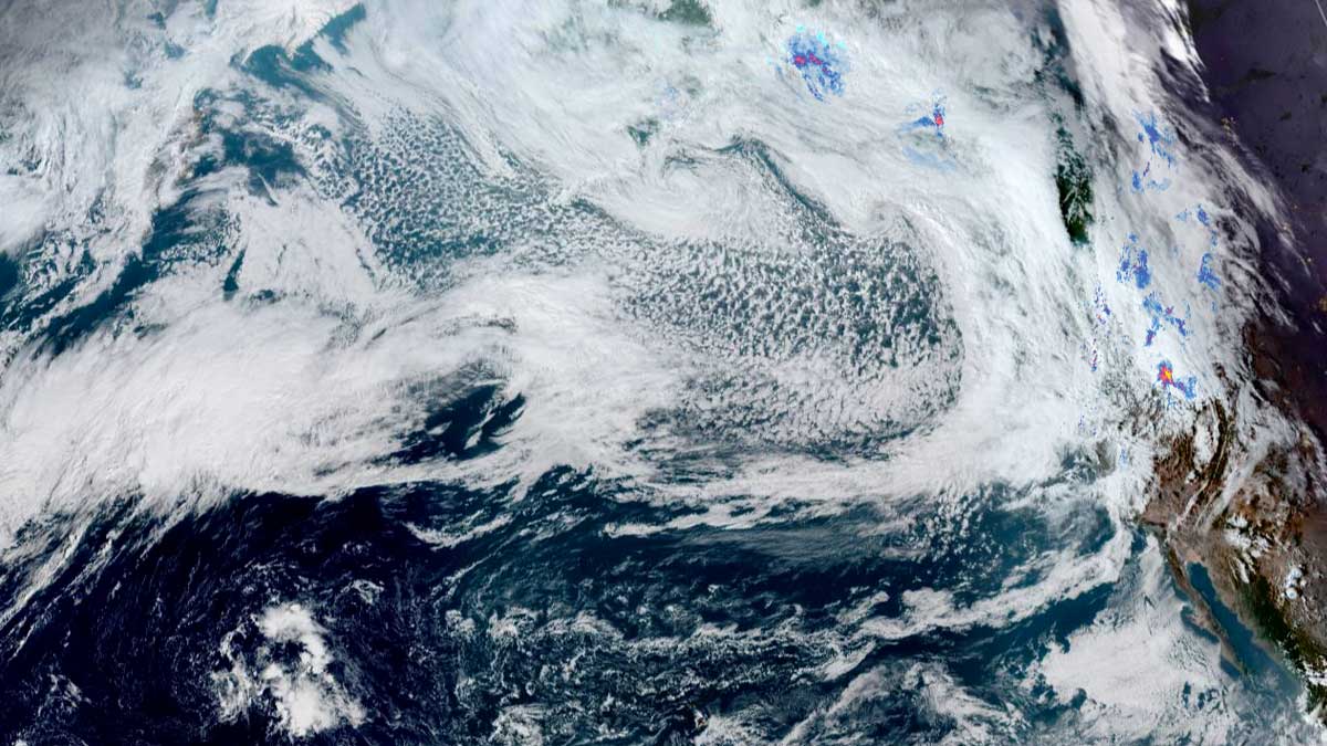
Photo credit: Zoom.Earth

[KIRKLAND] – (MTN) A string of powerful storms riding an atmospheric river will slam into the West Coast through Wednesday bringing high winds and heavy rain, but it appears Central Puget Sound will be spared.

It is possible we could see Wind Advisories for the Bellevue-Kirkland-Woodinville area on Sunday, Monday, or Tuesday. Right now, Monday is the most interesting day. A 50-mile change in the path of a fall wind storm can have a significant impact on our Puget Sound microclimates.

A “bomb cyclone” is developing to our west and will track north of Puget Sound and linger off Vancouver Island. The forecasted storm track is getting more consistent across the weather models this afternoon but there remains some disagreement.

The North American Mesoscale (NAM) model is forecasting the center will come closer to the Washington coast. If the NAM is correct, winds will be around 5 MPH higher than the current forecast. That isn’t quite enough for a Wind Advisory, but it is close. Additionally, the NAM model supports winds from the south, which enhances the impact for residents of Juanita, Finn Hill, and Kenmore.

Sunday morning will start off dry with wind and rain increasing by noon. Bellevue-Kirkland-Woodinville can expect winds up to 20 MPH that last for three to six hours. The storm system will linger off the coast as it heads towards Vancouver Island, creating blustery conditions overnight. Temperatures will be 56 to 59 degrees and expect up to a third of an inch of rain.

Sunday night temperatures will be 47 to 49 degrees, with winds of 10 to 15 MPH.

Monday looks a lot more interesting but there remains disagreement in the weather models. The Global Forecast System (GFS) is more conservative for storm development while the NAM, ECMWF, and ICON are in agreement a significant wind event is coming to the Straight of Juan de Fuca, the San Juan Islands, and North Washington. We believe this is the day to keep an eye out for a Wind Advisory and could create spotty power outages in the Central Puget Sound lowlands.

Bellevue-Kirkland-Woodinville will see south winds of 15 to 20 MPH and higher gusts. Peak winds will last for up to 12 hours, starting close to lunchtime. South winds move unobstructed across Lake Washington impacting Juanita, Finn Hill, and Kenmore more than other areas. Expect up to half an inch of rain with temperatures from 55 to 57 degrees.

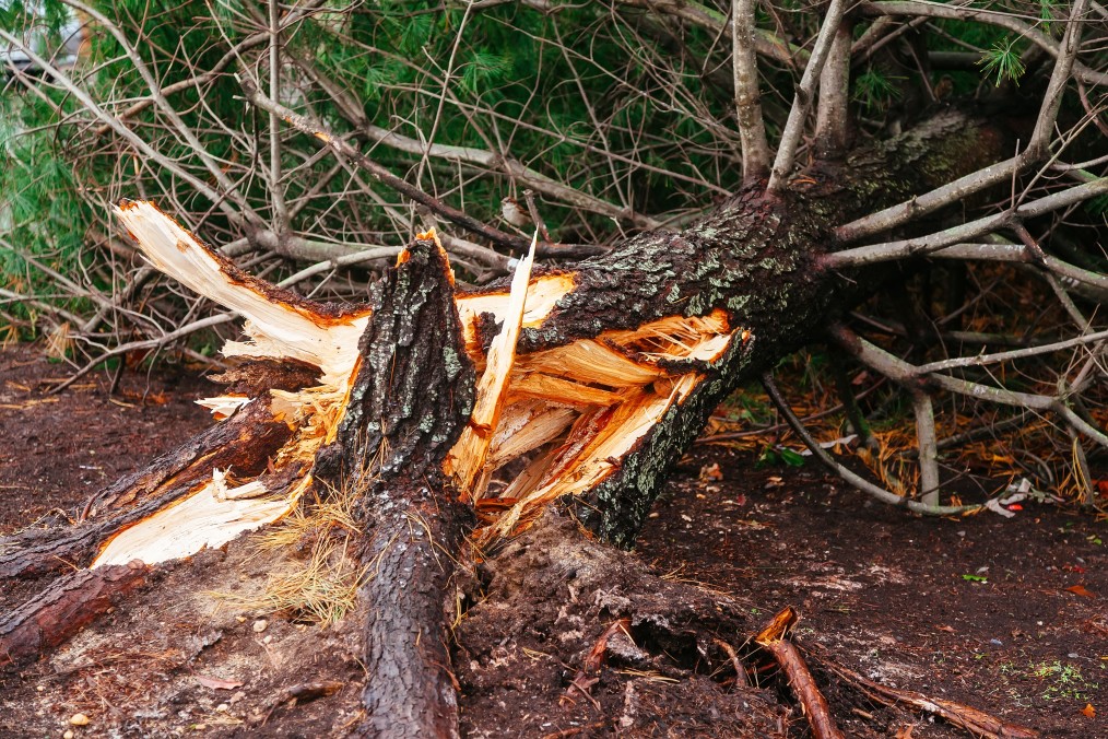
Many leaves remain on trees that suffered significant heat stress over the summer so it won’t take much to bring limbs down.

Monday night temperatures will drop to 48 to 50 degrees and rain will turn to showers. Winds will still be 5 to 15 MPH and continue from the south.

Tuesday another system will arrive along Vancouver Island. This one doesn’t look as strong as Monday’s system, but there is a fair amount of uncertainty in the weather models. Winds will be 10 to 20 MPH for the Bellevue-Kirkland-Woodinville area with up to a half-inch of rain. Temperatures will cool with highs between 53 and 55.

Looking into the crystal ball for the trick or treaters on Halloween, the weather forecast is looking perfect with no rain and highs in the 50s dropping to the mid-40s.

Region cleans up after windstorm rages through the night

The Puget Sound region woke up to hundreds of thousands without power after a windstorm tore through the area overnight. An atmospheric river pointed a firehose right at the heart of Puget Sound as pounding rain and howling winds battered the region. Peak wind gusts reached 40 to 70 MPH around midnight, sending trees crashing through homes and across highways. 

In the last 72 hours, 3.03 inches of rain has fallen at Seatac Airport, and since January 1, 7.45 inches of rain has fallen, making this the wettest start to January in history. A USPS truck was almost blown off the Deception Pass Bridge, and images showed it perched on the guardrail, partially dangling over the side. The driver was uninjured and was able to exit the vehicle. A large tree fell across all of the southbound lanes of SH-167 outside of Puyallup, closing the highway. Both the Deception Pass Bridge and SH-167 have reopened. 

A number of areas schools canceled class for the day due to widespread power and Internet outages making remote learning impossible. In Kirkland, fire and police were dispatched to a rollover accident at 100th NE and Juanita-Woodinville NE. Inoperable traffic lights may have been a contributing factor to the wreck. 

Further south in Dodson, Oregon, about 60 miles east of Portland, one person is missing after the vehicle they were in was swept away in a mudslide. Officials are searching for the victim but active mudslides are making it difficult

A much drier weather pattern lies ahead, with sun forecasted for Wednesday and Thursday. Over the weekend, light and scattered showers will return. The long-range forecast points to next week being much calmer. 

Wind storm moving into Puget Sound for Tuesday

Rain and wind are coming to Puget Sound as another wind storm event approaches the area. The National Weather Service has issued a Wind Advisory for Tuesday, from 8 AM to 5 PM. The official forecast predicts south winds, typically for a northern tracking storm, from 25 to 35 MPH with gusts to 50 MPH.

This particular system won’t be a significant rainmaker by November standards, with .25 to .30 inches of rain expected. Wind will arrive around 10 AM to noon on Tuesday, with the east side seeing the forecast model’s lower range.

Residents should prepare for power outages, especially in the areas commonly impacted, such as Finn Hill in Kirkland. Because most residents panic bought everything that wasn’t nailed down in the stores yesterday, everyone is already well-stocked with their French Toast supplies!

Significant weather event likely on Friday the 13th

The remnants of Tropical Storm Atsani is charging across the Pacific Ocean, on a collision course with the Pacific Northwest. Although Atsani lost all tropical characteristics days ago, the energy and moisture it collected are expected to arrive Friday in a two-day weather event.

The challenge in forecasting wind storms in western Washington is that the center of circulation’s location determines our region’s impact. If the storm passes to our north, close to the southern tip of Vancouver Island in British Columbia, we get the brunt of a wind event. If the storm passes to our south, up the Columbia River basin, Oregon receives the brunt of the wind. An error in the forecasted path of just 50 miles is the difference between a significant wind event and what we like to call “a nothing burger.”

Typically the computer models aren’t in agreement on the “where,” which is the case with the Friday forecast. The GFS model, which hasn’t been the most accurate for our winter weather, forecasts a significant, possibly historic wind event, with the storm passing over Vancouver Island. The Euro model, which was stellar a few years ago but has lost some accuracy, predicts Oregon will receive the most impact.

It is too far out with landfall still 72 hours away to narrow down the track, but here is what we do know. Forecast models put central pressure at landfall between 973 and 983 millibars – that is significantly more intense than Tropical Storm Eta when it crossed the Florida Keys. Barometric pressure this low is typically associated with Category I and Category II hurricanes (our November wind storms have nothing related to the mechanics of a tropical system, even if they are often the remnants of tropical systems).

Wave height forecasts for Friday and Saturday are, in a word, alarming. Some computer models forecast heights of 45 feet off the Oregon coast, with some models predicting higher than 50 feet.

What should you know? For central Puget Sound, there is growing potential for a significant weather event on Friday and Saturday. More specifically to the eastside, the chances for power loss, tree, and property damage is increasing and require a close watch. Along the coast, damaging waves that will cause low area flooding, erosion, and large debris to wash ashore and shift are likely, with the where being the bigger question. The Cascades can expect wind and mountain snow, and a lot of it. The storm track will determine the snow level, but anyone planning to cross the passes this weekend should consider leaving a day early.

Opening the new SH-520 bridge to relieve wind and wave stress is no longer required, and the latest design also prevents waves from over-topping the railings. Also, with reduced traffic in general due to COVID-19, regional travel shouldn’t be too challenging during the evening commute.

The weather model we prefer? That model shows the storm passing to our north but at the lower end of the strength forecast. We will continue to update this growing situation.