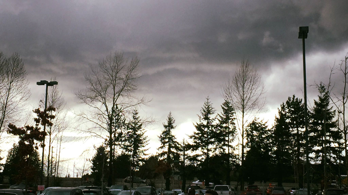
[KIRKLAND] – (MTN) The weather yesterday put on a choose your own adventure show across the region. Torrential rain, gusty winds, graupel, hail, and lightning crashed from black skies followed by periods of calm. Rinse, recycle, and repeat until the evening hours came. The weather may have seemed wild, but it isn’t an unusual March weather pattern. The picture of what is affectionately called a “mothership,” in meteorology? That wasn’t taken yesterday. That picture was snapped on March 6, 2016, in Kirkland!
To produce the wild weather we had yesterday you need moisture, atmospheric energy, and instability. When colder air rides over the top of warmer air, the warmer air wants to rise, and the colder air wants to sink. Throw in our microclimates, terrain, and the Convergence Zone, and you end up with some crazy weather. Warm air rushing up can carry raindrops into the colder air above, which freeze. They fall back down to be carried aloft again and build another layer. Eventually, the frozen raindrops grow so heavy the updrafts can’t carry them anymore, so they fall as hail. The miniature snowballs that fell yesterday are called graupel. Graupel forms when snowflakes at a higher elevation clump together, and are lifted repeatedly by updrafts like hail. The little snowballs reach a weight where they can’t be carried anymore.
Thunderstorms in the Pacific Northwest are unlike those that form in other parts of the country. In the Midwest and even out to the Northeast, supercell thunderstorms can tower 50,000 to 60,000 feet in the air. Here, the Pacific Ocean moderates our temperatures so thunderstorm rarely grow taller than 15,000 to 20,000 feet. The rumbles yesterday were created by the same instability that produced downpours, hail, and graupel. There are exceptions for Pacific Northwest thunderstorm development but they are exceedingly rare. For example, September 8, 2019, had a line of thunderstorms form after dark that would be more at home in Alabama than Washington.
Our bursts of wild lowland weather in March happens because of changing weather patterns as we approach astrological spring (meteorological spring started on March 1) and the Jet Stream starts to shift. The moisture and instability create our wild weather.
Pictures of Mammatus clouds flooded social media yesterday. These formations look like pouches hanging from the sky and are more associated with severe weather in the Midwest. They are formed when cold air is falling and pulls the cloud formations downward.
As for the rest of the week? The weather forecast is calling for normal conditions with highs in the 50s and lows in the 30s. Wednesday will produce a little rain, but no wild weather ahead!
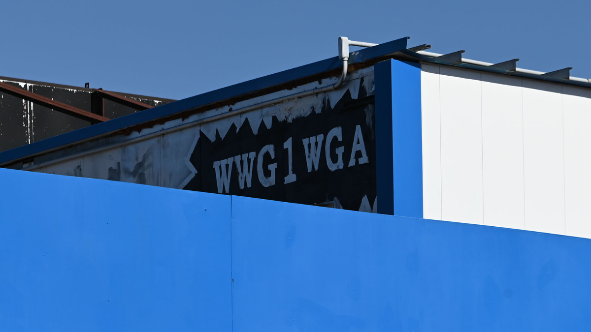
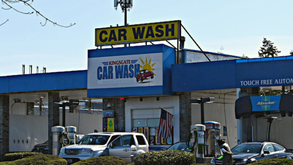
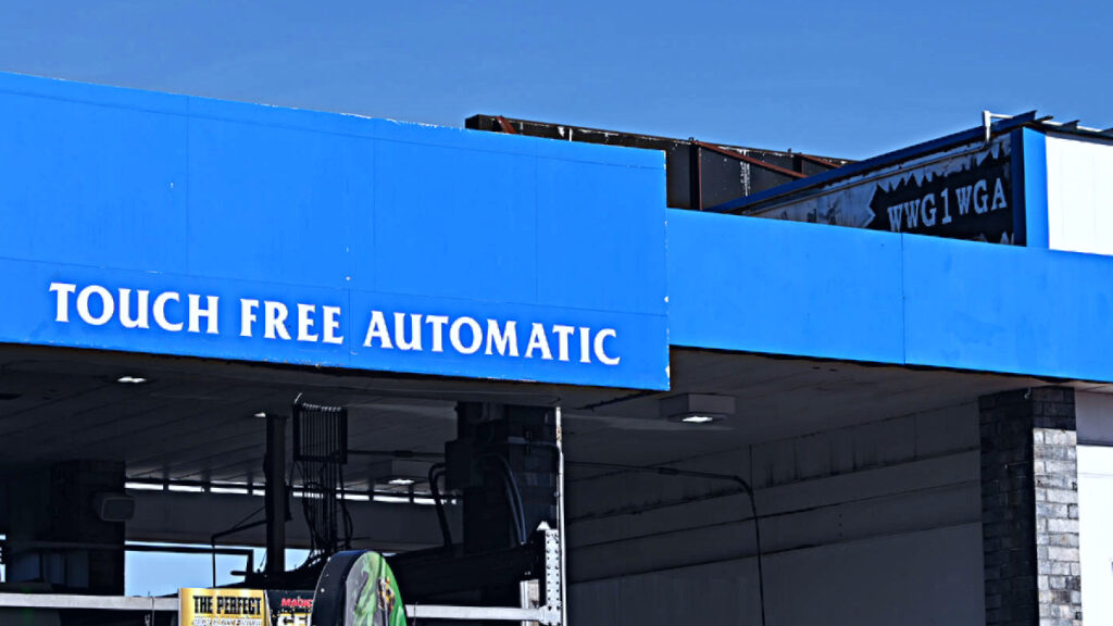
With temperatures tickling 60 degrees and the sun shining, Kingsgate Carwash in Kirkland was buzzing. The bays were full, and lines of cars waited to pass through two touchless lanes while an American flag hung outside. Overhead, hard to see on the building wall, the anacronym “WWG1WGA” faces out toward 124th Ave NE. Where We Go One, We Go All is a rallying cry for the conspiracy theory QAnon.
Kingsgate Car Wash in Kirkland was busy on a sunny Wednesday morning
QAnon started in the dark corners of the Internet, with no one exactly sure who “Q” is, but several theories exist. The individual or individuals that started the movement claim to have a “Q level” security clearance within the government. Q now has millions of followers, some of who have become militant and believe Q is working anonymously to expose the deep state.
QAnon believers subscribe to the idea that an illegitimate shadow government runs the United States. The shadow government architects are liberals, Hollywood elites, Jews, the Clintons, George Soros, the Obamas, and others. Believers further think these individuals and groups are part of a vast international child trafficking ring that supports pedophilia and consumes children’s blood to remain youthful and energetic.
The most high-profile QAnon fueled incident before January 2021 involved Edgar Maddison Welch. On December 4, 2016, Welch entered Comet Ping Pong in Washington, D.C., armed with an AR-15 semiautomatic rifle. Comet Ping Pong became ground zero for the QAnon pedophilia and blood-drinking liberal conspiracy theory.
Driving from North Carolina, Welch stormed the family-friendly restaurant, and as employees and customers fled in terror, he spent 20 minutes looking for the basement door. Comet Ping Pong has no basement. In frustration, he fired several rounds into a locked supply closet door before police surrounded the restaurant and convinced Welch to surrender.
Welch was sentenced to prison in 2017 and moved to a halfway house in March of 2020. His supervision ended on May 28. His actions in December became laughable within the moment because no one was hurt, and the ideas of QAnon were not mainstream. Today, the theory stands while the audience has grown much more prominent. The support of former President Donald Trump, the belief the 2020 election was stolen, and QAnon’s “save the children” ideas blend together for millions of Americans.
Since June 2020, the ideas supported by QAnon reached a fever pitch. QAnon espoused a “great awakening” where Donald Trump would be named the legitimate President and that warrants for the arrest of 195,000 people were already in place. The great awakening would be preceded by a total communications blackout, including the Internet and martial law declared. For the true believers of QAnon, these two events would signal that the deep state’s exposure was at hand.
Lawyers such as L Lin Wood, Sydney Powell, and Rudy Guiliani embraced some or all of the conspiracy theories within their legal filings. Believers eagerly awaited for Powell to “release the Kraken,” as she threatened. Any attempt to counter the narrative, including Trump-appointed judges and Supreme Court justices, was met with the accusation of being compromised by the deep state. As each promised event didn’t happen, the phrase “trust the plan” echoed through social media and the dark corners of the web.
By the time January 6, 2021, and the insurrection happened, followers became restless. Promised dates of the great awakening came and went. Q, using its social media channels, then moved the goalposts again to inauguration day. The theory being outgoing President Trump was waiting for all his enemies to be in the same place to start the great awakening. All the National Guard troops deployed to protect the Capitol? With so many deep state members in the same area, deployed troops would support mass arrests.
After Biden’s inauguration occurred, Q believers and the message “trust the plan” were fractured. Ron Watkins, who some believe is Q and is the son of 8Chan founder Jim Watkins, told his followers it was time to move on. Extremist organizations like Sovereign Citizen, listed as a domestic terrorism organization, moved in to scoop up crestfallen Q supporters, and a new theory was born.
Sovereign Citizen believes that Congress turned the United States into a corporation in 1871. Further, they think anything past the 14th Amendment and all Presidents elected after Ulysses S. Grant are illegitimate. Sovereign Citizen’s believe the correct inauguration day is March 4, not January 20. They think this because Franklin D. Roosevelt moved inauguration day in 1933.
The QAnon anacronym WWG1WGA isn’t easily visible to the casual observer
The new QAnon theory is Donald Trump will be inaugurated as the 19th President on Thursday, March 4, 2021, either in Washington D.C. or Mar-A-Lago in Florida. Some believe Trump will form the new government in Florida, making Mar-A-Lago the seat of power. March 4 will also bring the great awakening, the 195,000 arrests, along with the arrests of the Supreme Court, House, and Senate, for betraying Donald Trump. Like previous theories, the promised great awakening will be preceded by a total blackout of communications. If you’re reading this right now on the Internet, it is unlikely those trusting the plan will be happy on March 4.
To the outside observer, this can seem humorous. In December 2016, a lone gunman looking for an imaginary basement filled with blood-drinking liberals appeared comical. In the four years since QAnon has grown more mainstream, Congressional representatives like Marjorie Taylor Greene, former President Trump, and his inner circle have embraced the conspiracy. Blending with Sovereign Citizen, an organization that has murdered more than 40 people, the dangerous belief system continues to tear at our society’s fabric.
Now we come back to the other code of QAnon followers, WWG1WGA. The origin of “where we go one we go all” is a subject of debate. Many believe that the phrase, “where we go one we go all,” was inscribed on the bell of PT-109, the patrol boat John F. Kennedy commanded in World War II. However, there is nothing in the historical record from the U.S. Navy, National Geographic researchers, or the John F. Kennedy Library to support this.
It seems more likely the phrase comes from the 1996 ocean disaster thriller White Squall. The 2004 TV series Battlestar Galactica used a similar expression of “so say we all” to symbolize unity in the face of a common enemy. The sun shines brightly in Kirkland today, as cars line up to get washed under the QAnon code “where we go one, we go all.” If there is one thing that is certain after March 4, there will be a moving of the goalposts and true believers saying to “trust the plan.”
Attempts to reach the owner of the car wash went unanswered.
18-year old Cyrus Mason was shot and killed in Kirkland’s Houghton Beach Park on September 16, 2020, during an attempt to buy a firearm
Three suspects were arrested this morning after a months-long investigation – two are juveniles and one is an adult
The adult is Jowayne C. Kaufman, who was booked into King County Jail at 8:25 AM this morning
Cyrus Mason had moved to the area from Idaho and was working on the Microsoft campus as a painter
Houghton Beach Park was a trouble spot over the summer of 2020, making the national news when a brawl broke out among teens and young adults flaunting COVID rules – the city responded by closing the park
KIRKLAND, Wash. – Three suspects have been arrested in connection with the deadly shooting of a teenager at a Kirkland park last year, police say.
The three – two juvenile males and an adult male – were taken into custody early Wednesday after an investigation linked them to the killing of 18-year-old Cyrus Mason at Houghton Beach Park on Sept. 16, 2020.
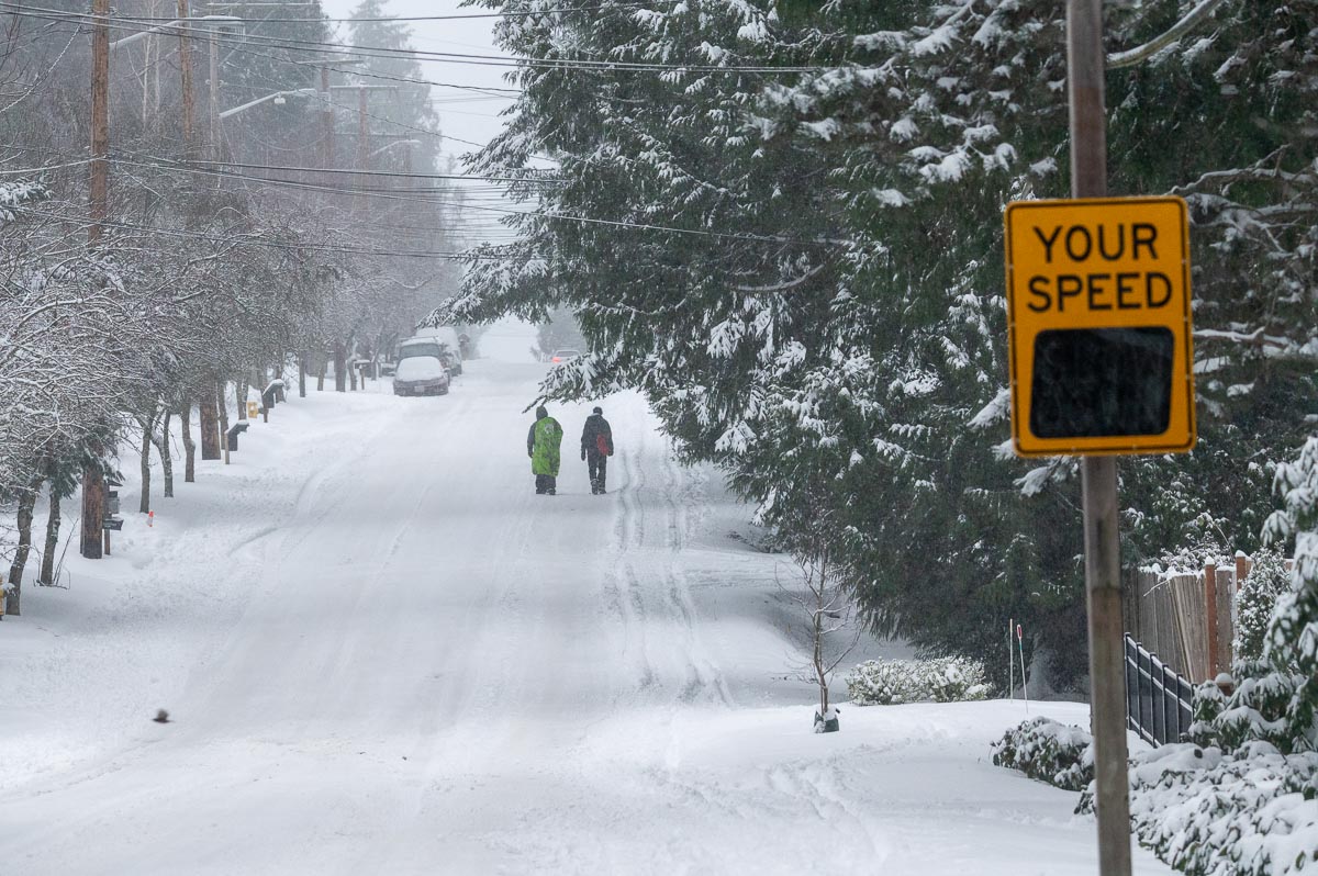
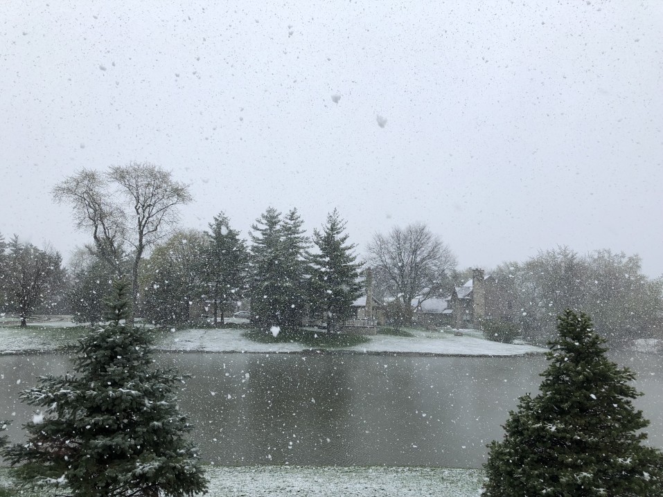
[KIRKLAND] – (MTN) Snow fell on Kirkland for over 24 hours, covering the city with six to nine inches of snow. The snow-covered streets brought out sledders, urban skiers, and pedestrians, who enjoyed the cold air and satisfying crunch of powdery snow. More snow is expected to fall Saturday night and Sunday.
UPDATE 4:00 PM PST: The National Weather Service has extended the Winter Storm Warning until 9:00 PM PST due to continued moderate to heavy snow falling in some areas within the region. Moderate to heavy bands of snow will continue to develop into the evening hours. Some of these bands can quickly drop one to two more inches of snow. People are advised to continue to avoid travel if possible.
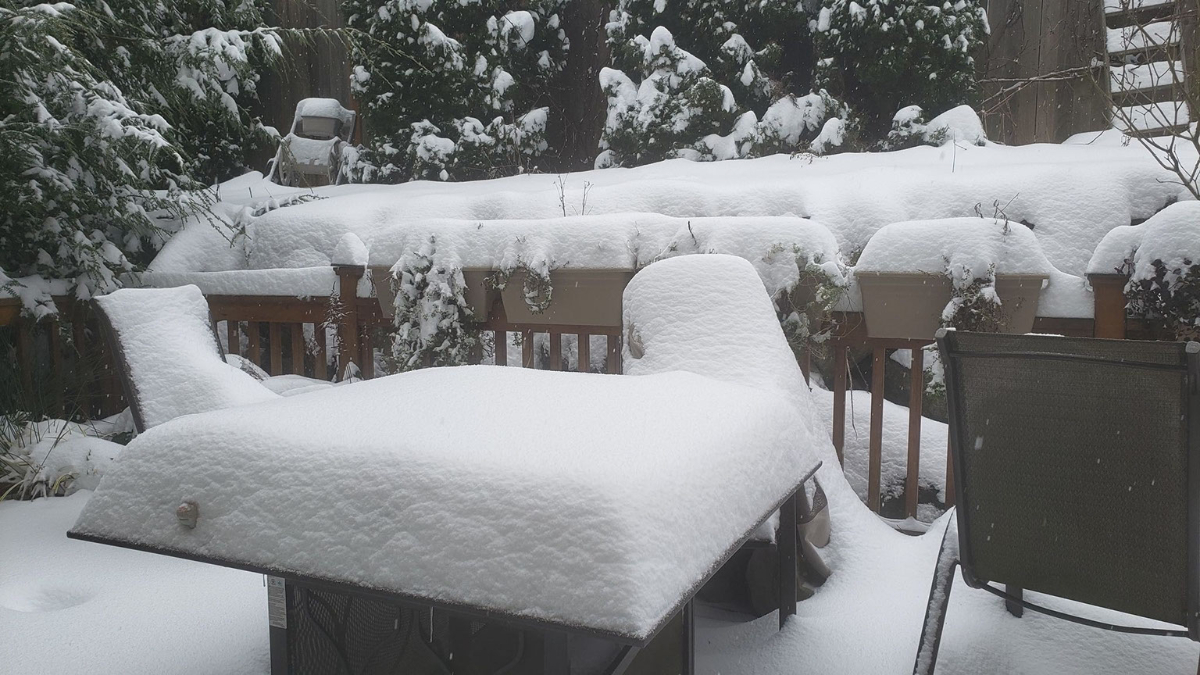
[SEATTLE] – (MTN) Puget Sound woke up to five to twelve inches of snow with more coming down on Saturday, as the biggest winter storm in two years blanketed the region. Light snow started falling between 6 PM and 8 PM in the Seattle-Bellevue area, while heavier snow accumulated in the South Sound. A third storm system is on tap for Saturday night and Sunday.
Snow showers from the current system are tapering off after a Convergence Zone formed from Marysville to Issaquah this afternoon. Saturday night, snow showers will increase again and get heavier into Sunday morning. By noon tomorrow, most areas will transition to a rain-snow mix or rain, but not before one to three more inches is added to current accumulations. Lows tonight will be 28 to 30 degrees and highs tomorrow will reach 35 to 37.
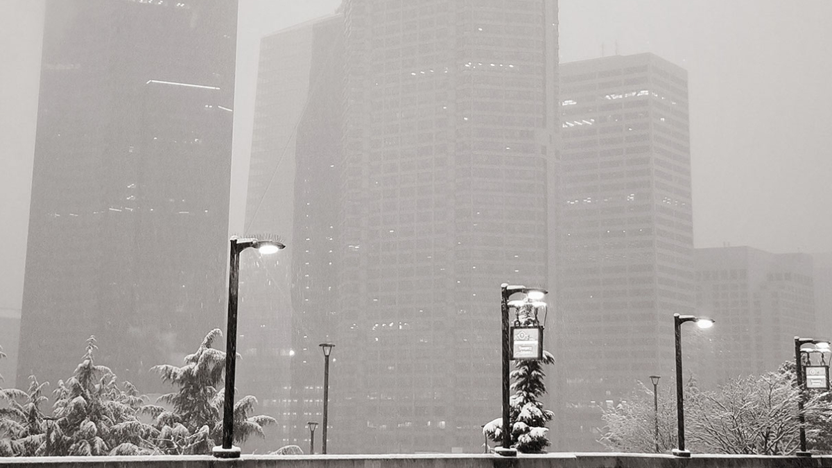
Many side streets are treacherous or impassable due to snow and ice throughout the region. During the early morning, hours on Saturday I-5 and I-405 were completely snow-covered, measured in inches in some location. Winds howled through the night with gusts as high as 40 MPH. Seattle-Tacoma International Airport had sustained winds of 25 MPH overnight, and wind chill as low as 10 degrees. In Kirkland, Seattle, and other communities, city officials closed numerous streets due to extreme conditions and the danger hills presented to drivers. Officials are appealing for people to stay off the roads if possible.
Further south in Tacoma and Olympia, 9 to 12 inches of snow fell bringing traffic to a standstill. I-5 was littered with accidents overnight in the metro Tacoma area despite light traffic, with emergency crews struggling to cover multiple crash scenes. Clark County where Vancouver is located has declared a state of emergency where roads are impassable. Portland, Oregon saw a wide range of snowfall amounts from 2 to 11 inches, with 6 inches in the city, as many areas experienced a major ice storm. Governor Kate Brown has declared a state of emergency in nine Oregon Counties due to ice accumulations, power outages, tree, and property damage. Over 130,000 people are without power in the hard-hit areas.
Monday will see temperatures approach 40 degrees with a transition to all rain. Side streets will remain a challenge in places likely into Tuesday as the snow gets converted into thick slush.
The snowstorm arriving on Friday could be the biggest event since February 3, 2019, when the Super Bowl storm blanketed the central lowlands. Cold air is spilling into Puget Sound from British Columbia tonight and will be entrenched at least until Monday, just in time for thee systems to pass through the area.
Malcontent News is issuing a French Toast Emergency for Friday
The first system is arriving on Thursday, and for the Seattle-Bellevue area will be a non-event. The day will start cold with the first hard freeze this winter season. Temperatures will be 23 to 26 before getting to 34 to 36 degrees. .Seattle should see a cloudy day with a slim chance of a few flakes in the afternoon but no accumulation. Further south, Tacoma is forecasted to receive 1 to 3 inches and Portland, Oregon 3 to 5 inches.
Friday is the main event, with the entire region poised to receive significant snow. The storm will move in from the south. For Portland, Oregon, the two systems will arrive back-to-back with almost no break. For the Seattle-Bellevue area, snow will arrive between 11 AM and 1 PM and continue to spread northward. Portland, Oregon, is poised for a significant storm, with snow totals of 10 to 14 inches. Tacoma will receive 7 to 10 inches, and the Seattle-Bellevue area 5 to 8 inches.
Our hyperlocal forecast for Kirkland-Bellevue-Woodinville projects 5 inches of snow in Woodinville, Kenmore, Juanita, Finn Hill, Kingsgate, and along the downtown waterfront. Rose Hill and the Houghton Highlands should expect 6 inches of snow, and Bridle Trails should expect 7 inches. Downtown Bellevue will see 5 to 6 inches of snow and amounts increasing as you head south toward Factoria. Crossroads in Bellevue should expect 7 inches. Slightly smaller totals should be expected in the northeast corner of Woodinville.
Saturday will see more snow with an additional 1 to 3 inches for the Seattle-Bellevue region before ending around 1 PM. Tacoma will see another 2 to 4 inches ending around 3 PM. Portland will transition to rain in the afternoon for a few hours before changing back to snow after sunset. The system should start to move out of the Rose City by 8 PM on Saturday.
Travel will be difficult through the entire region along the I-5 corridor and over the mountain passes. In Portland, winds of 20 to 30 MPH, with higher gusts, will create dangerous conditions. Travel on I-84 on the Oregon side and SH-14 on the Washington side of the Columbia River may be near impossible where winds could top 45 MPH.
Sunday into Monday, a third system will arrive. The weather models have very little agreement on what will fall from the sky on Sunday afternoon. Temperatures will be warmer than Saturday but still below average. There is the potential for more snow, but a sloppy wintery mix of snow, sleet, and freezing rain looks more likely. What and how much will depend on the storm track and elevation creating a very challenging weather forecast.
What to do with the leftover milk, bread, and eggs you horded
The US Coast Guard and King County Sheriff have been searching Lake Washington after a crewless boat slammed into a pier in Juanita Bay on Tuesday. Under its power, the craft struck a dock at the base of Finn Hill between Juanita and Kenmore. An inspection of the boat revealed a wallet and cellphone, causing officials to believe the operator has fallen overboard.
Officials initiated a search and rescue operation involving aircraft from King County, US Coast Guard, US Air Force, and watercraft from King County. The aerial search extended across almost the entire length of Lake Washington and was called off after nightfall on Tuesday. Shortly after sunrise on Wednesday morning, a Coast Guard helicopter flew a search pattern over Juanita Bay.
Officials have not identified the boat’s owner or the ID of the wallet and phone found onboard. There has been no indication of foul play, and officials are treating this as an accident. Search and rescue officials have not made any statement if they are still looking for survivors. Lake Washington is below 50 degrees this time of year, making survival for 24 hours in the water near impossible, even with a life presever.
[KIRKLAND] (Malcontent News) – After setting an official record high of 59 degrees on December 21, an intense cold front could bring a brief but intense burst of snow into the Puget Sound Lowlands. The National Weather Service has issued a Flood Advisory for a storm system dumping one to two inches of rain through the afternoon into the lowlands. Areas of poor drainage and clogged storm drains could create pockets of urban stream and street-level flooding.
At 3:00 PM, it was 55 degrees with heavy rain at Seatac Airport, while less than 100 miles to the north, it was 34 degrees with heavy snow in Bellingham. A cold front moving from the north will bring dramatically colder air, and a Converge Zone is expected to form in the next couple of hours. Forecast models indicate that temperatures could drop 20 degrees in two to three hours.
The challenge of forecasting a Convergence Zone is determining its exact location. Colliding winds moving north and south through Puget Sound are left with nowhere else to go but up, creating bands of intense precipitation that can be just 10 miles wide. Areas in these zones can see heavy rain or snow, with calm conditions a few miles away. Typically these zones appear on the King-Snohomish County line. Original forecast models had the zone forming north of Everett today, but current models and weather radar indicate it could develop much further south.
Areas that get heavy snow could see 1 to 3 inches of accumulation, which will likely melt quickly because surface temperatures are too warm. The intense snowfall could create short term travel problems with reduced visibility and slippery spots on less-traveled roads. Today’s weather system is very similar to storms that moved through the area on November 13, 2003, and November 27, 2006. The November 27 system crippled the Seattle area, turning highways and roads into parking lots filled with abandoned cars.
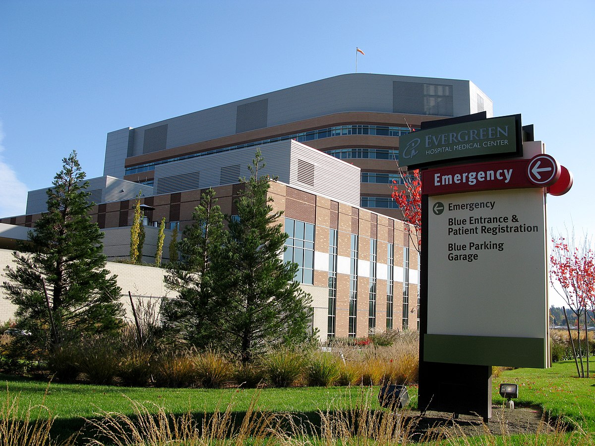
North King County and Snohomish County hospitals are nearing maximum ICU capacity, and a few have already hit that point. In Kirkland, Washington, the first significant outbreak site in the United States, Evergreen Hospital is currently at 90% ICU usage. Further north in Everett, Washington, Providence Hospital ICU is at 100% capacity.
In contrast, Seattle and Bellevue are reporting more available beds, but a worsening situation. Seattle is at 70% utilization while Overlake Hospital in Bellevue is at 64%. The utilization number at Overlake doesn’t tell a complete picture. The facility has a staffing crisis due to a low number of available specialists and many nurses sick with COVID. Traveling nurses are making as much as $10,000 a week to work at hospitals in COVID hotspots. Nurses are offered such high pay due to the dire need, long hours, and overall risk of infection. In Seattle, Harborview Medical Center has more patients with COVID than at any time since the pandemic started.
Area capacity to treat patients is reaching a critical breaking point. Seattle only has 121 ICU beds available as of this writing, based on a seven-day rolling average. With almost 1,100 patients in Washington hospitals with COVID, the governor’s office predicted that a “better case” scenario would be 2,000 hospitalized by the end of the year.
The central issue isn’t available hospital beds, but the staff to support sick patients. A COVID patient in ICU requires an extensive care team of three to four people per patient. Hospitals are optimized from a staff and revenue standpoint to operate at 60% to 80% capacity. The excess capacity is available for short term surges due to accidents, natural or humanmade disasters. To sustain above 80%, hospitals need additional staffing, which isn’t widely available.
Earlier today, the United States reached another grim milestone. Officials reported 3,054 COVID deaths, the most single-day fatalities in the United States since the pandemic started.
The New York Times, US Department of Health and Human Services, and The COVID Tracking Project provided some of this article’s data.
Rebecca Herman-Kerwin contributed to this story.
Journalists, activists, and researchers defending the First Amendment
Subscribe to Malcontent News
Register to feed your head holes with the Malcontent News newsletter.
Submitting your e-mail address gives us permission to send you e-mails. We do not sell or distribute our e-mail lists or share them with third parties.