Tag Archives: snow

Here we snow again!

[KIRKLAND, Wash.] – (MTN) Record-setting cold temperatures have prevented the Christmas weekend snow and ice from melting with another round of light snow set to arrive on Thursday.

If you squint, measurable snow has fallen at Seattle-Tacoma International Airport every day since Sunday. The temperature dropped to 17 degrees on Monday, a record, and was 91 degrees colder than the all-time record high set on June 28 of 108 degrees.

For the Bellevue-Kirkland-Woodinville area, most of Wednesday night and Thursday will be in a protective rain shadow formed by the Olympic Mountains. Heavier snow will fall to our south, particularly away from Puget Sound.

Tomorrow will start off cold with temperatures between 21 and 24 degrees under mostly clear skies. The clouds will move in during the afternoon, with a high temperature of 28 to 31 degrees.

On Wednesday night, snow will surround the Puget Sound lowlands, but won’t arrive in the metro Seattle-Bellevue area until close to midnight. Lows will be 23 to 25 degrees. Hit and miss light snow showers will start to filter in from the south.

Snow showers turn into light snow during the morning commute hours on Thursday, with areas south of Kirkland receiving more. Total accumulation will be one to three inches through our forecast region, with most areas on the lower side. The forecast is very tricky with just the smallest change in storm track having a major impact on the Bellevue-Kirkland-Woodinville area.

Looking at the forecast models, the total predicted snowfall by Thursday varies a lot over short distances:

  • Bellevue – 2.5 inches
  • Bothell – <1.0 inch
  • Duvall – 3.0 inches
  • Finn Hill – 1.0 inch
  • Issaquah – 3.0 inches
  • Juanita – 1.0 inch
  • Kenmore – <1.0 inch
  • Kingsgate – 1.0 inch
  • Novelty Hill – 2.0 inches
  • Redmond – 1.5 inches
  • Rose Hill – 1.0 inch
  • Sammamish – 3.0 inches
  • Totem Lake – 1.0 inch
  • Yarrow Point – 2.5 inches

When making snowfall forecasts, a difference of 50 miles in the storm track can have a major impact, and at 50 miles you’re metaphorically threading a needle blindfolded. Additionally, the forecast is supportive of a convergence zone forming in the South Sound. If the snow bands wiggle north by 20 miles, our forecast area will see a lot more white stuff on the ground.

Highs will be 33 to 35 degrees, but our region shouldn’t reach the high while it is snowing.

The South Sound will get a lot more snow including SeaTac Airport, which will get three to four inches, adding to existing travel woes. Additionally, if your travel plans include the passes on Thursday prepare for major delays and very cold temperatures.

Thursday night will remain cloudy with lows dropping back into the mid-twenties.

New Year’s Eve will be partly cloudy with a high of 31 to 33 before clouding up in the evening. There is a slim chance for a snow shower on New Year’s Eve night, with lows dropping back into the mid-20s.

The long-range forecast hints at some more snow on Saturday before temperatures finally get above freezing and we return back to normal – cloudy, cold, and raining.

Widespread lowland snow will bring a White Christmas to Western Washington after all

[KIRKLAND, Wash.] – (MTN) A small shift in the storm track with a little more intensification means widespread snow across Western Washington is likely on Christmas Day into Sunday morning. After the system moves out, record low temperatures will plunge Washington state into the deep freeze creating dangerous conditions.

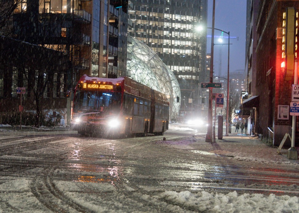
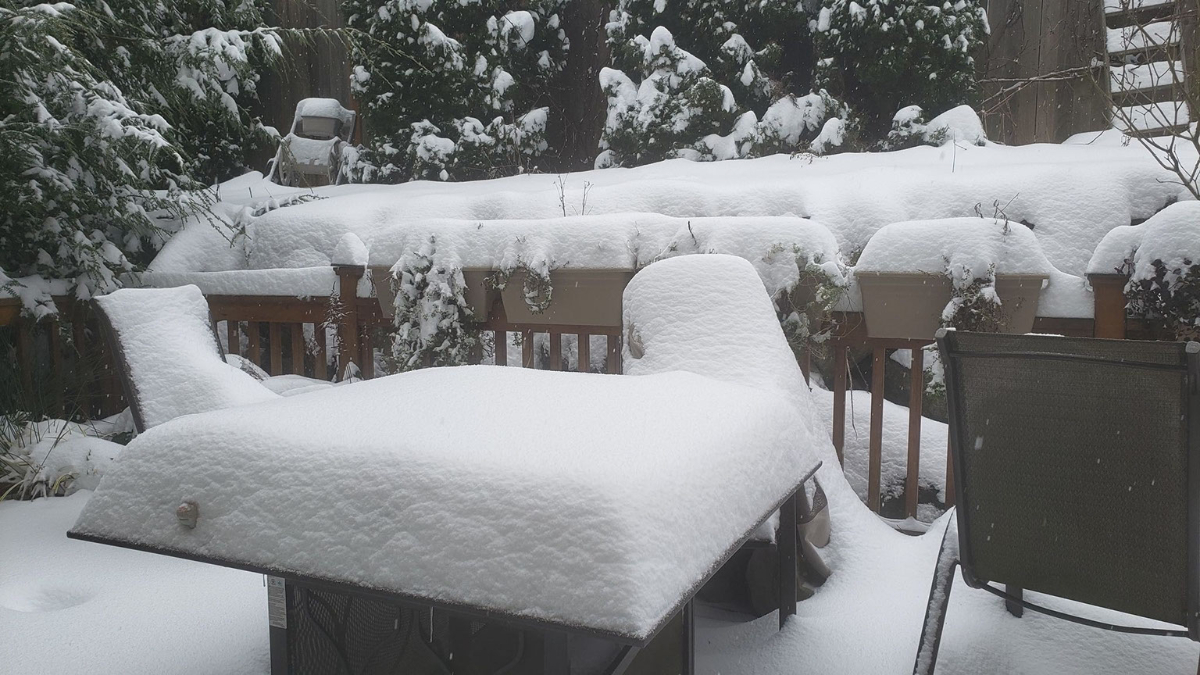
The I-405 corridor can expect one to four inches of snow, with some areas potentially seeing more. The Bellevue-Kirkland-Woodinville area will get three to five inches from Saturday morning to Sunday afternoon. To help the houseless, warming centers, overnight shelters, and housing vouchers are being provided across the county.

Friday morning the low-pressure system that will become our snowmaker was further south and a little stronger than what the models predicted yesterday. The National Weather Service has not issued any weather warnings for the Puget Sound lowlands at the time we went to press, but we expect Winter Weather Advisories for part of Saturday, Saturday night, and part of Sunday posted later today.

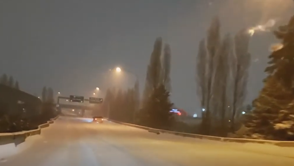
Christmas Eve started with a mix of sun and high clouds for the region, but that will be ending soon. Between 3 p.m. and 5 p.m., the rain will move into the area with wet snowflakes mixed in above 500 to 1,000 feet.

Friday night temperatures will drop close to freezing in the Bellevue-Kirkland-Woodinville area, Lows will be 33 to 35 and the rain should transition to wet snow for a few hours overnight. Drivers should be cautious, especially on side streets, hills, bridges, and overpasses.

The forecast for Christmas Day is more complex than yesterday. Your location and elevation will decide how much snow will fall during the day. The urban canyons of Bellevue and Seattle, along the shoreline of Puget Sound and Lake Washington, and area hot spots like Totem Lake will see more rain than snow. The hilltops such as Queen Anne, Finn Hill in Kirkland, and the foothills in Woodinville, Duvall, and Issaquah will see more snow. Precipitation will be in showers so some locations may be mostly dry while others could get dumped on. To complicate things further high temperatures will be 36 to 38 – a couple of degrees cooler will turn that rain/snow mix into mostly snow. Additionally, conditions are more favorable for a Convergence Zone to form in the evening. Expect one to two inches of snow, with the potential for a couple of areas to get higher amounts.

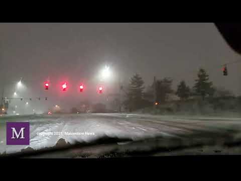
Saturday night the low-pressure area is now predicted to be just off the northeastern tip of Washington. Cold air will start to be pulled down from the Fraser Valley and light snow showers will fall through the region. Another one to two inches of snow will fall, while the urban canyons of Seattle and Bellevue will get more of a rain/snow mix. Temperatures will be 25 to 27 degrees, warmer in the urban cores, and roads will become slippery.

Sunday will be cold with widespread light snow across the region into the early afternoon. The change of about 100 miles in the location of the low-pressure area has boosted the amount of snow with two to three inches expected in the Bellevue-Kirkland-Woodinville area. It is too soon to predict if a convergence zone will form, but the models are more interesting than yesterday. Snow will taper off in the evening with highs between 28 and 30 degrees.

On Sunday night snow showers will end and our region will experience record-breaking cold under mostly cloudy skies. Lows will be 8 to 11 degrees. The record low at SeaTac is 20 and doesn’t stand a chance.

Monday will be partly cloudy and very cold, with a high of 22 to 25.

Monday night will be partly cloudy and cold, with temperatures from 13 to 15 degrees. The record low at SeaTac Airport is 12, so a tie isn’t out of the realm of possibility.

Tuesday will be a slight improvement under partly cloudy skies with a high of 28 to 30 degrees.

The outlook for the rest of the week is for temperatures ten to 15 degrees below normal through Thursday, with only a slight improvement in the long-range forecast. Your weather apps might be showing a snowflake on Thursday too, but it’s too far out to make a prediction.

Cold temperatures will bring life threatening conditions

Temperatures this low are life-threatening to the houseless and Seattle’s Human Services Department is opening two overnight shelters from Dec. 25 to Dec. 29. One shelter will be located at Seattle Center Exhibition Hall and can serve about 100 people, 18 and older including pets. The other is located in Pioneer Square and can serve 80 people, 18 and older. Additionally, the Salvation Army can accommodate up to 240 people at its shelter in SODO.

If you have children and live in King County, you can Parents can call the King County Emergency Family Shelter Intake Line at 206-245-1026 between 8 a.m. and 11:30 p.m. for assistance.

The City of Kirkland announced they will be providing hotel vouchers to the unhomed in the city as well as opening warming centers. Hotel vouchers are available by contacting the City of Kirkland, police, fire, or parks departments or by calling (425) 577-5656. For families living at the safe parking lot at the Lake Washington United Methodist Church, vouchers for extended stay hotels have been provided.

Warming centers will be available at the following locations.

  • North Kirkland Community Center
    • December 27 – 29, 1 PM to 4 PM
    • December 30, 8 AM to 12 PM
  • Peter Kirk Community Center
    • December 27 – 29, 8 AM to 5 PM
    • December 30, 8 AM to 12 PM
  • Kirkland City Hall
    • December 30, 8 AM to 12 PM

Temperatures this low will be a danger to pets and backyard livestock. Cats and dogs will need places to escape the cold, ideally inside your house. Water bowls for animals will freeze up in this weather making it impossible for them to drink water.

Outside faucets should have hoses disconnected and be covered or wrapped to protect them from freezing. Setting your faucets to the slowest trickle keeps water moving in your pipes preventing freezing. For sinks that face outside walls of your home, open the cabinet doors to allow warm air to circulate. Know where the water shutoff valve is for your house and make sure if you need a tool to use it, that you have one.

Extended cold is also hard on your car’s batteries. If the starter battery in your car is over four years old, the cold snap could spell the end of its useful life. Hybrid and electric vehicles can lose effective range when it is this cold. This happens due to physics impacting battery performance and the increased draw from the cabin heater, window defrosters, and comfort accessories like heated seats. If you find your range is deteriorating turning off the cabin heat and using heated seats to stay warm uses less power.

Malcontentment Happy Hour: February 22, 2021

Our live webcast from the Seattle Anarchist Jurisdiction

The show from February 22, 2021, featured David Obelcz and our co-host Jennifer Smith.

  • Most Tacoma Police Department officers will have body cams by end of the week
  • UW students suspended from attending in-person classes after a snowstorm kegger
  • Rochester, New York Police release 86 more minutes of video of 9-years-old girl pepper sprayed
  • Justice for Elijah McClain inches closer
  • Malcontented Minutes
    • Ohio bomb squad is called on Sprinkles the cat
    • Mashpee-Wampanoag First Nation will keep their tribal lands
    • Mariners president resigns after telling the awful truth about baseball
    • Lake Travis residents in Texas help each other in face of winter disaster
    • Catholic League leaders say Joe Biden’s LGBT obsession is hurting Christians
    • LGBTQ virtual spaces help keep college students connected to combat isolation and depression
    • U.S. shelters for migrant children near-maximum capacity as Biden Administration struggles with “kids in cages’
    • A mariachi band from Houston serenades Ted Cruz outside his home to bring a bit of Mexico vacation to him
    • Mancin Music on TikTok video absolutely shreds Kashmir by Led Zeppelin
    • Kayne West and Kim Kardashian are calling it quits
  • Chad Wheeler arrest video and audio released by Kent Police
  • Walking while Black incident in Plano, Texas
  • Insurrection Update
  • The tale of three vehicular assaults and three different forms of justice in the United States

Malcontentment Happy Hour: February 18, 2021

Our live webcast from the Seattle Anarchist Jurisdiction

The show from February 18, 2021, featured David Obelcz and our co-host Jennifer Smith.

  • Remembering Anias Valencia – NAAM Memorial
  • Seattle police shoot and kill a suicidal man
  • Malcontented Minutes
    • Disney issues cultural advisories on certain movies but excludes Pocahontas
    • Two Florida men claim to be US Marshals to avoid wearing masks
    • Seattle’s Woodland Park Zoon greets a newborn baby gorilla
    • Puerto Rico declares an emergency due to ongoing gender-identification violence
    • Bachelor/Bachelorette host Chris Harrison stepping down amid southern plantation ball flap
    • Ohio man skips a job interview to rob a bank instead
    • Mattress Mack of Houston opens up his stores to freezing Houston residents
    • Los Angeles Schools defund the police to invest in Black student achievement
    • Ted Cruz says “let ’em eat snow” as he takes off for Cancun amid one of worst weather disasters in Texas history
    • US House is expected to pass sweeping LGBTQ reform bill next week
  • Joe Biden gets facts wrong on minimum wage, immigration, and what is going on with COVID stimulus
  • Insurrection upate

Malcontentment Happy Hour: February 15, 2021

Our live webcast from the Seattle Anarchist Jurisdiction

The show from February 15, 2021, featured David Obelcz and our co-host Jennifer Smith.

  • Andy Finseth goes from Seattle Firefighter of the Year to an accused felon, and Dave Preston of Safe Seattle inserts himself into the story
  • Seattle has the biggest snowstorm since 1968, sort of
  • Malcontented Minutes
    • Rupaul’s Drag Race Sherry Pie, aka Joey Gugliemelli, embroiled in a catfishing scandal
    • UFC fighter Julian Marquez asks Miley Cyrus for a date in a cringeworthy way
    • A man hikes over 6 miles carrying a lost dog in the Irish wilderness
    • Senator Steve Daines (R-MT) threatens to block the Senate confirmation of Deb Halland to Secretary of the Interior
    • CDC study indicates ER visits for drug overdoses increased 45% from June 2019 to May 2020
    • Pioneering LGBTQIA+ artist who worked with Madonna, Chaka Khan, and Cyndi Lauper dies of leukemia
    • Dave Chappelle releases a video discussing the hypocrisy of Colin Kaepernick critics
    • A “war” over tips in Cinncinnati nets over $34,000 for restaurant workers
    • Animals at the Oregon Zoo relished playing in the snow
    • Six indigenous artists received $50K grants to support their “bold artistic vision” and protect native American artistry techniques
  • Tacoma “Love” update
  • COVID Five Fast Facts
  • Impeachment closure

Winter Weather Advisory issued as snow continues

[SEATTLE] – (MTN) Much of western Washington remains in an icy grip after a storm on Saturday dumped as much as a foot of snow, sleet, and freezing rain from Vancouver to Bellingham. A Winter Weather Advisory has been issued from noon to 10 PM, while Portland, Oregon is under an Ice Storm Warning.

[Best_Wordpress_Gallery id=”27″ gal_title=”February 2021 Snowstorm”]

Snow started falling across much of the region by 7 AM. Much of the Seattle area has received an inch already, with another one to three inches likely before the snow transitions to sleet, possibly some freezing rain, and then all rain tonight.

Area streets including arterials remain treacherous and travel should be avoided if at all possible. Monday will continue a cold wet pattern, but temperatures will climb to 40 degrees, bringing an end to the snow.

February 13 snowstorm gallery

[KIRKLAND] – (MTN) Snow fell on Kirkland for over 24 hours, covering the city with six to nine inches of snow. The snow-covered streets brought out sledders, urban skiers, and pedestrians, who enjoyed the cold air and satisfying crunch of powdery snow. More snow is expected to fall Saturday night and Sunday.

[Best_Wordpress_Gallery id=”25″ gal_title=”February 2021 Snowstorm”]

Round three of snow coming

UPDATE 4:00 PM PST: The National Weather Service has extended the Winter Storm Warning until 9:00 PM PST due to continued moderate to heavy snow falling in some areas within the region. Moderate to heavy bands of snow will continue to develop into the evening hours. Some of these bands can quickly drop one to two more inches of snow. People are advised to continue to avoid travel if possible.

[SEATTLE] – (MTN) Puget Sound woke up to five to twelve inches of snow with more coming down on Saturday, as the biggest winter storm in two years blanketed the region. Light snow started falling between 6 PM and 8 PM in the Seattle-Bellevue area, while heavier snow accumulated in the South Sound. A third storm system is on tap for Saturday night and Sunday.

[Best_Wordpress_Gallery id=”26″ gal_title=”February 2021 Snowstorm”]

Snow showers from the current system are tapering off after a Convergence Zone formed from Marysville to Issaquah this afternoon. Saturday night, snow showers will increase again and get heavier into Sunday morning. By noon tomorrow, most areas will transition to a rain-snow mix or rain, but not before one to three more inches is added to current accumulations. Lows tonight will be 28 to 30 degrees and highs tomorrow will reach 35 to 37.

Many side streets are treacherous or impassable due to snow and ice throughout the region. During the early morning, hours on Saturday I-5 and I-405 were completely snow-covered, measured in inches in some location. Winds howled through the night with gusts as high as 40 MPH. Seattle-Tacoma International Airport had sustained winds of 25 MPH overnight, and wind chill as low as 10 degrees. In Kirkland, Seattle, and other communities, city officials closed numerous streets due to extreme conditions and the danger hills presented to drivers. Officials are appealing for people to stay off the roads if possible.

Further south in Tacoma and Olympia, 9 to 12 inches of snow fell bringing traffic to a standstill. I-5 was littered with accidents overnight in the metro Tacoma area despite light traffic, with emergency crews struggling to cover multiple crash scenes. Clark County where Vancouver is located has declared a state of emergency where roads are impassable. Portland, Oregon saw a wide range of snowfall amounts from 2 to 11 inches, with 6 inches in the city, as many areas experienced a major ice storm. Governor Kate Brown has declared a state of emergency in nine Oregon Counties due to ice accumulations, power outages, tree, and property damage. Over 130,000 people are without power in the hard-hit areas.

Monday will see temperatures approach 40 degrees with a transition to all rain. Side streets will remain a challenge in places likely into Tuesday as the snow gets converted into thick slush.

Updated: Winter Storm Slams Puget Sound – Live Blog Updates

We storm chased last night and early this morning

You can join us on Twitch, no subscription required at malcontentnews.tv
We will start our feed between 9 PM and 10 PM PST, depending on the weather.

We will do storm updates as a live blog on this story

Saturday 11:35 AM – Snow is starting to taper off in our area. Temperatures are 27 to 29 degrees and there is very light snow or light freezing drizzle falling through the area. Another inch of snow is possible before tapering off, but it will be short lived. We have another shot of snow coming tonight into Sunday morning, with 2 to 3 inches likely in our area before it transitions to a rain or rain-snow mix. Roads are in poor condition. I-5 and i-405 are in much better shape than they were at 4 AM. The region received 5 to 12 inches last night. Shoreline was reporting 10 inches, downtown Seattle 6 inches, and in the Kirkland-Bellevue-Woodinville area reports are coming in of 6 to 9 inches of snow. You can watch our video from last night to see how bad it was at 4 AM.

Saturday 4:15 AM – I-5 from Tacoma to Boeing Field has deep snow on it with large sections untreated. I-5 in Auburn and Federal Way is in extremely poor condition, as are the roads in Tacoma. I-5, I-90, I-405, and SH-520 are all snow-covered. There are numerous road closures in Kirkland due to snow and ice build-up on roads. Along the waterfront, the wind is blowing in excess of 20 MPH creating reduced visibility and drifting snow. Snowfall rates are an inch an hour or more, and public works along with state DOT simply can’t keep up. Lake Shore Blvd has waves of snow and tire tracks of cars that pass through disappear within minutes. Many places in Kirkland have 3 to 4 inches of snow already with the heaviest snow bands arriving now. Temperatures are 24 to 26 degrees and the wind chill is 12 to 15 degrees. If you have travel plans tomorrow, especially before noon, we strongly advise you cancel them. Sections of I-5 from Lewis-McChord to Federal Way are the worst I have seen in 21 years of living in this area.

Saturday 12:45 AM – Moderate to heavy snow is falling throughout the Seattle-Bellevue-Tacoma area. Road conditions on I-5 have gotten much worse between Olympia and Tacoma and are fully snow-covered. I-705 to City Center is treacherous and at Woodbridge Ave we came across numerous vehicles unable to navigate the uphill ramp along the Ruston waterfront. Wind chills are from 10 to 15 degrees and moderate to heavy snow will continue through the overnight. We measured 7″ of snow just outside of the Capitol complex in Olympia, and 4″ in Tacoma along Ruston.

Friday 11:15 PM – Road conditions are rapidly deteriorating through the Puget Sound region, especially from Tacoma south. Conditions will get worse across all of Puget Sound as the night continues. In Olympia, there is already 4 to 6 inches of snow on the ground with moderate snow and 28 degrees. Snow now extends across the entire region into Canada, with a wintery mix along the coast. Seattle-Tacoma International Airport is down to 25 degrees with winds of 24 MPH! The wind chill is down to 10 degrees. From Dupont to Olympia I-5 is in poor shape, snow-covered and icy. There were multiple accidents all through Tacoma. There is still a battle between the dry air to the east and the moisture coming off of the coast. Regions west of I-405 in our immediate area will get less snow, but don’t be surprised to see 3 inches fall by morning and another 2 inches on Saturday.

LIVE STREAM COVERING WINTER STORM 2021

Friday 7:26 PM – Seattle-Tacoma International Airport is reporting light snow, visibility of 3 miles, 27 degrees, and an east wind of 10 MPH with gusts of 24 MPH. That puts the wind chill at 17 degrees. Tacoma (at Tacoma Narrows Airport) is reporting light snow, visibility of 2 miles, 25 degrees, and a north wind of 9 MPH. That puts the wind chill at 16 degrees. Snow will continue to get heavier moving south to north. It could be worse, Portland, Oregon is 27 degrees with mixed freezing rain and snow. The winds are blowing from the east at 25 MPH creating a wind chill of 12 degrees!

Friday 6:25 PM – The easterlies are collapsing and combined with the arrival of sunset area temperatures have dropped into the high 20s. Winds are coming from the south and southwest, although if you got 20 miles north of Kirkland, the winds are still flowing from the east. There is a distinct line between the dry air and the moist air flowing in. By 6:00 PM all areas of Kirkland have light snow falling. They are fine flakes but they are already sticking to the pavement. Snow extends north almost to Everett and will continue to expand and intensify. Snow arrived 4 hours earlier than the forecast models. Buckle up Kirkland, it’s going to be very white tomorrow morning.

Friday 5:07 PM – Snowing in Bridle Trails area of Kirkland

Friday 2:24 PM – Easterly flow has kicked in and shredded the snow advancing on the central Sound. Now the 2″ versus 6″ question – how strong will that easterly flow be and how long it will last? We’ll have to see.

Friday 1:22 PM – Snow has reached Federal Way, Washington – if the current northward movement continues, it will be snowing in Seattle-Bellevue around 4 PM

Friday 11:41 AM – Snow has reached Olympia, Washington

[Seattle] – (MTN) A Winter Storm Warning is in effect from 10 PM Friday to 4 PM Saturday, for the most significant snowstorm since February 2019. Warnings extend from Snohomish County to the Oregon border, where the Puget Sound lowlands can expect considerable snowfall.

For the Kirkland-Bellevue-Woodinville area, snow will arrive between 8 PM and 10 PM and steadily increase during the overnight hours. The snow will be moving up from the south, where snow is already falling. Areas east of I-405 and north of SH-520 will get less snow overall.

Most areas received 1/2 to 1 inch of snow overnight in the Kirkland-Bellevue-Woodinville area. An inch of snow is possible on Friday. Overnight, the region can expect 4 to 6 inches of additional snow through Saturday afternoon.

Winds will increase to up to 40 MPH overnight, with temperatures in the 20s, creating dangerous wind chills and blowing snow that will reduce visibility. Travel overnight will be difficult and is already challenging in the Portland, Oregon area.

The one wildcard in this is the easterly winds coming off of the Cascades. We’ve had several forecasted snowstorms shredded by easterlies, which dries out the air and creates a “rain shield” over the Cascade foothills that can extend to Seattle. If the flow becomes strong, it will reduce the snowfall forecast.

With wind gusts forecasted to 40 MPH, areas that are prone to power outages should make sure to have candles and batteries ready. Grilles, portable gas heaters, and generators should never be run indoors due to carbon monoxide poisoning risk. If you lose power in cold weather, setting your faucets to a slow trickle or drip will help prevent pipes from freezing.

How to use up those french toast supplies you over bought