[HOUSTON] – (MTN) Oil went above $60 a barrel for the first time in a year as oil production and refining ground to a halt. Oil and natural gas wells stopped pumping in the Permian Basin, and refineries went into complete shutdown in the Golden Triangle over the weekend, stopping gasoline production.
Engineered to work in the Texas heat, the pumps and refineries cannot operate safely in frigid temperatures. Additionally, with 3.8 million people out of power and rolling blackouts now impacting five states, the electricity and employees required to run these operations are unavailable.
The historic winter storm slammed the Midwest and Texas, bringing accumulating snow as far south as Brownsville, Texas, and even Mexico. Snow and freezing rain have collapsed power lines while Texans, whose homes aren’t designed for this kind of weather, send electricity and natural gas demand to unprecedented levels.
Twitter user @nessanicole10 shows snow in Brownsville, Texas, located on the gulf coast and the Mexico border
The situation in Texas represents a massive disruption to energy distribution in the United States. In the Permian Basin, which includes the Texas cities of Midland and Odessa, one million barrels of daily oil production is offline, representing 9% of total U.S. production.
Locally, this will mean higher prices at the gas pump, even though Washington state is a closed-loop system. Ninety-percent of Washington crude oil comes from Alaska due to the Rocky Mountains preventing pipeline transmission to the region. Almost all of our gasoline and aviation fuel is refined in-state.
In the early 2000s, Shell closed down two refineries in California to tighten west coast supply and raise overall prices. Shell claimed the Bakersfield refinery needed to be shuttered because it was too expensive to operate due to California regulations. In California, regulators indicated they offered full waivers to the Shell Bakersfield plant. Leaked internal memos showed the refinery was one of the most profitable Shell owned. Shell sold the refinery to Flying J, in a deal backed by California. Ultimately the plant was shuttered when Flying J went bankrupt in 2008 due to the Great Recession and plummeting demand for diesel fuel at their numerous truck stops. The permanent closure reduced diesel and gasoline supply in northern California, Oregon, and Washington.
Despite the region’s insulation from Midwest and Texas supply disruptions, distribution costs in our area will go up. With it, you’ll be paying more at that pump.
The disruptions out of Texas may be long term. The Southwest Power Pool manages electricity across 14 states in the south and Midwest. It has notified all customers there is a Level Three power emergency that requires rolling blackouts through the entire region to prevent the electrical grid from collapsing.
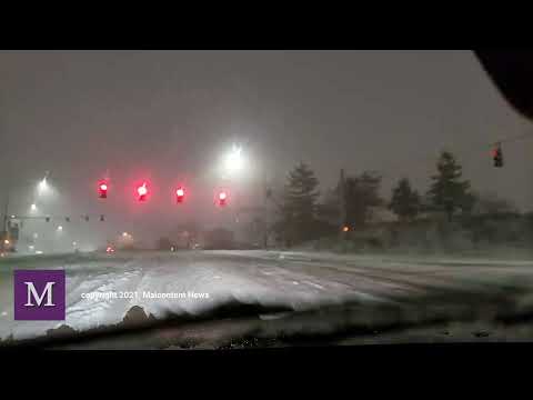
In southeast Texas, including Houston, the system is so overloaded and damaged that rolling blackouts are no longer possible. Customers have been advised to treat any power outage as long-term and plan accordingly. Videos are showing overloaded powerlines exploding in fireballs, like glowing elements of a toaster.
power lines are exploding throughout texas due to ice, wind, and overloads
Natural gas demand is so high that the required pressure collapses, causing shortages and cutoffs to businesses and homes. The situation will only get worse as record cold, possibly the coldest weather in 150 years, will blanket the Lone Star state tonight. Forecasters expect freezing rain to strike southeast Texas Tuesday night and Wednesday, adding to the region’s woes.
2.5 million without power across Texas …in some of the coldest weather in over 30 years 🥶
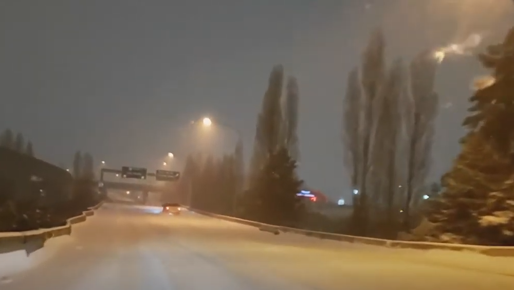
Houston, texas is snow-covered including the downtown freeways with more cold weather on the way
Residents are flooding area 911 systems with calls desperate about the cold and no way to heat their homes or stay warm. Officials ask people to conserve energy, bundle up, and protect the pipes with even colder weather on tap. City officials in Houston have appealed to people to treat this like a Category V hurricane and stay home.
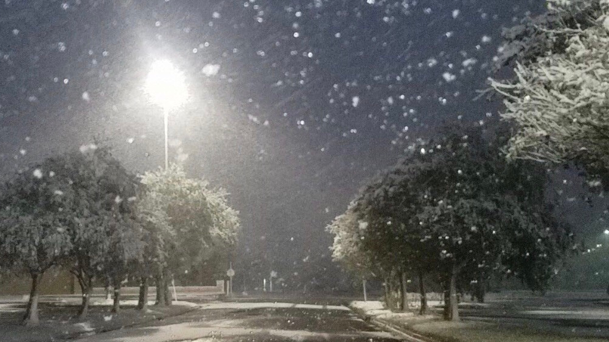
[SEATTLE] – (MTN) Much of western Washington remains in an icy grip after a storm on Saturday dumped as much as a foot of snow, sleet, and freezing rain from Vancouver to Bellingham. A Winter Weather Advisory has been issued from noon to 10 PM, while Portland, Oregon is under an Ice Storm Warning.
Snow started falling across much of the region by 7 AM. Much of the Seattle area has received an inch already, with another one to three inches likely before the snow transitions to sleet, possibly some freezing rain, and then all rain tonight.
Area streets including arterials remain treacherous and travel should be avoided if at all possible. Monday will continue a cold wet pattern, but temperatures will climb to 40 degrees, bringing an end to the snow.
UPDATE 4:00 PM PST: The National Weather Service has extended the Winter Storm Warning until 9:00 PM PST due to continued moderate to heavy snow falling in some areas within the region. Moderate to heavy bands of snow will continue to develop into the evening hours. Some of these bands can quickly drop one to two more inches of snow. People are advised to continue to avoid travel if possible.
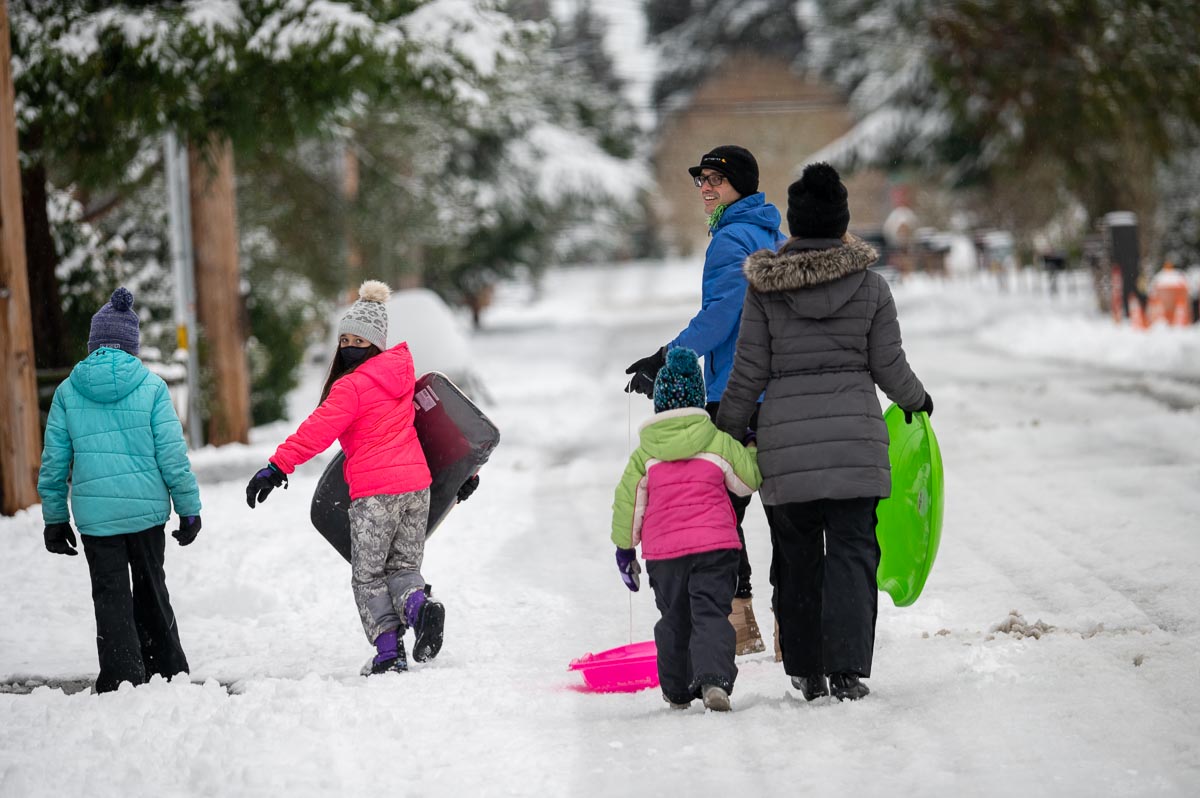
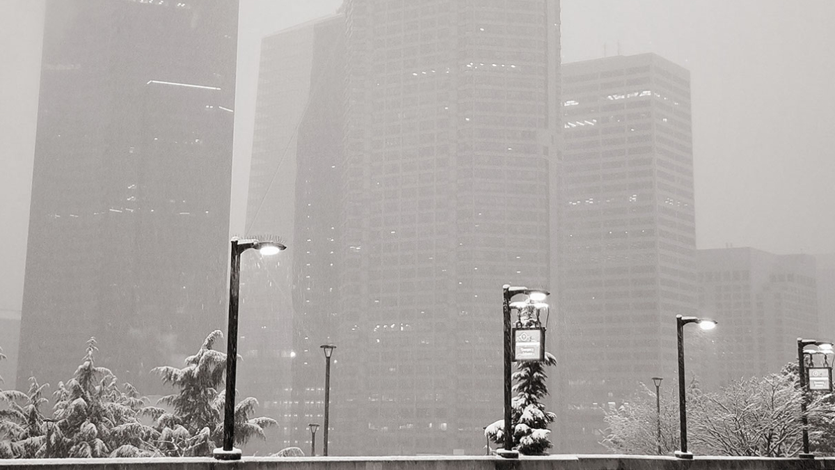
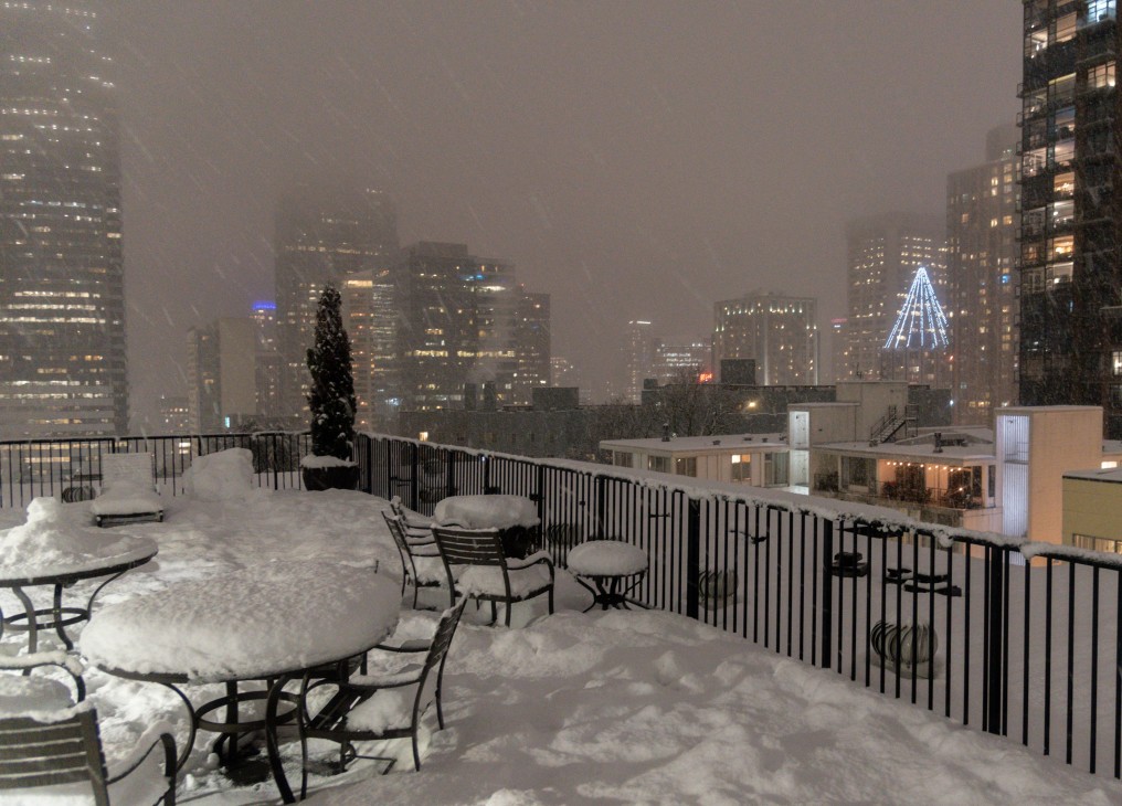
[SEATTLE] – (MTN) Puget Sound woke up to five to twelve inches of snow with more coming down on Saturday, as the biggest winter storm in two years blanketed the region. Light snow started falling between 6 PM and 8 PM in the Seattle-Bellevue area, while heavier snow accumulated in the South Sound. A third storm system is on tap for Saturday night and Sunday.
Snow showers from the current system are tapering off after a Convergence Zone formed from Marysville to Issaquah this afternoon. Saturday night, snow showers will increase again and get heavier into Sunday morning. By noon tomorrow, most areas will transition to a rain-snow mix or rain, but not before one to three more inches is added to current accumulations. Lows tonight will be 28 to 30 degrees and highs tomorrow will reach 35 to 37.
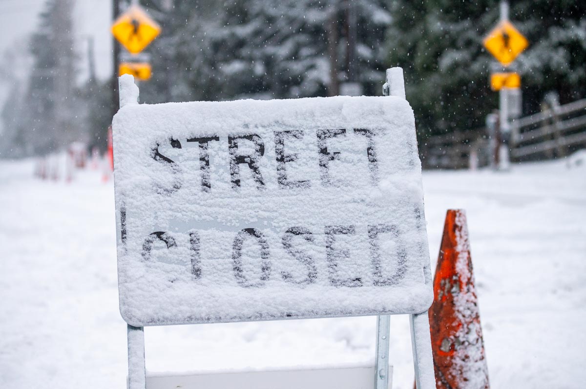
Many side streets are treacherous or impassable due to snow and ice throughout the region. During the early morning, hours on Saturday I-5 and I-405 were completely snow-covered, measured in inches in some location. Winds howled through the night with gusts as high as 40 MPH. Seattle-Tacoma International Airport had sustained winds of 25 MPH overnight, and wind chill as low as 10 degrees. In Kirkland, Seattle, and other communities, city officials closed numerous streets due to extreme conditions and the danger hills presented to drivers. Officials are appealing for people to stay off the roads if possible.
Further south in Tacoma and Olympia, 9 to 12 inches of snow fell bringing traffic to a standstill. I-5 was littered with accidents overnight in the metro Tacoma area despite light traffic, with emergency crews struggling to cover multiple crash scenes. Clark County where Vancouver is located has declared a state of emergency where roads are impassable. Portland, Oregon saw a wide range of snowfall amounts from 2 to 11 inches, with 6 inches in the city, as many areas experienced a major ice storm. Governor Kate Brown has declared a state of emergency in nine Oregon Counties due to ice accumulations, power outages, tree, and property damage. Over 130,000 people are without power in the hard-hit areas.
Monday will see temperatures approach 40 degrees with a transition to all rain. Side streets will remain a challenge in places likely into Tuesday as the snow gets converted into thick slush.
You can join us on Twitch, no subscription required at malcontentnews.tv We will start our feed between 9 PM and 10 PM PST, depending on the weather.
We will do storm updates as a live blog on this story
Saturday 11:35 AM – Snow is starting to taper off in our area. Temperatures are 27 to 29 degrees and there is very light snow or light freezing drizzle falling through the area. Another inch of snow is possible before tapering off, but it will be short lived. We have another shot of snow coming tonight into Sunday morning, with 2 to 3 inches likely in our area before it transitions to a rain or rain-snow mix. Roads are in poor condition. I-5 and i-405 are in much better shape than they were at 4 AM. The region received 5 to 12 inches last night. Shoreline was reporting 10 inches, downtown Seattle 6 inches, and in the Kirkland-Bellevue-Woodinville area reports are coming in of 6 to 9 inches of snow. You can watch our video from last night to see how bad it was at 4 AM.
Saturday 4:15 AM – I-5 from Tacoma to Boeing Field has deep snow on it with large sections untreated. I-5 in Auburn and Federal Way is in extremely poor condition, as are the roads in Tacoma. I-5, I-90, I-405, and SH-520 are all snow-covered. There are numerous road closures in Kirkland due to snow and ice build-up on roads. Along the waterfront, the wind is blowing in excess of 20 MPH creating reduced visibility and drifting snow. Snowfall rates are an inch an hour or more, and public works along with state DOT simply can’t keep up. Lake Shore Blvd has waves of snow and tire tracks of cars that pass through disappear within minutes. Many places in Kirkland have 3 to 4 inches of snow already with the heaviest snow bands arriving now. Temperatures are 24 to 26 degrees and the wind chill is 12 to 15 degrees. If you have travel plans tomorrow, especially before noon, we strongly advise you cancel them. Sections of I-5 from Lewis-McChord to Federal Way are the worst I have seen in 21 years of living in this area.
Saturday 12:45 AM – Moderate to heavy snow is falling throughout the Seattle-Bellevue-Tacoma area. Road conditions on I-5 have gotten much worse between Olympia and Tacoma and are fully snow-covered. I-705 to City Center is treacherous and at Woodbridge Ave we came across numerous vehicles unable to navigate the uphill ramp along the Ruston waterfront. Wind chills are from 10 to 15 degrees and moderate to heavy snow will continue through the overnight. We measured 7″ of snow just outside of the Capitol complex in Olympia, and 4″ in Tacoma along Ruston.
Friday 11:15 PM – Road conditions are rapidly deteriorating through the Puget Sound region, especially from Tacoma south. Conditions will get worse across all of Puget Sound as the night continues. In Olympia, there is already 4 to 6 inches of snow on the ground with moderate snow and 28 degrees. Snow now extends across the entire region into Canada, with a wintery mix along the coast. Seattle-Tacoma International Airport is down to 25 degrees with winds of 24 MPH! The wind chill is down to 10 degrees. From Dupont to Olympia I-5 is in poor shape, snow-covered and icy. There were multiple accidents all through Tacoma. There is still a battle between the dry air to the east and the moisture coming off of the coast. Regions west of I-405 in our immediate area will get less snow, but don’t be surprised to see 3 inches fall by morning and another 2 inches on Saturday.
LIVE STREAM COVERING WINTER STORM 2021
Friday 7:26 PM – Seattle-Tacoma International Airport is reporting light snow, visibility of 3 miles, 27 degrees, and an east wind of 10 MPH with gusts of 24 MPH. That puts the wind chill at 17 degrees. Tacoma (at Tacoma Narrows Airport) is reporting light snow, visibility of 2 miles, 25 degrees, and a north wind of 9 MPH. That puts the wind chill at 16 degrees. Snow will continue to get heavier moving south to north. It could be worse, Portland, Oregon is 27 degrees with mixed freezing rain and snow. The winds are blowing from the east at 25 MPH creating a wind chill of 12 degrees!
Friday 6:25 PM – The easterlies are collapsing and combined with the arrival of sunset area temperatures have dropped into the high 20s. Winds are coming from the south and southwest, although if you got 20 miles north of Kirkland, the winds are still flowing from the east. There is a distinct line between the dry air and the moist air flowing in. By 6:00 PM all areas of Kirkland have light snow falling. They are fine flakes but they are already sticking to the pavement. Snow extends north almost to Everett and will continue to expand and intensify. Snow arrived 4 hours earlier than the forecast models. Buckle up Kirkland, it’s going to be very white tomorrow morning.
Friday 5:07 PM – Snowing in Bridle Trails area of Kirkland
Friday 2:24 PM – Easterly flow has kicked in and shredded the snow advancing on the central Sound. Now the 2″ versus 6″ question – how strong will that easterly flow be and how long it will last? We’ll have to see.
Friday 1:22 PM – Snow has reached Federal Way, Washington – if the current northward movement continues, it will be snowing in Seattle-Bellevue around 4 PM
Friday 11:41 AM – Snow has reached Olympia, Washington
[Seattle] – (MTN) A Winter Storm Warning is in effect from 10 PM Friday to 4 PM Saturday, for the most significant snowstorm since February 2019. Warnings extend from Snohomish County to the Oregon border, where the Puget Sound lowlands can expect considerable snowfall.
For the Kirkland-Bellevue-Woodinville area, snow will arrive between 8 PM and 10 PM and steadily increase during the overnight hours. The snow will be moving up from the south, where snow is already falling. Areas east of I-405 and north of SH-520 will get less snow overall.
Most areas received 1/2 to 1 inch of snow overnight in the Kirkland-Bellevue-Woodinville area. An inch of snow is possible on Friday. Overnight, the region can expect 4 to 6 inches of additional snow through Saturday afternoon.
Winds will increase to up to 40 MPH overnight, with temperatures in the 20s, creating dangerous wind chills and blowing snow that will reduce visibility. Travel overnight will be difficult and is already challenging in the Portland, Oregon area.
The one wildcard in this is the easterly winds coming off of the Cascades. We’ve had several forecasted snowstorms shredded by easterlies, which dries out the air and creates a “rain shield” over the Cascade foothills that can extend to Seattle. If the flow becomes strong, it will reduce the snowfall forecast.
With wind gusts forecasted to 40 MPH, areas that are prone to power outages should make sure to have candles and batteries ready. Grilles, portable gas heaters, and generators should never be run indoors due to carbon monoxide poisoning risk. If you lose power in cold weather, setting your faucets to a slow trickle or drip will help prevent pipes from freezing.
How to use up those french toast supplies you over bought
The snowstorm arriving on Friday could be the biggest event since February 3, 2019, when the Super Bowl storm blanketed the central lowlands. Cold air is spilling into Puget Sound from British Columbia tonight and will be entrenched at least until Monday, just in time for thee systems to pass through the area.
Malcontent News is issuing a French Toast Emergency for Friday
The first system is arriving on Thursday, and for the Seattle-Bellevue area will be a non-event. The day will start cold with the first hard freeze this winter season. Temperatures will be 23 to 26 before getting to 34 to 36 degrees. .Seattle should see a cloudy day with a slim chance of a few flakes in the afternoon but no accumulation. Further south, Tacoma is forecasted to receive 1 to 3 inches and Portland, Oregon 3 to 5 inches.
Friday is the main event, with the entire region poised to receive significant snow. The storm will move in from the south. For Portland, Oregon, the two systems will arrive back-to-back with almost no break. For the Seattle-Bellevue area, snow will arrive between 11 AM and 1 PM and continue to spread northward. Portland, Oregon, is poised for a significant storm, with snow totals of 10 to 14 inches. Tacoma will receive 7 to 10 inches, and the Seattle-Bellevue area 5 to 8 inches.
Our hyperlocal forecast for Kirkland-Bellevue-Woodinville projects 5 inches of snow in Woodinville, Kenmore, Juanita, Finn Hill, Kingsgate, and along the downtown waterfront. Rose Hill and the Houghton Highlands should expect 6 inches of snow, and Bridle Trails should expect 7 inches. Downtown Bellevue will see 5 to 6 inches of snow and amounts increasing as you head south toward Factoria. Crossroads in Bellevue should expect 7 inches. Slightly smaller totals should be expected in the northeast corner of Woodinville.
Saturday will see more snow with an additional 1 to 3 inches for the Seattle-Bellevue region before ending around 1 PM. Tacoma will see another 2 to 4 inches ending around 3 PM. Portland will transition to rain in the afternoon for a few hours before changing back to snow after sunset. The system should start to move out of the Rose City by 8 PM on Saturday.
Travel will be difficult through the entire region along the I-5 corridor and over the mountain passes. In Portland, winds of 20 to 30 MPH, with higher gusts, will create dangerous conditions. Travel on I-84 on the Oregon side and SH-14 on the Washington side of the Columbia River may be near impossible where winds could top 45 MPH.
Sunday into Monday, a third system will arrive. The weather models have very little agreement on what will fall from the sky on Sunday afternoon. Temperatures will be warmer than Saturday but still below average. There is the potential for more snow, but a sloppy wintery mix of snow, sleet, and freezing rain looks more likely. What and how much will depend on the storm track and elevation creating a very challenging weather forecast.
What to do with the leftover milk, bread, and eggs you horded
A series of three storm systems are bringing snow to the Seattle area from Thursday to Monday. The storm systems will be passing to the south of Seattle, bringing the heaviest snow to Tacoma and through southwest Washington, and further south to Portland, Oregon. The Seattle area could see 4 to 8 inches of snow from Thursday to Saturday, Tacoma 8 to 12 inches, and Portland, Oregon, 14 to 18 inches.
The National Weather Service has posted a Winter Storm Watch for Pierce County and points south, with the potential for up to 8 inches of snow in the Tacoma area on Thursday and into Friday morning. Lesser amounts will fall in Seattle and Bellevue. Temperature models have moderated from earlier this week. The urban core of the Puget Sound lowlands will still experience a hard freeze starting Wednesday night.
Closer to our local area, Wednesday will be mostly cloudy for the Kirkland-Bellevue-Woodinville area, with a high temperature of 39 to 42 degrees. Wednesday night will have cloudy skies, and temperatures will drop to 23 to 26.
Thursday will see snow moving into the area from the south. Models indicate snow will arrive in the Seattle area from 11 AM to 1 PM and increase to a peak during the evening commute. Light snow will continue into Friday morning, with this event bringing 2 to 4 inches to our region. Areas south of Kirkland and Shoreline will get more snow, increasing significantly south of Federal Way. The high will only get to 33, so this will be a snow event for everyone.
Thursday night temperatures will drop back into the mid-20s, and Friday will struggle to get above 30 degrees with some sunbreaks. The next round of snow is the strongest of the three systems. It will arrive between midnight and 2 AM on Saturday with 2 to 4 inches of snow in the Kirkland-Bellevue-Woodinville area tapering off in the early afternoon. Like all three systems, the further south you go, the more snow in the models, with Vancouver and Portland seeing 8 to 12 inches from this system.
A third system will arrive on Sunday night. This one is too far out to forecast with accuracy, but models indicate this will pass closer to the Seattle area. Temperatures are on the edge of supporting snow, so it is possible for a wintery mix before a transition to rain on Monday morning.
Kirkland-Bellevue-Woodinville residents should plan for 4 to 8 inches of snow between Thursday and Saturday, with very little melting between each day. Sunday’s models are indicating a more significant event with 3 to 5 inches possible. For now, you should stay tuned.
If your weekend travel plans including heading south on I-5 or crossing the mountain passes, particularly Snoqualmie, you should have a winter survival kit in your vehicle. That includes tire chains as required and crossing the pass with a full gas tank (or battery charge). Travel south of Olympia could be very challenging on Friday.
Submitting your e-mail address gives us permission to send you e-mails. We do not sell or distribute our e-mail lists or share them with third parties.