Category Archives: Weather

Coldest temperatures in a decade and snow on tap this week

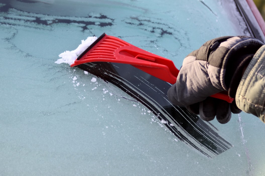
After a tepid and bland winter where La Nina has hardly made an appearance, an Arctic blast is on tap this week. The Seattle-Bellevue area may see the coldest low temperatures since 2014 and the first day not getting above freezing in a decade. Computer models are growing in agreement and possible accumulation numbers for a snow event on Friday.

A Malcontent News French Toast Watch is in effect from February 8 to February 13

From 10 PM to 2 AM tonight, there is a slight chance of some lowland snow in the Kirkland-Bellevue-Woodinville area. Woodinville is under a Winter Weather Advisory. There appears to be a sputtering convergence zone attempting to form on the King-Snohomish County line, but a more substantial zone south of Seattle dominates the current weather pattern.

Monday will be partly-cloudy with highs into the low 40s and lows on Monday night close to freezing. Tuesday will be a repeat of Monday, with clouds forming late in the day. A weak system will pass through on Tuesday night, carrying very little moisture, but bringing bitterly cold air.

The weather models are increasingly in agreement that there will be lowland snow showers on Wednesday morning, but not enough to cause travel problems. Highs on Wednesday will get to the mid to high 30s. Wednesday night will drop into the low 20s through the region.

Thursday will be cloudy as cold air and more moisture spills into our region. Temperatures will struggle to get to 30 degrees in the urban centers and along the lakeshore. Areas away from the water and our higher hills won’t get above the 20s. Models are increasingly in agreement that snow showers will move in late on Thursday as temperatures drop to around 20 degrees, lower to the east and in the hills.

A “French Toast Watch” and “French Toast Emergency” is a local area measure to how significant a weather event will be. In Western Washington upon the first sight of snow, residents typically panic buy eggs, milk, and bread, clearing store shelves. These three items are the key ingredients to making French Toast. Historically the first time this type of panic buying was observed at scale was the Great New England Blizzard of 1978.

David obelcz – CCO

The forecast for Friday is too far out to predict with confidence. There is little disagreement in the computer models that it will be bitterly cold, only getting to 30 degrees for a high. Any precipitation that falls on Friday will fall as snow, and it will accumulate. Some models (including the model we trust) indicate the potential for 4 to 8 inches of snow on Friday and into Saturday morning. We will have a lot more confidence in our forecast by the middle of the week.

Looking past Saturday, there is a slight warming trend potentially next week, with a wetter system arriving. However, that system could start as a snow event before turning into rain.

First hard freeze of the winter is coming, but no snow

Fans of lowland snow and windstorms haven’t had much to rejoice about this winter, and it doesn’t look like that streak is going to change. A change in the weather is coming, including the coldest air of this winter, but the arctic blast will also bring sunshine and clear nights.

Friday afternoon will bring a mixed bag to the Kirkland-Bellevue-Woodinville area with sun, clouds, and a few raindrops. Temperatures will get into the low 50s, which is warm for this time of year and won’t drop below 40 tonight.

Saturday and Sunday are almost twins with typical February weather. Temperatures will reach into the 40s on both days. It will be cloudy with a chance of rain showers each day, but not a washout. Sunday night will drop to 32-36 degrees, making it possible for some wet snowflakes on Super Bowl Sunday. There is nothing in the forecast model to indicate a repeat of 2019, which brought a surprise snowstorm to the region.

All of next week is looking sunny for now, but forecasts more than five days out aren’t much better than throwing darts. Tuesday night could see temperatures as low as 20 degrees, and Wednesday may not get much above freezing. If the model holds, next week will deliver the first hard freeze of the season for the area.

Malcontentment Happy Hour: February 1, 2021

Our live webcast from the Seattle Anarchist Jurisdiction

WARNING: This episode includes videos of police violence, child abuse, protest, and discusses domestic violence in detail – viewer discretion is advised.

The show from February 1, 2021, featured David Obelcz and our co-host Jennifer Smith.

  • Rochester, New York Police pepper-spray a handcuffed 9-year-old child – community outrage explodes as body camera video becomes available
  • Malcontented Minutes – our new speed round of news
    • The state of Texas has things go very wrong when they issue an Amber Alert for Chucky – yes the murderous horror movie doll Chucky
    • Redditors go after silver commodity trading as a new tactic in their fight against hedge funds
    • Missouri Museum of history launches an online exhibit of LGBTQIA history in the state of Missouri
    • Jason Raantz (Seattle) goes on a racist rant about how BLM education during Black History Month in Seattle schools is instilling the fear of police into a new generation of children
    • David Bell, a Black man, dies in a hospital parking lot in Missouri after emergency room physicians refuse to treat him on his third trip for breathing problems
    • President Biden replaces Andrew Jackson’s portrait with a Native American sculpture
    • The National Zoo in Washington D.C. releases a video of a panda playing in the snow
    • LGBTQ activist Carmen Vasquez, 72-years old, dies of COVID-19
    • Data breach exposes the private personal identification (PII) of 1.6 million Washingtonians who have applied for or received unemployment for almost all of 2020, including bank account numbers and ID information
    • Birth certificate controversy over Archie, the child of Prince Harry and Meghan Markle explodes in tabloid press
  • Chad Wheeler domestic violence assault update as his victim faces him in court for the first time
  • COVID-19 Five Fast Facts
  • Reading recommendations for Black History Month
  • David and Jennifer provide their insurrection update

Boring, normal, average weather ahead for start to February

If you’re a fan of lowland snow or big waves on Alki driven by winter windstorms, this has been a disappointing winter season. The boring and very average weather pattern will continue for the start of February.

The week will start off quite wet, with rain arriving Sunday afternoon and continuing through Monday. Over the next 24 hours, 1 to 1.5 inches of rain will fall in the Kirkland-Bellevue-Woodinville area, and Monday looks to get breezy as well, with a weak front pulling through the area Monday night.

The rest of the week is shaping up to be wet, with Wednesday the driest day. Temperatures in the model look to cool down over the weekend, but it will once again be dry. Most of the Kirkland-Bellevue-Woodinville area hasn’t experienced a hard frost this year and only a short-lived snow event. Bulbs and fruit trees are confused by the tepid conditions with many reporting early buds and shoots. Despite earlier models indicating the region would be colder than normal for the start of February, things appear to be average to slightly below average.

The mountains and passes will continue to get plenty of snow, so skiers can rejoice.

Colder weather is here, but snow is unlikely

Enjoy the rest of Saturday if you can because colder and wetter weather is coming, but not cold enough. After some areas experienced their first hard freeze of the winter season last night, Puget Sound is enjoying a perfectly sunny day today. All of that will come to an end tonight.

On Saturday night rain showers will move in turning into a light steady rain overnight. Sunday is wet, with small break midday for a few hours when another round of moisture moves through on Sunday night.

Sunday night into Monday morning moisture will linger and temperatures will drop to near freezing. Some wet snowflakes are possible in the morning, particularly on our highest area hills in the Kirkland-Bellevue-Woodinville area such as Finn, North Rose, Houghton Highlands, or out toward Duvall and the eastern edges of wine country. Anything that falls will likely not stick to the roads and will only be dusting.

The chance of snow for Wednesday we’ve been watching has disappeared, and Wednesday is looking like a dry day with some possible sunbreaks. There is nothing in the forecast model for the next ten days to indicate any chance of significant lowland snow, but late next week is looking wet and cold, with lows in the mid-30s and a lot of rain.

Narrow chance of lowland snow on Monday

When it comes to forecasting snow in the Puget Sound lowlands, you should never say “never.” For the coming days in the Seatle area, the odds of it snowing early next week are slim at best. Monday is a little bit interesting, but it doesn’t appear all of the elements to produce significant lowland snow will come together.

Friday and Saturday will be pleasant for January. Both days will be partly to mostly sunny with highs in the mid-40s, while the low on Friday night will drop into the mid-20s. For the Kirkland-Bellevue-Woodinville area, it may be our first hard freeze of the winter season. Saturday will be warmer as a wet system arrives on Sunday.

Sunday looks like a washout, with rain through the day. The rain turns to showers and tapers off through Monday, with temperatures dropping close to freezing on Monday night. If there is enough stray moisture in the air, there is a chance for some wet flakes as the system moves out. Another forecasting wildcard is if a convergence zone sets up on Monday. Some models support this and show a burst of snow similar to our event in December.

Next week looks unsettled, and we have our eye on Wednesday, the 27th, for possible morning snow. Right now, that is too far out to make an accurate forecast.

Malcontentment Happy Hour: January 18, 2021

Our live webcast from the Seattle Anarchist Jurisdiction

The show from January 18, 2021, featured David Obelcz and our co-host Jennifer Smith.

  • Dr. Martin Luther King Day 2021 – his words continue to be taken out of context more than 50 years after his death
  • Seattle Police Department is off to a very bad start in January
  • Five Fast Facts about COVID -19 – our COVID update
  • Insurrection update
  • Will it snow next week?

Cooler weather is coming, but snow is unlikely

January in Seattle has started historically wet and over 9 degrees above average, but both trends are coming to an end. After 7.45 inches of rain fell and highs reaching up to 57 degrees in the first two weeks, the region settled into a partly to mostly cloudy pattern over the past weekend. Some AI-based weather apps are indicating snow for the end of the week, but it is unlikely.

Monday and Tuesday will be seasonable and partly cloudy, with temperatures in the high 40s during the day and mid-30s at night. The entire week is looking dry for January, with Thursday the most likely day for rain showers. Long-range models indicate a cooling trend at the end of the week, but still seasonable.

Although it is too far out to be accurate, weather models indicate temperatures will drop into the low and mid-40s over the coming weekend, and we’ll get some moisture. Daytime temperatures won’t support snowfall and there isn’t a lot of moisture or energy coming into the region. We’ll keep an eye on the forecast, but we wouldn’t worry about finding a snow shovel for now.

Region cleans up after windstorm rages through the night

The Puget Sound region woke up to hundreds of thousands without power after a windstorm tore through the area overnight. An atmospheric river pointed a firehose right at the heart of Puget Sound as pounding rain and howling winds battered the region. Peak wind gusts reached 40 to 70 MPH around midnight, sending trees crashing through homes and across highways. 

In the last 72 hours, 3.03 inches of rain has fallen at Seatac Airport, and since January 1, 7.45 inches of rain has fallen, making this the wettest start to January in history. A USPS truck was almost blown off the Deception Pass Bridge, and images showed it perched on the guardrail, partially dangling over the side. The driver was uninjured and was able to exit the vehicle. A large tree fell across all of the southbound lanes of SH-167 outside of Puyallup, closing the highway. Both the Deception Pass Bridge and SH-167 have reopened. 

A number of areas schools canceled class for the day due to widespread power and Internet outages making remote learning impossible. In Kirkland, fire and police were dispatched to a rollover accident at 100th NE and Juanita-Woodinville NE. Inoperable traffic lights may have been a contributing factor to the wreck. 

Further south in Dodson, Oregon, about 60 miles east of Portland, one person is missing after the vehicle they were in was swept away in a mudslide. Officials are searching for the victim but active mudslides are making it difficult

A much drier weather pattern lies ahead, with sun forecasted for Wednesday and Thursday. Over the weekend, light and scattered showers will return. The long-range forecast points to next week being much calmer. 

Malcontentment Happy Hour: December 21, 2020

Our live webcast from the Seattle Anarchist Jurisdiction

The show from December 17, 2020, featured guest host, Jennifer Smith.

  • Record high, record rain, and snow?
  • Uneven enforcement of Cal Anderson Park closure results in 7 arrests with one injury at Cal Anderson Park
  • Two new strains of COVID-19 in U.K. and South Africa, U.S. holds off on a travel ban, and vaccination delays
  • Seattle Police Department destroys Mutual Aid supplies including food, clothing, and bedding during Cal Anderson Park homeless sweep
  • A $900B stimulus deal is signed by the House and Senate and goes to Trump’s desk
  • The name of the team Atlanta Braves becomes a political issue
  • “Behind the Pole,” Cal Anderson Park homeless sweep