Tag Archives: weather forecast

Soggy, steamy, east coast style weekend ahead

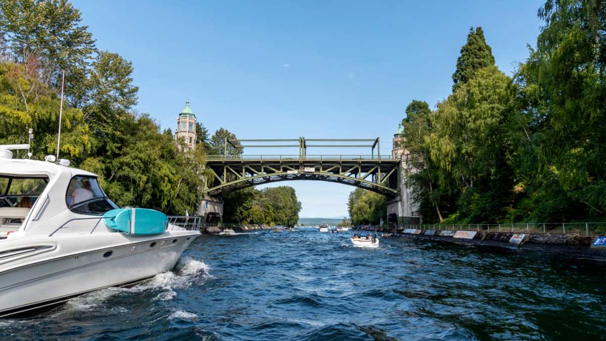
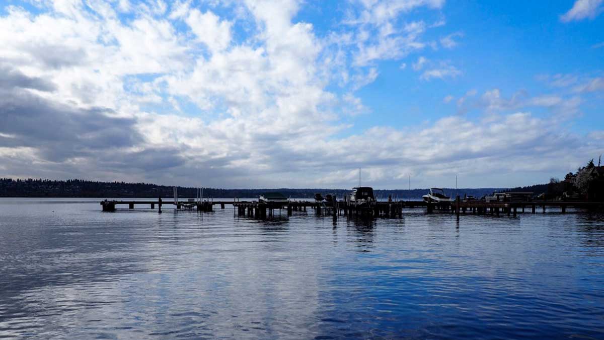
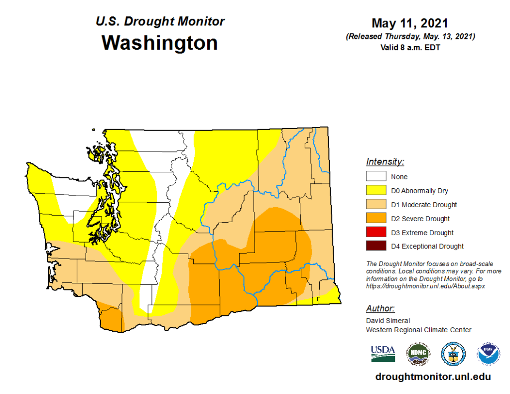
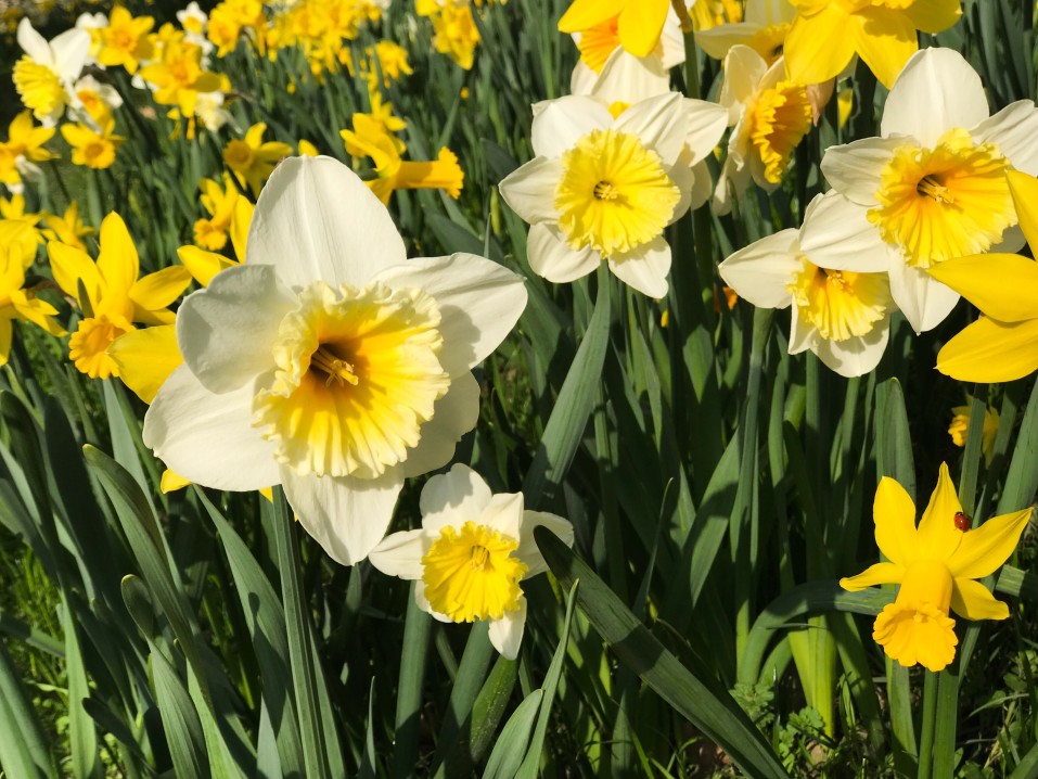
[KIRKLAND] – (MTN) The Seattle area had the fourth driest spring in history, and it appears that the region will make up some of that precipitation deficit this weekend. An unusual weather pattern will bring a Pineapple Express to the Pacific Northwest on Sunday. Sunday will feel more like a rainy March day in Orlando versus our usual June gloom.

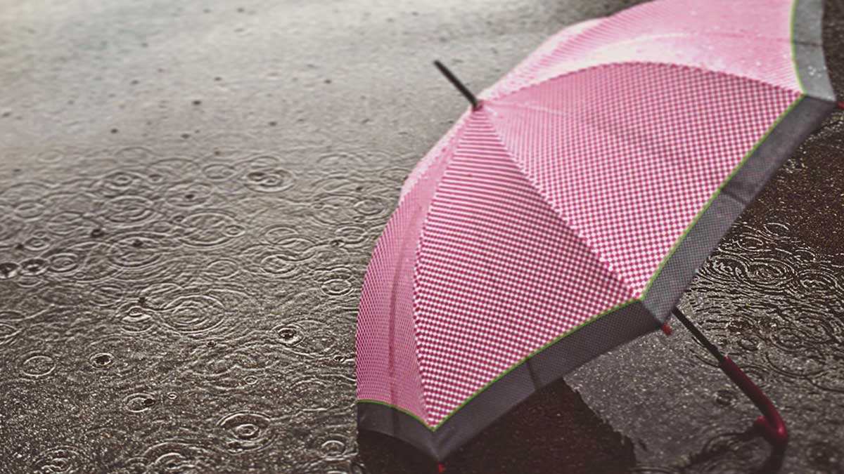
Two rare events are coming together to turn Seattle from Fifty Shades of Grey to Sixty Shades of Sticky. Pineapple Express weather systems are more associated with wintertime storms carrying tropical moisture on a conveyor belt straight to the Pacific Northwest. These systems bring heavy rains, breezy conditions, and warmer temperatures.

Sunday’s weather models shows a river of moisture extending from Hawaii to the Pacific Northwest

Usually, when we warm up in Seattle, it is from an eastern flow from the Cascades. The air compresses and gets warmer, squeezing out the moisture at the same time. Our hottest days typically have low humidity, so we get a “dry heat” in the lowlands to make it feel more tolerable. These same easterly flows dry out our air, preventing rain from falling.

In more recent years, we have gotten hot days from warm air coming from the southwestern United States, which is happening this weekend.

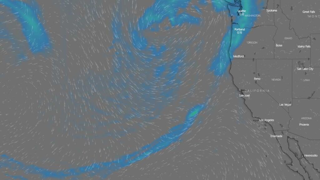
In reviewing the weather models, there is agreement on when and where but disagreement on how much rain. There is widespread agreement that southwest Washington and the Olympics will get significant rain on Sunday morning and the Cascades later in the day as the system makes landfall. One model predicts widespread record rainfall for Seattle, with the potential for one inch of rain – average rainfall for June is 1.57 inches! 

For the rest of Friday, our area will see a typical Juneuary day of clouds, rain showers, and sun breaks. High temperatures will struggle to reach 58 to 62 in the Kirkland-Bellevue-Woodinville area. The wettest period will be between 2 PM and 4 PM.

Friday night could bring some more light showers into the area, with lows from 52 to 54 degrees.

Saturday is looking pleasant, although partly to mostly cloudy. Highs will be 73 to 78, depending on what time the cloud cover starts to thicken up for the main event. It won’t feel sticky, but you may think to yourself, “this feels warmer than the 70s.”

Saturday night and early Sunday morning, the Pineapple Express arrives. Models are predicting rain will increase from 3 AM to 5 AM. Low temperatures will only drop to around 60 degrees, and dew points will creep into to 60s.

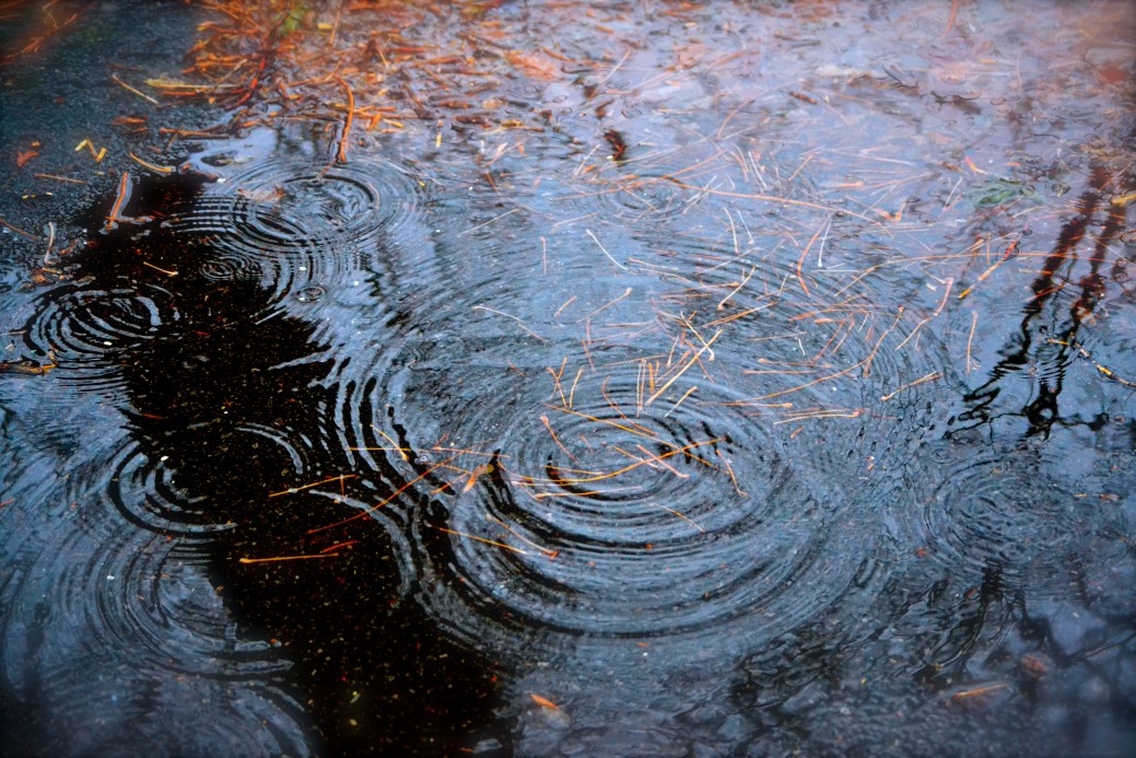
Sunday will see variable amounts of rain. Heavy rain showers will form with a chance for some grumbles of thunder. In the heaviest pockets, there could be minor street flooding and reduced visibility. Temperatures will hover around 70 degrees, while the dew point could reach 67. Your friends and family on the east coast won’t offer any sympathy if you call and complain about it being muggy, but this is a rare event for Puget Sound.

How much rain you will get on Sunday will depend on your location, and weather records will fall if a heavy pocket of rain lingers over the rain gauge at Seattle-Tacoma International Airport. Some areas may see 1/3 to 1/2 an inch of rain, while localized areas could see an inch or more. 

Looking further out, Monday will get a little drier, but the humidity will linger. Tuesday appears to bring a round of spotty showers and thunderstorms to the area before moving back to a dry summertime pattern.

Summer arrives right on time (technically)

[KIRKLAND] – (MTN) Meteorological summer starts on June 1 and the weather gods are smiling upon Puget Sound with warm temperatures ahead.

The entire Kirkland-Bellevue-Woodinville area will see blue skies and temperatures from 79 to 83 degrees. Finn Hill, North Rose Hill, and right along Lake Washington might not pierce 80, while area hot spots like Totem Lake will be warmer.

Tonight will be sleeping weather with temperatures dropping to 55 to 57 degrees under clear skies.

Tomorrow will be even warmer with the entire area getting over 80. Temperatures will be 82 to 86 with abundant sunshine.

Thursday the marine layer will start to push back in, and the region will be mostly cloudy. Highs will be 71 to 74.

Friday is a bit far out, but appears to be pleasant, and 69 to 73 before rain pushes in for Saturday.

A desperately needed drippy week lies ahead

[KIRKLAND] – (MTN) The forecast next week is looking cool and damp after the first 3 weeks of May have produced only 2/3 of an inch of rain and April dropping less than an inch. The first 14 days of 2021 were exceptionally wet, with 5.74 inches of rain falling at Seattle-Tacoma International Airport, before a slow drying out with average rainfall in February, and below average in March.

On Sunday the marine layer will be even stronger than today, with a chance of drizzle over the lowlands. The day will stay cloudy, with some sun breaks in the afternoon and highs below normal from 62 to 65 degrees through the Kirkland-Bellevue-Woodinville region.

Sunday night through Tuesday is looking rather wet, and if the forecast model holds, we’ll exceed April’s rain total by Tuesday morning. Monday will have showers through the day and highs only 58 to 61 through our area. Monday night showers will turn to steady rain overnight, before tapering off Tuesday morning. Tuesday will have sun breaks again in the afternoon, with highs from 61 to 63.

Wednesday through Friday is further out in the weather models, but for now, Wednesday is looking like the best day next week. The marine layer will hold on with clouds in the morning, and then moisture will move back in late during the day. Highs will be 66 to 69, giving us a normal late-day May.

Thursday and Friday are also looking wet.

If you’re wondering about Memorial Day weekend that forecast is too far out to be accurate. For now, the computer models are favorable for Saturday and Monday. The models for Sunday don’t look like a washout, but there is a lot of disagreement on how much moisture will be in the area.

Rain comes on Tuesday as Puget Sound lowlands precipitation deficit grows

[KIRKLAND] – (MTN) Less than an inch of rain fell in April at Seatac International Airport (KSEA) and halfway through May, only .52 inches has fallen so far, and more than half of that on May 4. With temperatures tickling 80 degrees on the eastside today, it is easy to ignore the growing deficit as our dry season inches closer.

Significant drought is already gripping the nation from eastern Washington to Minnesota, south to Texas, and then back west to California. In Los Angeles, the Palisades Fire has grown to more than 1,000 acres with mandatory evacuations ordered in fire-ravaged Topanga. In April, during a near historically early fire weather alert, a dozen fires popped up in western Washington, with one burning in Auburn for almost a week.

Only the Cascade and Olympic Mountains ranges are normal in the state of Washington, as drought conditions grow through the rest of the state

Monday will be cloudy and much cooler, with temperatures in the low 60s. Monday night and into Tuesday morning, rain will move in with .25 inches possible on the eastside. Rain will gradually give way to clouds but some drips are possible into Wednesday morning.

The long-range forecast is more seasonable with temperatures in the mid-60s to around 70, but the dry weather pattern returns. The Puget Sound lowlands get most of its water from snowpack melt in the summer months, and the snowpack was at or near record levels this year.

The continued dry weather will increase wildfire risk as the summer progresses. In 2020 wildfires tore through the western side of the Cascades from Oregon to Washington, shrouding the area in dark clouds of smoke for weeks.

Fire season off to a troubling early start

[PORTLAND] – (MTN) Officials are warning of another historic fire season with large swaths of southern and central Washington already under a Special Weather Statement for unseasonably high fire danger through the rest of this week. A spell of warm weather with low humidity and forecasted offshore flow will create favorable condtions for wildfires in the South Washington Cascade Foothills, the Cascades, the Western and Central Columbia River Gorge, Willapa Hills, Cowlitz County, and the greater Vancouver, Washington area.

Despite near historical levels of snowpack in the Cascades, eastern Washington has experienced drier conditions resulting in the advisory. Large swaths of the country are also grappling with concern climate and conditons data from eastern Washington to Minnesota and from California to Texas. In the heartland, wildfires are burning from Oklahoma to North Dakota, mostly in rural and federal lands.

This is the time of the year to get ready for summer wildfire season and possible smoke.

As we start to approach summer, with another long-range forecast model of, “hotter and dryer than the norm,” now is the time to get prepared.

  • Get some N-95 masks. Due to COVID they remain difficult to secure. If you have allergies, asthma or other breathing issues, you should try and secure a supply now. Small children and those with facial hair can’t use them.
  • Surgical masks don’t block fine particulates, they don’t work for aiding with smoke exposure.
  • Our smoky days typically go hand-in-hand with our hottest days. In 2018 and 2020 we had several days that would have been record-shattering hot, but the smoke kept us in the 90s. Ideally, on the worst days, you should keep your windows closed. Now is the time to consider a portable air conditioner for at least one room, to create a clean air space in your home.
  • Along with a room with AC, having a box fan with a furnace filter taped to the “intake” side (the side that pulls the air) has been shown to dramatically reduce particulate matter in the air. If you can’t afford an AC, a $20 box fan and a $10 filter can significantly improve air quality in a single room.
A furnace filter duct taped to a box fan is a low cost way to clean the air in a single room.
  • When you drive your car run your AC and run it in the “max” or “recirculation” mode. This recycles the air within your cabin. If your car doesn’t have working AC, you’ll need to wear an N-95 mask when driving during smoky days.
  • On the worst smoky days don’t do outdoor activity if you can. If you work outdoors, your employer should provide N-95 masks. This is vital on days where there is ash fall.
  • Exercise should be done indoors in a climate controlled setting. If you have medical issues, to begin with, avoid exercise or better yet, talk to your doctor.
  • Contact wearers should make sure now that their glasses prescription is up to snuff. On the worst days, you’ll want to rip your eyeballs out when you’re wearing contacts.

Winter makes a final stand before spring-like weather finally arrives

[KIRKLAND] – (MTN) If you’re feeling like March and the start of April have been cooler than normal, especially in the evenings, you would be correct. In an average year, Seattle would see its last day with an evening low below 40 degrees on March 20. Sixteen of the last 20 days were at or below normal for low temperatures, and the trend is going to continue into early next week.

Friday will be 6 to 8 degrees below normal, with highs struggling to get to 50 degrees. Tonight will see lows of 35 to 37 with rain coming in overnight. The snow level in the mountains passes will drop to 2,500 feet. With moisture on the way, the west slope of the Cascades is under a Winter Weather Advisory for 4 to 7 inches of snow expected to fall overnight.

Saturday will start damp and clear out for the afternoon, but again, high temperatures will struggle to get to 50 degrees. Saturday night will be cool, with low temperatures in the Kirkland-Bellevue-Woodinville area of 29 to 32 degrees – 10 to 13 degrees below normal, and representing one of our latest area frosts on record.

Back on March 27, we predicted the last frost of the year could be as late as April 11.

Looking further ahead, nighttime lows will remain below average until Wednesday, while the days will be sunny and mild. Our first 70 degree days of the year are in sight on the long-range forecast, with the end of next week looking promising.

Cool weather will persist into the first week of April

[KIRKLAND] – (MTN) By local standards, this past winter wasn’t a hardship, especially for a La Nina year. The forecast models point to a sunny and dry week ahead, but nighttime temperatures will hover at or below freezing during the start of the week. The long-range forecast shows a cooling trend into next week and a wetter pattern.

A common question the gardening community asks us is when will the last frost be. Statistically speaking, we are past the point of having a hard frost (below 27 degrees), and the average date for the last possible frost in the Kirkland area is April 4. Historically speaking, Kirkland has had measurable snow as late as April 11, so temperatures below freezing are still possible deep into April. 

Sunday, Monday, and Tuesday will see lows from 30 to 33 through the Kirkland-Bellevue-Woodinville region. Sunday night will be after a rainy day, so it’s unlikely there will be frost. Monday and Tuesday night look like solid possibilities, so gardeners should plan their planting accordingly. The long-range forecast shows lows in the high 30s through the first week of April.

Our prediction for the last possible day for frost in our region is April 11. If you’re getting tired of the cool weather, don’t despair. By the end of the week, daytime highs will be approaching 60 degrees. 

Springing ahead, literally and metaphorically

[KIRKLAND] – (MTN) Winter will finally lose its grip over the Puget Sound lowlands with a warming trend and Daylight Savings Time ahead. Thursday through Saturday will see a run of sunshine, and 60 degrees over most of the Kirkland-Bellevue-Woodinville area by the weekend. Also, Daylight Savings Time starts on March 14 at 2:00 AM, when we turn our clocks forward.

Thursday will see highs in the mid-50s with abundant sunshine. Due to a lack of cloud cover, lows will drop to between 31 and 35 Thursday night.

Friday will see even warmer temperatures, with hot spots like Totem Lake and downtown Bellevue ticking 60 degrees. Overnight temperatures will drop to 32 to 36 degrees.

Saturday will see almost all areas break 60, with temperatures from 58 to 63 degrees. Clouds will start to roll in by sunset. The cloud cover will act like a blanket, keeping temperatures between 39 and 42, with rain developing.

Sunday is looking like a rainy day, however, high temperatures will be 56 to 59 degrees. If you’re picking a day for outdoor activity, Saturday is the winner.

On Saturday night we’ll turn the clocks ahead an hour, providing daylight hours past 7 PM. Looking at the long-range forecast, it appears we’ll be able to enjoy that extra daylight starting on Monday with no rain indicated until deep into next week.

Update: Stevens, White, & Snoqualmie Passes closing due to extreme avalanche danger, Pineapple Express arrives

UPDATE: Washington Department of Transportation added White Pass to the mandatory 6 PM closure.

[SEATTLE] – (MTN) Washington Department of Transportation announced they would be closing Stevens Pass, White Pass, and Snoqualmie Pass at 6 PM on Sunday due to an extreme risk of Avalanche. Our earlier cold snap and snow event created some of the deepest snowpacks in the country, but the looming Pineapple Express weather system will make the snow highly unstable. The three closures essential cuts the state in half.

Both mountain passes have had periodic closures today, and require chains for all vehicles except AWD/4WD. Stevens Pass has had 64 inches of snow in the last 7 days and 425 inches of snow so far this winter season, while Alpental at Snoqualmie has had 440 inches.

Operators of Stevens Pass ski area announced they were closing at 4 PM today. Operators at Snoqualmie Pass announced Alpental was closed, the sledding and tubing area would close at 3:30 PM, and the remainder of the ski area would close at 4 PM. Both ski areas appealed for people to stay “in bounds” due to the growing danger.

In the lowlands, the coming week will be warm, wet, and windy. In our local forecast area of Kirkland-Bellevue-Woodinville, residents should prepare for potential power outages tonight. Although the official forecast is calling for winds of 10 to 20 MPH and there is no advisory or warning, the weather model we trust is favorable for borderline Wind Advisory conditions early Monday morning. Temperatures on Monday will reach the mid-50s, 15 degrees warmer than a week earlier. Although lowland rain amounts won’t set any records, the lowland snow combined with the heavy rain that followed has left the ground saturated. The lowlands could see a growing risk of landslides as the week progresses.

Round three of snow coming

UPDATE 4:00 PM PST: The National Weather Service has extended the Winter Storm Warning until 9:00 PM PST due to continued moderate to heavy snow falling in some areas within the region. Moderate to heavy bands of snow will continue to develop into the evening hours. Some of these bands can quickly drop one to two more inches of snow. People are advised to continue to avoid travel if possible.

[SEATTLE] – (MTN) Puget Sound woke up to five to twelve inches of snow with more coming down on Saturday, as the biggest winter storm in two years blanketed the region. Light snow started falling between 6 PM and 8 PM in the Seattle-Bellevue area, while heavier snow accumulated in the South Sound. A third storm system is on tap for Saturday night and Sunday.

[Best_Wordpress_Gallery id=”26″ gal_title=”February 2021 Snowstorm”]

Snow showers from the current system are tapering off after a Convergence Zone formed from Marysville to Issaquah this afternoon. Saturday night, snow showers will increase again and get heavier into Sunday morning. By noon tomorrow, most areas will transition to a rain-snow mix or rain, but not before one to three more inches is added to current accumulations. Lows tonight will be 28 to 30 degrees and highs tomorrow will reach 35 to 37.

Many side streets are treacherous or impassable due to snow and ice throughout the region. During the early morning, hours on Saturday I-5 and I-405 were completely snow-covered, measured in inches in some location. Winds howled through the night with gusts as high as 40 MPH. Seattle-Tacoma International Airport had sustained winds of 25 MPH overnight, and wind chill as low as 10 degrees. In Kirkland, Seattle, and other communities, city officials closed numerous streets due to extreme conditions and the danger hills presented to drivers. Officials are appealing for people to stay off the roads if possible.

Further south in Tacoma and Olympia, 9 to 12 inches of snow fell bringing traffic to a standstill. I-5 was littered with accidents overnight in the metro Tacoma area despite light traffic, with emergency crews struggling to cover multiple crash scenes. Clark County where Vancouver is located has declared a state of emergency where roads are impassable. Portland, Oregon saw a wide range of snowfall amounts from 2 to 11 inches, with 6 inches in the city, as many areas experienced a major ice storm. Governor Kate Brown has declared a state of emergency in nine Oregon Counties due to ice accumulations, power outages, tree, and property damage. Over 130,000 people are without power in the hard-hit areas.

Monday will see temperatures approach 40 degrees with a transition to all rain. Side streets will remain a challenge in places likely into Tuesday as the snow gets converted into thick slush.