
Breaking News
Historic Flooding Swamps Washington’s Snoqualmie River Basin
The towns of Fall City, Carnation, and Duvall are cut-off from the world as the Snoqualmie River continues to rise on Thursday night.
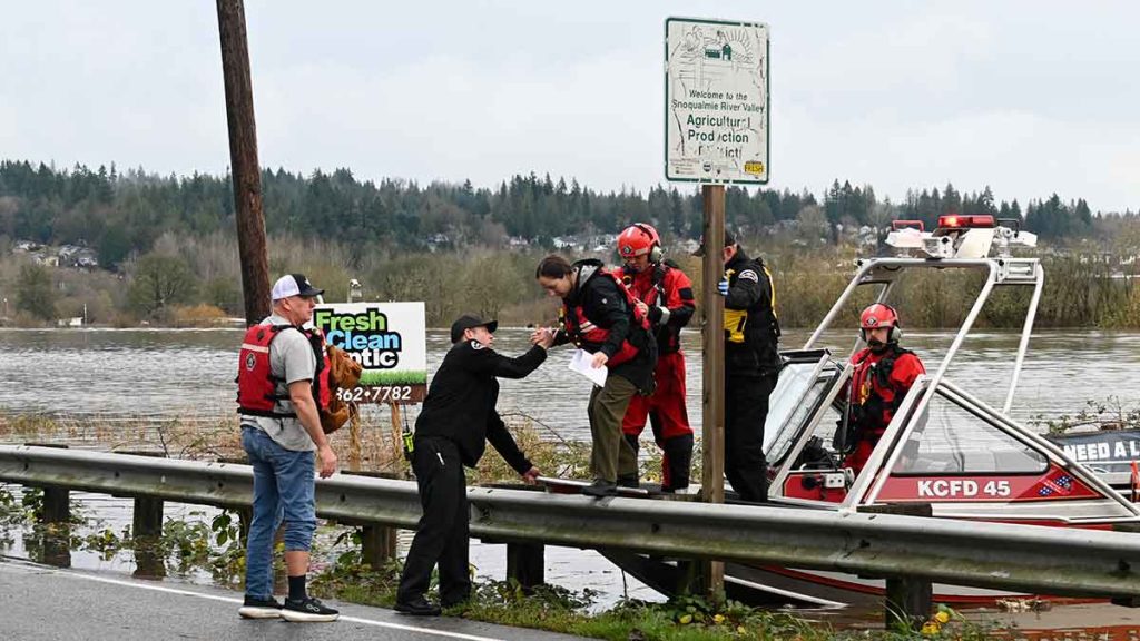
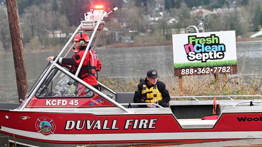
Exhausted rescue teams continued technical rescues in Western Washington’s Snoqualmie River Basin as record flooding left thousands stranded in their homes.
A Pacific Coast phenomenon known as an “atmospheric river” was intensified by unseasonably warm weather, resulting in heavy rainfall across Puget Sound and the western Cascade Mountains. Historic and near-historic flooding from Skagit to Pierce County has forced up to 100,000 people to leave their homes. The National Weather Service described the situation as “catastrophic.”
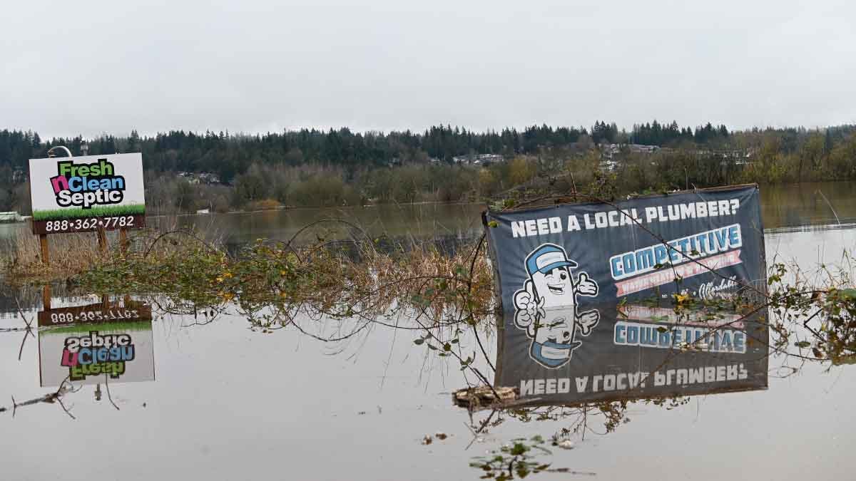
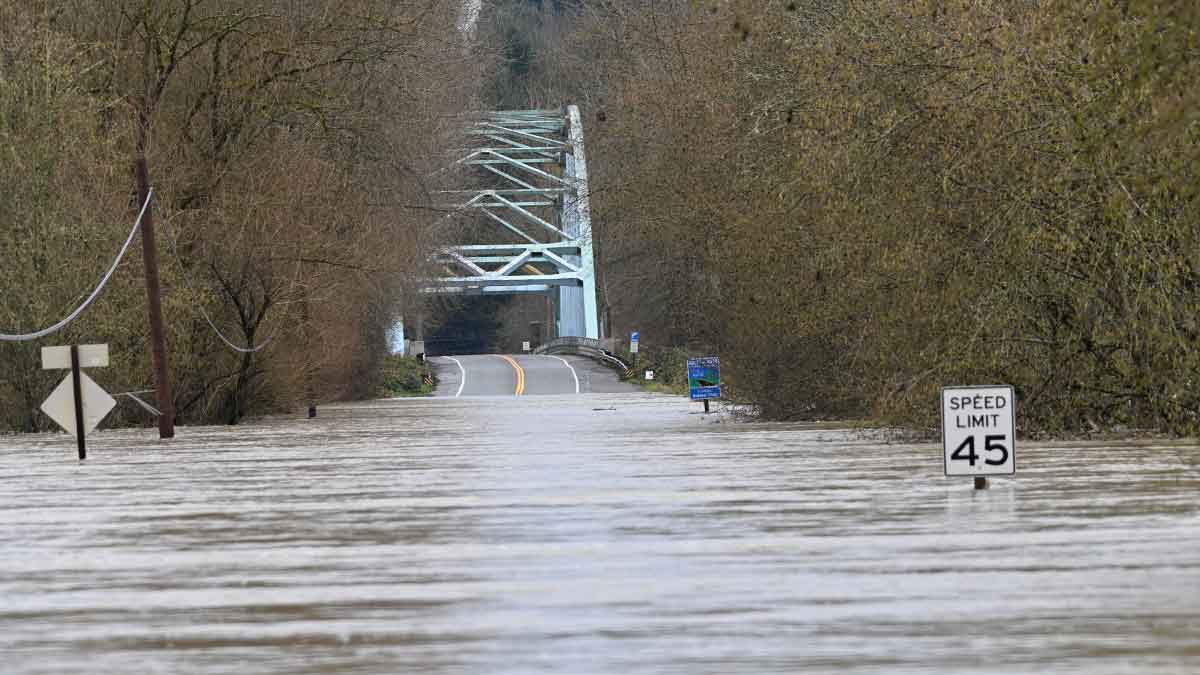
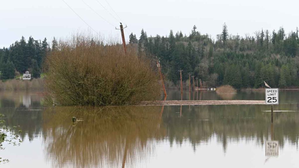
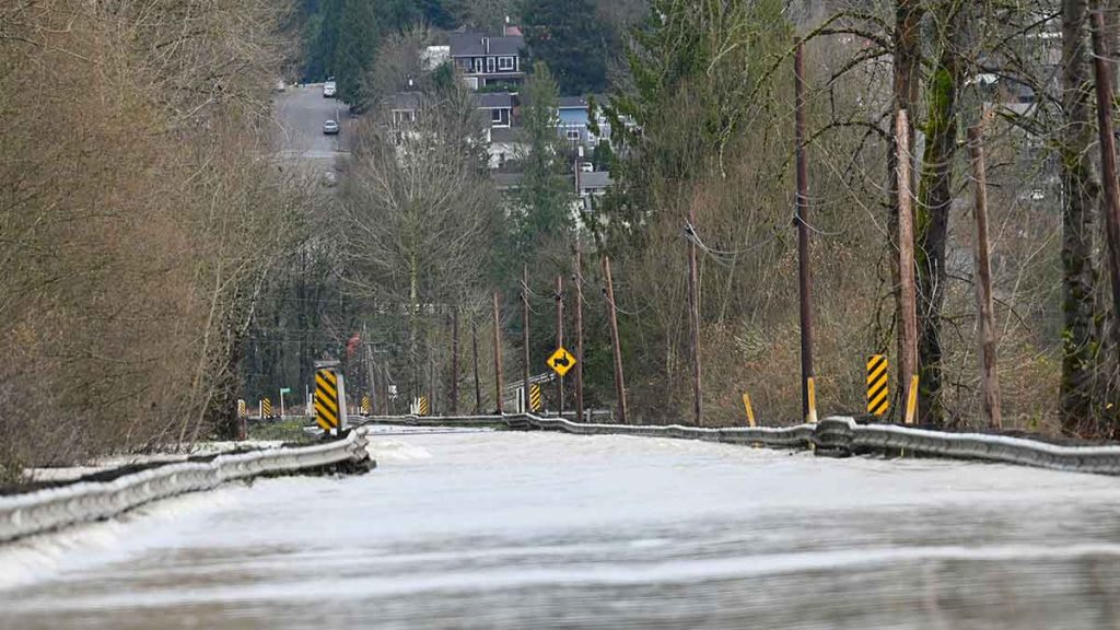
Near Bellevue, Washington, the Snoqualmie River Basin was swamped by floodwaters flowing downstream from Snoqualmie Falls. In the farming town of Duvall, a new all-time record was set, with the scale on the city’s public flood gauge completely submerged. Residents who remained in Fall City and Carnation were cut off from the rest of the world, while Duvall remained accessible only via a 2.5-hour detour that included rutted, muddy dirt roads.

On Thursday evening, the City of Duvall advised residents that Redemption Church was designated as a shelter for displaced residents, with support from the Carnation Duvall Citizen Corps Council. The shelter was also open to pets.
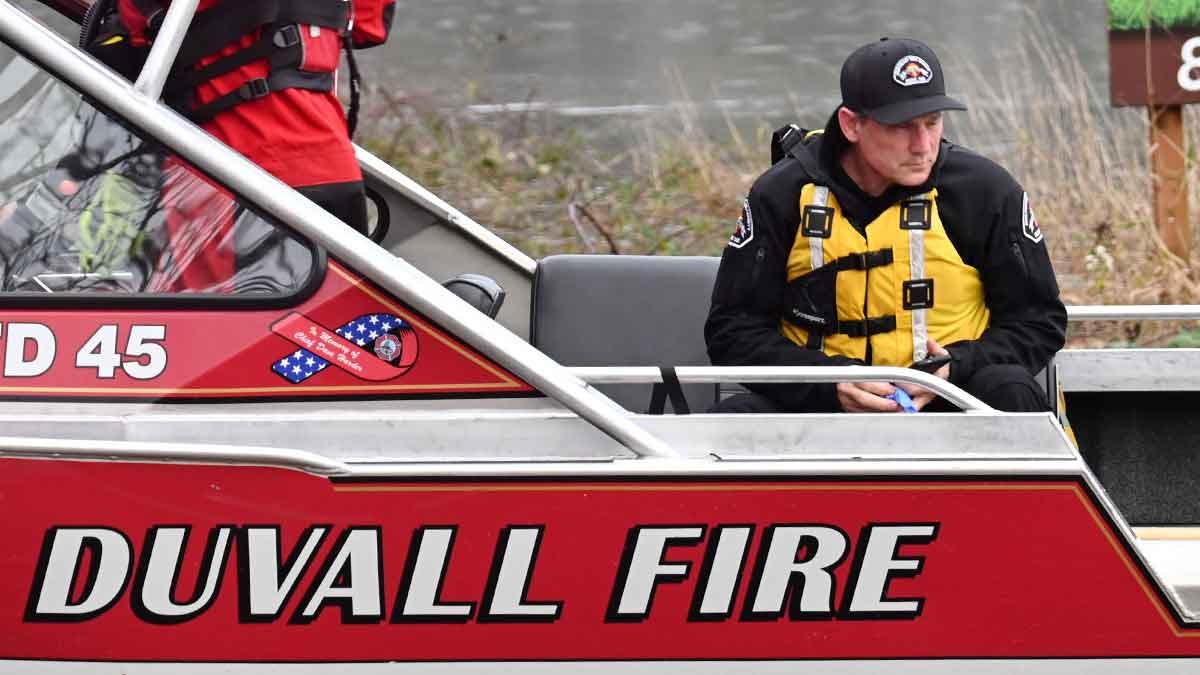
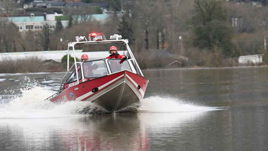
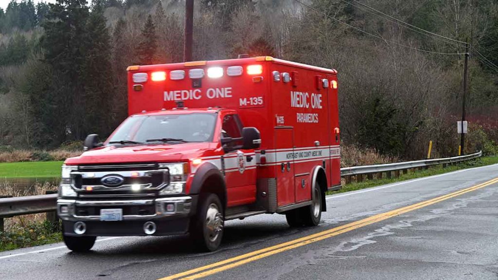
Local fire departments, supported by King County, the State of Washington, and the National Guard, carried out technical rescues of stranded residents throughout the day. In Duvall, a helicopter with the King County Sheriff’s Department repeatedly flew overhead, following the river.
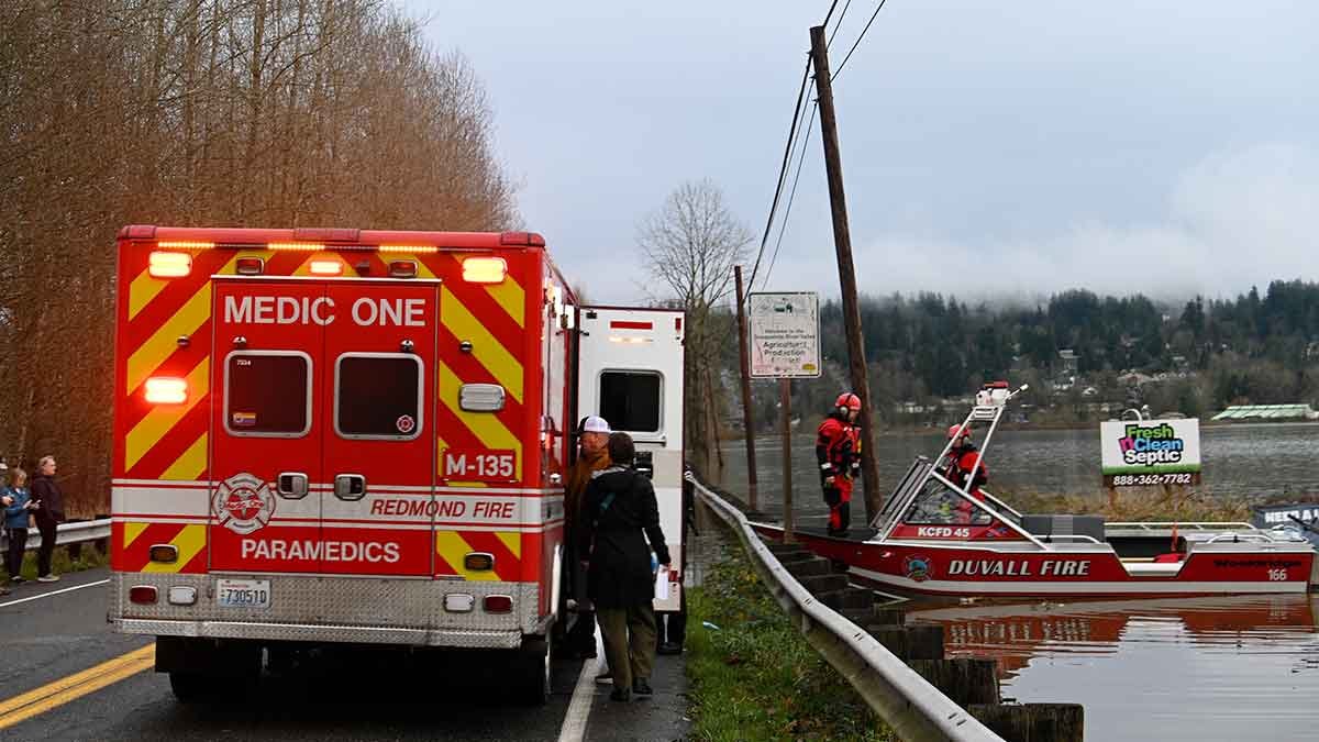
At approximately 3:00 p.m. on Thursday, the Duvall Fire Department transported two people across the Snoqualmie River to NE Woodinville-Duvall Road and W Snoqualmie Valley Road NE, for medical transport. Northeast King County Medic One took a man and a woman from the scene.
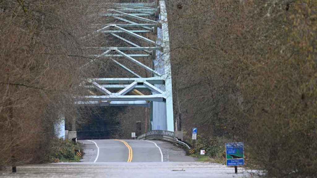
At NE 124th Street, the Novelty Bridge was flooded, with local residents saying they had never seen the river so high. On the west side of the bridge, the floodwaters were less than 50 feet from W Snoqualmie Valley Road NE.
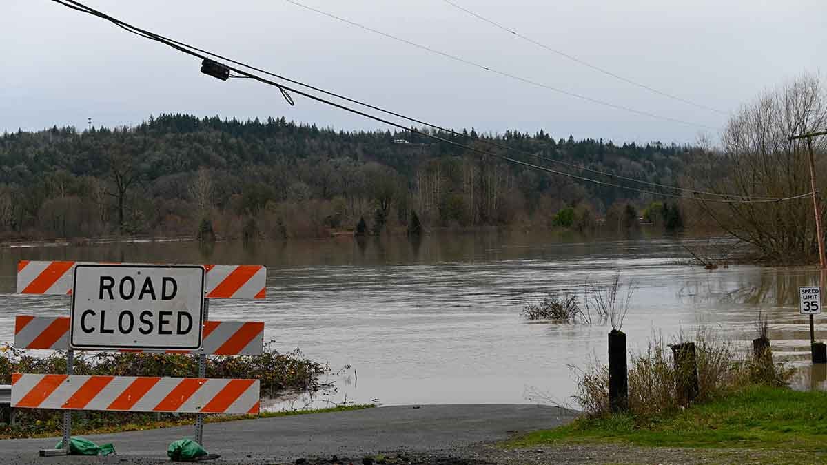
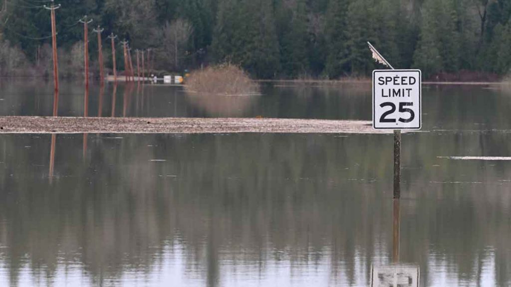
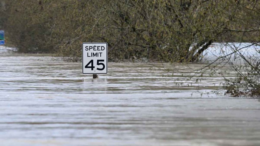
At the time of publication, King County and the USGS reported that the Snoqualmie River in Duvall was almost 14 feet above the December median level, at a record-setting 45.23 feet, and was still rising. In December, the river would normally be at 31.42 feet.
South of the river basin, Issaquah Creek was just inches away from setting a new flood record on Wednesday night, reaching 9.36 feet. The crest was just 1.4 inches below the February 2020 record of 9.48 feet. Phase 4 flooding continued on the Cedar River in Renton, reaching 18.2 feet, just shy of the all-time record.
Across Western Washington, area school districts had already announced delays and closures for Friday due to flooding. The Skykomish School District reported that the first floor of their only school was flooded.
To the north in Snohomish County, the city of Snohomish was experiencing major flooding, and the Snohomish River wasn’t expected to crest until early Friday morning.
Washington will get a break from the rain on Friday and Saturday, but more bad weather is on the way. The long-range models suggest high temperatures will be 3 to 11 degrees above normal from Sunday to Wednesday, with another 2.5 to 4.5 inches of rain expected.
Journalism in the United States is under attack. Malcontent News is an independent news agency established in 2016 and a Google News affiliate. To remain independent, we rely on our subscribers to help us limit advertising. The easiest way to support our team is to subscribe to our Substack, Patreon, or Newsbreak.
Please Support Malcontent News
|
When you become a subscriber, you help us stay independent and paid advertiser free. A free press is a Constitutional right, but it doesn’t come free. Our core missions are showing you an unfiltered view of the before, during, and after, defend the First Amendment, and amplify BIPOC and LGBTQIA+ voices in an advertisement free experience. |
|
 |
For as little as $5 a month, you can support Malcontent News. Becoming a Patreon will help cover technology, data, bandwidth, and travel costs. Patreons get early access to content and a Discord server, virtual meetings with the staff, and private Zoom meetings. Subscribe NOW! |
 |
A one-time Venmo donation can help with safety gear, equipment, or a small thank you to show your appreciation for what Malcontent News provides. No amount is too small, even $5 goes a long way. Venmo NOW! |