


For the 3rd time since the dry streak started, showers dodge the rain gauge at Seattle-Tacoma Airport.

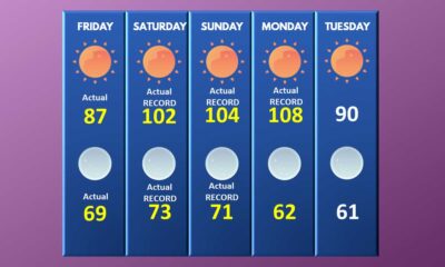
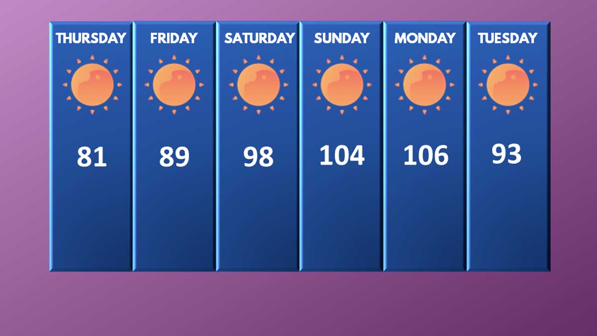
A mixed bag of weather is on tap for the weekend with temperatures approaching 90 on Friday.

Drizzle and some light showers moved through the area, but no rain fell at SeaTac Airport.

The smoke will be at higher altitudes creating haze and spectacular sunsets, but make no mistake, smoke season is here.

We conclude our live blog as the heatwave continues for parts of the Pacific Northwest and Canada.
All-time record highs will shatter across the Pacific Northwest as burn bans go up across Washington state.


Many weather records could be shattered this weekend and early next week with temperatures over 110 in the PNW.

The midweek cool off appears to be fizzling out and next weekend could be a scorcher.


So far, June has delivered a record high, the coldest day in 9 years, and above average rainfall.
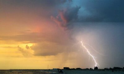
Southeastern Washington has a great chance of thunderstorms, but western Washington could be a legion of boom today.
Your Comments